Greenbelt in Prince George's County, Maryland — The American Northeast (Mid-Atlantic)
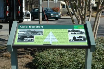
Gas Station
Cars were indispensable in this new suburban community. In 1939, when owning a car was still considered a luxury, 65% of Greenbelt households owned an automobile. In 1938 the gas station charged $1.25 for an oil change, and the price for gasoline was 23 cents per gallon (about $2.30 in 1999 dollars). Carpools and a bus that connected with the streetcar line transported Greenbelt residents to jobs in Washington, D.C.
Erected by Greenbelt Museum.
Topics. This historical marker is listed in these topic lists: Industry & Commerce • Railroads & Streetcars • Roads & Vehicles • Settlements & Settlers. A significant historical year for this entry is 1937.
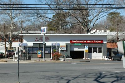
Location. 39° 0.098′ N, 76° 52.489′ W. Marker is in Greenbelt, Maryland, in Prince George's County. Marker is at the intersection of Crescent Road and Centerway and Gardenway, on the right on Crescent Road. Marker is in front of the Mobil station. Touch for map. Marker is at or near this postal address: 161 Centerway, Greenbelt MD 20770, United States of America. Touch for directions.
Other nearby markers. At least 5 other markers are within walking distance of this marker. Roosevelt Center (about 400 feet away, measured in a direct line); Greenbelt Homes Inc. (about 700 feet away); Swimming Pool (about 800 feet away); City of Greenbelt (about 800 feet away); Eleanor Roosevelt (approx. 0.2 miles away). Touch for a list and map of all markers in Greenbelt.
Additional commentary.
1. Woody’s Flying A
I want to add that I remember Woody and his Flying A station well. I hung out there and at the fire station right next door (to the left in this photo). Also fooling around in the winter, sleigh-riding down to the underpass (to the right in this photo).
— Submitted May 16, 2007, by Dennis Evanosky of Oakland, California.
2. Change of Brands
The gas station now sells Sunoco gasoline.
— Submitted December 26, 2007, by Tom Fuchs of Greenbelt, Maryland.
Credits. This page was last revised on January 12, 2020. It was originally submitted on March 22, 2006, by Tom Fuchs of Greenbelt, Maryland. This page has been viewed 1,801 times since then and 13 times this year. Photos: 1, 2. submitted on March 22, 2006, by Tom Fuchs of Greenbelt, Maryland. • J. J. Prats was the editor who published this page.
Editor’s want-list for this marker. Photo of the former fire station and the slope to the underpass • Can you help?

