Near Frederick in Frederick County, Maryland — The American Northeast (Mid-Atlantic)
Worthington House
Monocacy National Battlefield
— National Park Service, U.S. Department of the Interior —
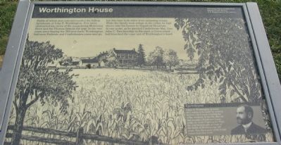
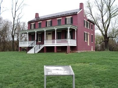
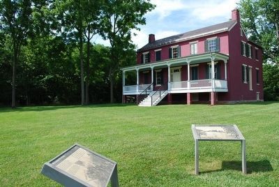
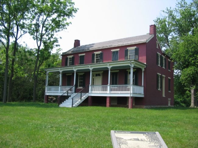
Fields of wheat and corn surrounded the hilltop farmhouse of John T. Worthington. Few trees obstructed his views of the meandering Monocacy River and Thomas farm to the east. In the two years since buying the 300-acre farm, Worthington had seen Federals and Confederates come and go, but this time both sides were amassing troops. While the family took refuge in the cellar, he had slaves take his horses to Sugarloaf Mountain. At one point, as he greeted Confederate Maj. Gen. John C. Breckinridge in the yard, a Union minie ball knocked the cane out of Worthington's hand.
(sidebar): Eyewitness
Glenn H. Worthington, as a boy of 6, watched the battle by peeking between the boards covering the cellar windows. In his 70s, after he had become a Frederick County judge, he wrote Fighting for Time, the only book-length account of the Battle of Monocacy for 130 years. This illustration of the house comes from that book.
Erected by National Park Service, U.S. Department of the Interior.
Topics. This historical marker is listed in this topic list: War, US Civil.
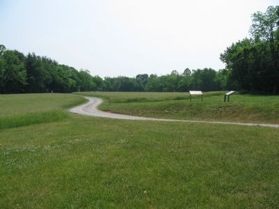
Location. Marker has been reported permanently removed. It was located near 39° 21.693′ N, 77° 24.127′ W. Marker was near Frederick, Maryland, in Frederick County. Marker could be reached from Baker Valley Road, on the right when traveling south. Located at stop three of the auto-tour of Monocacy Battlefield. This marker set is at the trail head for the Worthington Farm walking tour. To reach the stop, from Baker Valley Road, turn northwest onto the park service road (running parallel to Interstate 270, from which there is no direct access). Follow the service road to the parking lot near the Worthington House. Touch for map. Marker was in this post office area: Frederick MD 21704, United States of America.
We have been informed that this sign or monument is no longer there and will not be replaced. This page is an archival view of what was.
Other nearby markers. At least 8 other markers are within walking distance of this location. Through a Child's Eyes (within shouting distance of this marker); Ambush (within shouting distance of this marker); Caught in the Crossfire (approx. 0.6 miles away); L'Hermitage (approx. 0.7 miles away); 1862 Antietam Campaign (approx. 0.7 miles away); The Lost Order (approx. 0.7 miles away); Final Attack (approx. 0.7 miles away); Civilians Under Siege (approx. 0.7 miles away). Touch for a list and map of all markers in Frederick.
More about this marker.
The background image on the marker is a drawing of Worthington House taken from the book Fighting for Time. In the sidebar is a portrait of Glenn H. Worthington.
Related markers. Click here for a list of markers that are related to this marker. This marker is among several describing the battle of Monocacy, to "tour" the battlefield using the related HMBd markers sites.
Also see . . . Battle of Monocacy. National Park Service site for Worthington House. (Submitted on November 4, 2007, by Craig Swain of Leesburg, Virginia.)

Photographed By Craig Swain, November 3, 2007
6. West Side of Worthington House
Confederate artillery deployed across the hilltop around the house during the battle. At the time, the position offered a commanding view of the surrounding fields. Today, however, tree lines around the modern I-270 limits observations.
Credits. This page was last revised on April 27, 2022. It was originally submitted on November 4, 2007, by Craig Swain of Leesburg, Virginia. This page has been viewed 2,146 times since then and 21 times this year. Last updated on March 23, 2022, by Connor Olson of Kewaskum, Wisconsin. Photos: 1. submitted on November 4, 2007, by Craig Swain of Leesburg, Virginia. 2. submitted on April 23, 2011, by Bill Coughlin of Woodland Park, New Jersey. 3. submitted on November 4, 2007, by Craig Swain of Leesburg, Virginia. 4. submitted on August 9, 2015, by Brandon Fletcher of Chattanooga, Tennessee. 5, 6. submitted on November 4, 2007, by Craig Swain of Leesburg, Virginia. • J. Makali Bruton was the editor who published this page.
