Rosslyn in Arlington in Arlington County, Virginia — The American South (Mid-Atlantic)
American Indian Villages and Captain John Smith
George Washington Memorial Parkway
| — | National Park Service, U.S. Department of the Interior | — |
Photographed by Devry Becker Jones (CC0), May 15, 2020
1. American Indian Villages and Captain John Smith Marker
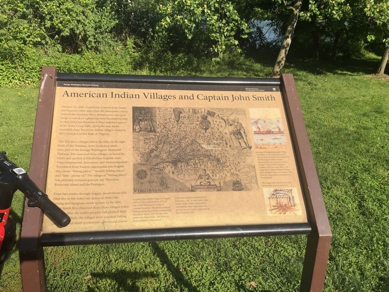
On June 16,1608, Englishman Captain John Smith and fourteen other men from the Jamestown colony entered the Potomac River aboard a two-ton open barge in search of a glistering metal the [natives] told us they had from Patowmeck. They explored upriver as far as the Great Falls. Along the way, Smith recorded many American Indian villages, which he later included on his Map of Virginia.
The first three villages below the falls, on the right bank of the Potomac, were located on lands now part of the George Washington Memorial Parkway. The names of these villages, as heard by Smith and spelled in Elizabethan English, were Namoraughquend, Assaomeck, and Namassingakent. Translated from Eastern Algonquian into English they mean "fishing place," "middle fishing place," and "fish - plenty of." The village of "fishing place" was probably between present-day Theodore Roosevelt Island and the Pentagon.
From late winter through August, anadromous fish (that live in salt water but spawn in fresh) like herring and sturgeon, swam upriver to the falls. When Smith first observed these three villages it was late June, after the native peoples
this page online
Captain John Smith's Map of Virginia (above), first published in 1612, is one of the best known maps of colonial America. The three seasonal fishing camps that Smith recorded are identified above. The Tuscan cross marks the Great Falls - the farthest limit of Smith's exploration.
If the map appears "sideways," it is because "up" is west rather than north. In the 1600s, mapmakers customarily drew maps from the perspective of a sailor approaching the land from the sea.
Erected by National Park Service, U.S. Department of the Interior.
Topics. This historical marker is listed in these topic lists: Exploration • Indigenous Peoples and Communities. A significant historical month for this entry is June 1786.
Location. 38° 53.736′ N, 77° 3.986′ W. Marker is in Arlington, Virginia, in Arlington County. It is in Rosslyn. It is on George Washington Parkway, on the right when traveling north. Located in the parking area adjacent to the foot bridge to Theodore Roosevelt Island. Touch for map. Marker is in this post office
Photographed by Devry Becker Jones (CC0), May 15, 2020
2. American Indian Villages and Captain John Smith Marker

Regionally, this marker is in the Washington Metropolitan Area and in Northern Virginia. It is also in the American South, specifically in the Upper South, in the Mid-Atlantic, and on the Eastern Seaboard. Globally, it is in the North Atlantic Region, North America, the Western Hemisphere, the Western World, and the Anglosphere. Historically, it finds itself in what was once the territory of the Mississippian Culture, one of the original Thirteen Colonies, one of the Confederate States of America, and the Antebellum South.
Other nearby markers. At least 8 other markers are within walking distance of this marker: Force of Nature (a few steps from this marker); Mount Vernon Trail (a few steps from this marker); Fort Haggerty (about 700 feet away, measured in a direct line); Theodore Roosevelt (approx. 0.2 miles away in District of Columbia); Making the Memorial (approx. 0.2 miles away in District of Columbia); Mason Mansion (approx. ¼ mile away in District of Columbia); Causeway (approx. ¼ mile away in District of Columbia); Urban Wilderness (approx.
Photographed by Craig Swain, August 8, 2008
3. Little River Chute of the Potomac
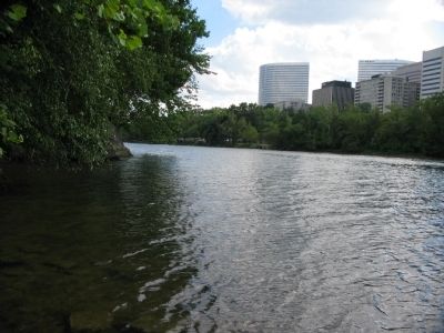
With modern office buildings in the background, this branch of the Potomac appears peaceful in comparison.
More about this marker. On the far right are illustrations of Native Americans life as seen by the European explorers. In 1584-85, Englishman John White, a member of the Roanoke Colony, drew a series of watercolors depicting the life of the North Carolina Algonquians, who shared a culture similar to that of their linguistic cousins of the Potomac River. The image above depicts Indians fishing from a dugout canoe, including a fish weir for trapping fish (shown in the background). Another image shows how they broiled fish over an open fire.
Photographed by Allen C. Browne
4. Prehistory - Analostan - 1717
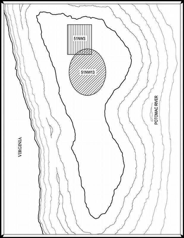
“In 1711, Swiss explorer Baron Christoph von Graffenried described the present-day Theodore Roosevelt Island as "all cut out of rock. above it is a very fine and good soil, sufficient to support a whole family. Indians live there. One could make an impregnable fort of it." These inhabitants were most likely members of the Necostin, or Anacostin, tribe. Many of the island's earliest names appear to be derivatives of the tribal name, including "Anacostien," "Anacostian," "Annalostian," and finally "Analostan," a name that would remain in use until the twentieth century. Two prehistoric archeological sites are known on the island, 51nw3 and 51nw12. The latter was described in 1923 as a "village," and may potentially be the long-sought native American Settlement of Namoraughquend. The 1967 excavation of site 51 nw3 uncovered large quantities of pottery sherds, projectile points, animal bones, and similar artifacts, giving tangible proof of a substantial, and most likely long-term, Native American presence. The major occupation dates to the end of the early woodland and beginning of the middle woodland periods, ca. 750 B.C. to 200 A.D. ” — HABS (Map based on Harvard G. Ayers "Report of Archeological Testing on the Site TR#1 on Theodore Roosevelt Island")
Credits. This page was last revised on February 1, 2023. It was originally submitted on June 15, 2009, by Craig Swain of Leesburg, Virginia. This page has been viewed 3,021 times since then and 113 times this year. Last updated on March 26, 2022, by Connor Olson of Menomonee Falls, Wisconsin. Photos: 1, 2. submitted on May 15, 2020, by Devry Becker Jones of Washington, District of Columbia. 3. submitted on June 15, 2009, by Craig Swain of Leesburg, Virginia. 4. submitted on April 9, 2017, by Allen C. Browne of Silver Spring, Maryland. • Devry Becker Jones was the editor who published this page.
