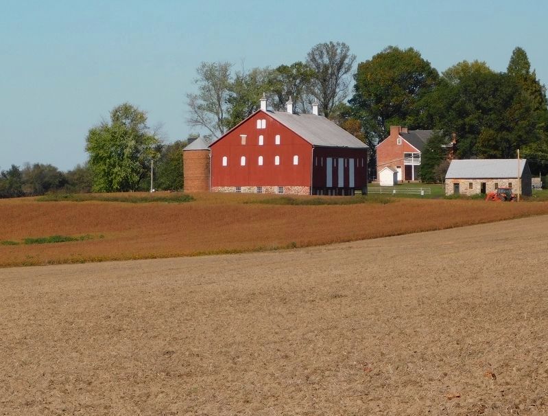
Near Frederick in Frederick County, Maryland — The American Northeast (Mid-Atlantic)
Thomas Farm
Monocacy National Battlefield
— National Park Service, U.S. Department of the Interior —
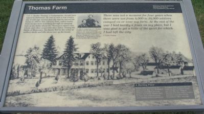
There was not a moment for four years when there were not from 4,000 to 14,000 soldiers camped on or near my farm. At the end of the war I had hardly a fence on my place, but I was glad to get a little of the quiet for which I had left the city.
C. Keefer Thomas
(Sidebar): A Meeting Place
In June 1863, a year before the battle, Union Maj. Gen. Winfield S. Hancock established his headquarters here at the Thomas farm for three days while his troops were heading north to Gettysburg.
In August 1864, a month after the battle, Lt. Gen. Ulysses S. Grant met with Maj. Gen. Philip H. Sheridan and other military leaders at Araby to map plans for the Shenandoah Valley campaign.
Erected by National Park Service, U.S. Department of the Interior.
Topics. This historical marker is listed in this topic list: War, US Civil . A significant historical month for this entry is June 1863.
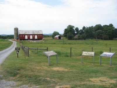
Location. Marker has been reported permanently removed. It was located near 39° 21.436′ N, 77° 23.468′ W. Marker was near Frederick, Maryland, in Frederick County. Marker was on Baker Valley Road, on the right when traveling south. Located at stop four of the auto-tour of Monocacy Battlefield. This marker set is at the trail head for the Thomas Farm walking tour. Touch for map. Marker was in this post office area: Frederick MD 21704, United States of America.
We have been informed that this sign or monument is no longer there and will not be replaced. This page is an archival view of what was.
Other nearby markers. At least 8 other markers are within walking distance of this location. Final Attack (within shouting distance of this marker); Civilians Under Siege (within shouting distance of this marker); 10th Vermont Monument (approx. 0.3 miles away); State of Pennsylvania Monument (approx. 0.3 miles away); Final Stand (approx. 0.3 miles away); Clustered Spires of Frederick (approx. half a mile away); History of the Monocacy River Valley (approx. half a mile away); The Battle That Saved Washington (approx. half a mile away). Touch for a list and map of all markers in Frederick.
More about this marker. The background image on the marker is a drawing of Araby. A small photograph in the upper center is a group portrait of three men, captioned, "On July 5, young Samuel S. Thomas [Center of photograph] and two friends were sitting on the Araby porch when U.S. soldiers forced them to join the 11th Maryland Regiment or face arrest. Fortunately a 'sympathetic officer' let them go free after four days."
Also see . . . Thomas Farm. More detailed information about the Thomas Farm, from the National Parks Service site. (Submitted on November 3, 2007, by Craig Swain of Leesburg, Virginia.)
Credits. This page was last revised on April 17, 2022. It was originally submitted on November 3, 2007, by Craig Swain of Leesburg, Virginia. This page has been viewed 2,392 times since then and 17 times this year. Last updated on March 28, 2022, by Connor Olson of Kewaskum, Wisconsin. Photos: 1, 2, 3. submitted on November 3, 2007, by Craig Swain of Leesburg, Virginia. 4. submitted on September 1, 2008. 5. submitted on April 11, 2021, by Bradley Owen of Morgantown, West Virginia. 6. submitted on November 4, 2007, by Craig Swain of Leesburg, Virginia. • J. Makali Bruton was the editor who published this page.
