Near Flint Hill in Rappahannock County, Virginia — The American South (Mid-Atlantic)
Hittle's Mill
Leading Lee's Second Northern Invasion
— Gettysburg Campaign —
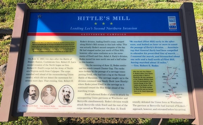
After Confederate Gen. Robert E. Lee's stunning victory at Chancellorsville in May 1863, he led the Army at Northern Virginia west to the Shenandoah Valley, then north through central Maryland and across the Mason-Dixon Line into Pennsylvania. Union Gen. George G. Meade, who replaced Gen. Joseph Hooker on June 28, led the Army of the Potomac in pursuit. Confederate cavalry commander Gen. J.E.B. Stuart cut Federal communication and rail lines and captured supplies. The armies collided at Gettysburg on July 1, starting a battle that neither general planned to fight there. Three days later, the defeated Confederates retreated, crossing the Potomac River into Virginia on July 14.
On June 11, 1863, two days after the Battle of Brandy Station, Confederate Gen. Robert E. Lee's second invasion of the North began as Gen. Richard S. Ewell's corps led the Army of Northern Virginia north from Culpeper. The corps marched well ahead of the reconnoitering Union cavalry, which did not detect the movement for several more days. That evening, Gen. Robert E. Rode's division, leading Ewell's corps, camped along Hittie's Mill stream in this lush valley. This was actually Rodes's second campsite of the day. He had stopped earlier just north of Flint Hill however, after some confusion as to the movements of Ewell and Gen. Jubal A. Early's division, Rodes moved his men north one and a half miles to this location.
On the morning of June 12, Rodes continued his march toward Chester Gap. The ranks were broken by the passage of a carriage transporting Ewell, who had lost a leg at the Second Battle of Manassas. The carriage caught up to the division command near Sandy Hook (now Huntly) where Rodes joined Ewell in the carriage as it continues toward the Blue Ridge ahead of the marching troops.
Ewell informed Rodes of plans to attack the unsuspecting Union garrisons at Winchester and Berryville simultaneously. Rodes's division would attack Berryville while Ewell and the rest of the corps moved on Winchester. On June 13, Ewell soundly defeated the Union force at Winchester. The garrison at Berryville had learned of Rodes's approach, however, and retreated before his arrival.
"We reached [Flint Hill] early in the afternoon, and halted an hour or more to await the passage of Early's division. … Ascertaining that General Early had been compelled to abandon his prescribed line of march, … I resumed the march, and bivouacked about one mile and a half north of Flint Hill, having marched about 15 miles."
— Gen. Robert E. Rodes
After the war, Gen. Robert E. Rodes's sister, Lucy Rodes, married John J. Reid of Woodville.
Erected by Virginia Civil War Trails.
Topics and series. This historical marker is listed in this topic list: War, US Civil. In addition, it is included in the Virginia Civil War Trails series list. A significant historical month for this entry is May 1863.
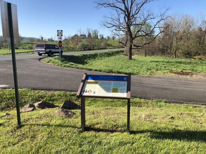
Location. 38° 47.502′ N, 78° 6.283′ W. Marker is near Flint Hill, Virginia, in Rappahannock County. Marker is at the intersection of Zachary Taylor Highway (U.S. 522) and Hittles Mill Road, on the right when traveling south on Zachary Taylor Highway. Touch for map. Marker is at or near this postal address: 955 Zachary Taylor Hwy, Flint Hill VA 22627, United States of America. Touch for directions.
Other nearby markers. At least 8 other markers are within 5 miles of this marker, measured as the crow flies. Flint Hill Baptist Church (approx. 1.9 miles away); Albert Gallatin Willis (approx. 1.9 miles away); Albert G. Willis (approx. 3.4 miles away); Piedmont (approx. 4.2 miles away); Gettysburg Campaign (approx. 5 miles away); Warren County / Rappahannock County (approx. 5 miles away); Minding the Gaps (approx. 5.1 miles away); Chester Gap (approx. 5.1 miles away). Touch for a list and map of all markers in Flint Hill.
Credits. This page was last revised on April 4, 2022. It was originally submitted on April 17, 2021, by Devry Becker Jones of Washington, District of Columbia. This page has been viewed 486 times since then and 43 times this year. Last updated on April 4, 2022, by Bill Stuart of Hinton, Va.. Photos: 1, 2. submitted on April 17, 2021, by Devry Becker Jones of Washington, District of Columbia. • J. Makali Bruton was the editor who published this page.

