Chesterfield in Chesterfield County, Virginia — The American South (Mid-Atlantic)
Chesterfield County Courthouse
Photographed by Bernard Fisher, May 30, 2009
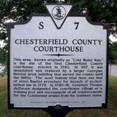
1. Chesterfield County Courthouse Marker
This area, known originally as "Cold Water Run," is the site of the first Chesterfield County courthouse, erected in 1750. In 1917 it was demolished and replaced by a larger Georgian Revival brick building that served the county until the 1960s. The most famous trial here was that of seven Baptist preachers for breach of ecclesiastical law in 1773. In 1780-81, Governor Thomas Jefferson designated the courthouse village as a training post and encampment of all reinforcements for the Continental armies from the southern states.
Erected 1987 by Department of Conservation and Historic Resources. (Marker Number S-7.)
Topics and series. This historical marker is listed in these topic lists: Architecture • Colonial Era • War, US Revolutionary. In addition, it is included in the Former U.S. Presidents: #03 Thomas Jefferson, and the Virginia Department of Historic Resources (DHR) series lists. A significant historical year for this entry is 1750.
Location. 37° 22.554′ N, 77° 30.41′ W. Marker is in Chesterfield, Virginia, in Chesterfield County. It is at the intersection of Iron Bridge Road (Virginia Route 10) and Wagners
this page online

Regionally, this marker is in the Piedmont, in Central Virginia, and in the Richmond Metropolitan Area. It is also in the American South, specifically in the Upper South, and on the Eastern Seaboard. Globally, it is in the North Atlantic Region, North America, the Western Hemisphere, the Western World, and the Anglosphere. Historically, it finds itself in what was once the territory of the Mississippian Culture, one of the original Thirteen Colonies, one of the Confederate States of America, and the Antebellum South.
Other nearby markers. At least 8 other markers are within walking distance of this marker: Veterans Memorial Wall (a few steps from this marker); World War I in Chesterfield County (within shouting distance of this marker); Magnolia Grange (within shouting distance of this marker); a different marker also named Chesterfield Court House (within shouting distance of this marker); Employee Service Recognition (within shouting distance

Photographed by Bernard Fisher, May 30, 2009
2. Chesterfield County 1917 Courthouse
Town website entry:
Click for more information.
Click for more information.
Another marker is no longer nearby. Chesterfield Court House (was within shouting distance of this marker but has been replaced with another marker now near it).
Also see . . . Chesterfield County Courthouse and Courthouse Square. Wikipedia entry (Submitted on January 6, 2024, by Larry Gertner of New York, New York.)
Photographed by Bernard Fisher, May 30, 2009
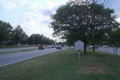
3. Chesterfield County Courthouse Marker on Iron Bridge Road (facing west).
Photographed by Bernard Fisher, May 31, 2009
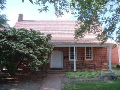
4. Chesterfield County Museum housed in a reconstruction of the 1750 Courthouse.
Photographed by Bernard Fisher, May 30, 2009
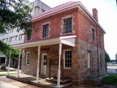
5. The Old Jail at Chesterfield Courthouse
May 30, 2009
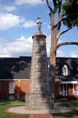
6. Chesterfield and Manchester Confederate Memorial
Photographed by Adam Margolis, July 4, 2014
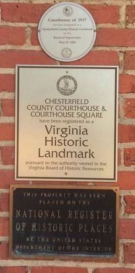
7. Historic Register Plaques
Credits. This page was last revised on March 31, 2025. It was originally submitted on June 1, 2009, by Bernard Fisher of Richmond, Virginia. This page has been viewed 2,446 times since then and 71 times this year. Photos: 1, 2, 3, 4, 5. submitted on June 1, 2009, by Bernard Fisher of Richmond, Virginia. 6. submitted on June 1, 2009. 7. submitted on January 12, 2022, by Adam Margolis of Mission Viejo, California.
