Cumberland Township near Gettysburg in Adams County, Pennsylvania — The American Northeast (Mid-Atlantic)
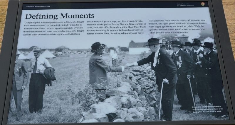
Defining Moments
| — | Gettysburg National Military Park | — |
Photographed by Karl Stelly, February 28, 2022
1. Defining Moments Marker
(caption)
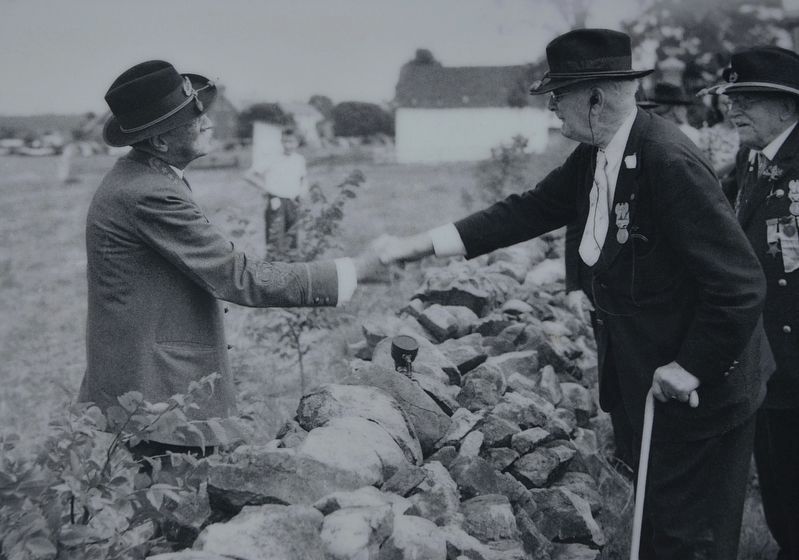
Union and Confederate veterans shake hands across the stone wall during the 75th reunion in 1938.
Erected 2022 by National Park Service, U.S. Department of the Interior.
Topics. This historical marker is listed in this topic list: War, US Civil. A significant historical year for this entry is 1938.
Location. 39° 48.803′ N,
this page online

Regionally, this marker is in South-Central Pennsylvania. It is also in the American Northeast, in the Mid-Atlantic, in Appalachia, and specifically in Northern Appalachia. Globally, it is in North America, the Western Hemisphere, the Western World, and the Anglosphere. Historically, it finds itself in what was once the Haudenosaunee (Iroquois) Confederacy and also one of the original Thirteen Colonies.
Other nearby markers. At least 8 other markers are within walking distance of this marker: The Aftermath (here, next to this marker); Gettysburg Cyclorama (a few steps from this marker); Arnold's Battery (a few steps from this marker); Twenty-Sixth North Carolina Regiment (a few steps from this marker);
Photographed by Karl Stelly, February 28, 2022
2. Defining Moments Marker
Closeup of Union and Confederate veterans shaking hands across the stone wall near "The Angle"
Other markers no longer nearby. Battlefield Landmarks - West and North (was here, next to this marker but has been replaced with another marker now near it); Pettigrew and Trimble's Attack (was here, next to this marker but has been replaced with another marker now near it); Cyclorama Focal Point (was a few steps from this marker but has been replaced with another marker now near it).
Related marker. Click here for another marker that is related to this marker. Old Marker At This Location titled "Battlefield Landmarks - West and North".
Also see . . . Gettysburg National Military Park. National Park Service (Submitted on April 12, 2022.)
Photographed by Karl Stelly, February 28, 2022
3. Defining Moments Marker
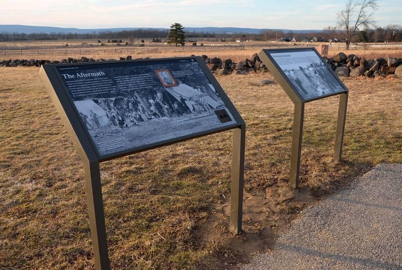
This group of two new markers is in front of "The Angle" on Cemetery Ridge. The marker on the left is entitled "The Aftermath," and the one on the right is entitled "Defining Moments."
Credits. This page was last revised on February 7, 2023. It was originally submitted on April 10, 2022, by Karl Stelly of Gettysburg, Pennsylvania. This page has been viewed 373 times since then and 28 times this year. Photos: 1, 2, 3. submitted on April 10, 2022, by Karl Stelly of Gettysburg, Pennsylvania. • Bernard Fisher was the editor who published this page.
