Anaheim in Orange County, California — The American West (Pacific Coastal)
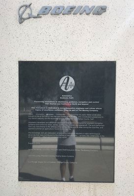
Boeing Autonetics
Anaheim, Calif.
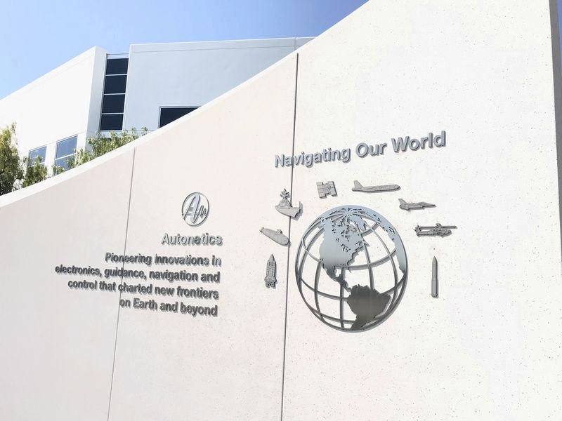
Pioneering innovations in electronics, guidance, navigation and control that charted new frontiers on Earth and beyond.
This monument is dedicated to every Autonetics employee and retiree whose legacy of excellence continues today as part of The Boeing Company.
Vision ... Innovation ... Progress ... Community ... For more than 50 years, these words were brought to life at this site by the men and women of Autonetics, who contributed substantially to our nation's security and the economic growth of Anaheim and Orange County, Calif.
Autonetics developed and advanced electronics and electro-mechanics for precision navigation, guidance and control for ships, planes, submarines, missiles and spacecraft. The work performed here was instrumental in the defense of the United States and its allies during the Cold War, and sparked commercial applications found in everyday life.
The knowledge, skill and dedication of Autonetics individuals resulted in major technological advances that have contributed to the charting of new frontiers air and beyond. effectively navigating our world.
August 3, 2010
James McNerney, Chairman, President and Chief Executive Officer, The Boeing Company
John McLuckey, President (retired), Boeing Space Systems
Curt Pringle, Mayor, City of Anaheim, Orange County, California
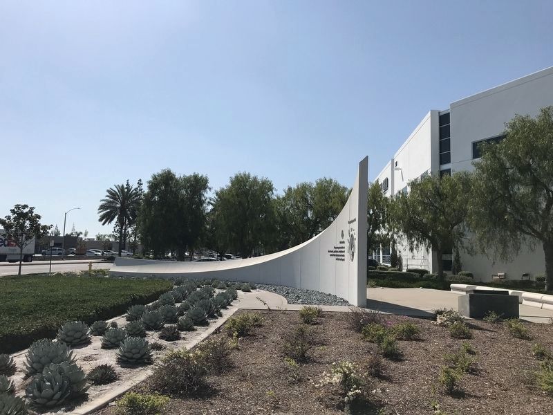
A home in Anaheim
In 1959, Los Angeles-based North American Aviation began moving its expanding Autonetics division to this site in Anaheim, Orange County, California.
Autonetics history and growth coincided with that of the missile and space age in the mid-20th century. At its peak in the 1960s, the Autonetics workforce numbered nearly 36,000 men and women, and the Anaheim site encompassed more than three million square feet of offices and laboratories on approximately 260 acres.
"The North American Aviation teams, which became Autonetics ... were always on the cutting edge of technology. Autonetics gave the nation a number of 'firsts' ..." wrote John R. Moore, who served as the first president of Autonetics from 1955 to 1966. Under his leadership, Autonetics became a force in the navigation marketplace.
In 1967, North American Aviation merged with Rockwell Standard to become the North American Rockwell Corporation; it subsequently became known as Rockwell. In 1966, Rockwell and Boeing announced that Boeing was acquiring Rockwell's aerospace and defense business, including Autonetics.
Boeing began combining its Southern California resources in 2006 by moving many Anaheim programs to the Huntington Beach facility. This streamlining of Boeing's presence was accomplished while preserving the core capabilities of the former Autonetics division.
Images: Boeing
[bottom sidebar]
Autonetics grew to be a sprawling 260-acre facility as shown in this 1985 aerial image (left). The name, Autonetics, comes from the terms, Automation and Cybernetics. A plaque (center) marked the dedication of the Autonetics Headquarters building in 1964 (right), originally located on Miraloma Ave.
Contributions to U.S. security on land
When the Soviet Union launched a man-made satellite, Sputnik, in October 1957, the United States became aware that its adversary now had the ability to launch a weapon toward its shores. To counter, the U.S. accelerated development of a protective fleet of land-based missiles.
In 1958, Autonetics joined a contractor team selected by the U.S. Air Force to produce the Minuteman missile. Named in honor of the advance scouts of the American Revolution, the Minuteman was conceived as a rapidly deployable, highly reliable ballistic missile with intercontinental range. It was a weapon system marvel, capable of being launched in less than one minute and reach its target in less than 30 minutes. On February 1, 1961, Minuteman made a successful first flight from Cape Canaveral Air Force Station, Florida, with Autonetics navigation and flight control hardware and software directing the system.
Autonetics ultimatly supplied more than 3,000 internal guideance and control systems for the Minuteman I and the follow-on Peacekeeper, the most accurate ICBM ever developed. Contributions to U.S. missile defense continue at Boeing, such as providing seeker hardware for the Patriot missile and as the integrator for the Ground-based Midcourse Defense missile system.
[left sidebar]
Shown is a Minuteman test launch from Vandenberg Air Force Base California. The inset depicts the evolution of missile guidance and control systems provided by Autonetics, and the close-up shows the advanced guidance replacement unit deployed on all operational Minutman IIIs.
Images: USAF, Boeing
[bottom sidebar]
Autonetics provided the guidance and control for the Peackeeper missile (left), whose mission came to an end in September 2005. Inset shows the missile guidance system Autonetics developed and Boeing has continued to provide more than 1,000 millimeter wave radar seekers (inset) for the Patriot Advanced Capability (PAC-3) missile (center). Boeing is the prime contractor for the Ground-based Midcourse Defense missile system (right).
Images: Boeing, US Army, Missile Defense Agency
Electronics for precision navigation, guidance and control
At a time in the mid-20th century when there were no satellite-based or complex computing aids available, Autonetics tackled the problem of how to precisely, autonomously and reliably guide a missile, ship, submarine or aircraft from its starting point to its destination, a path that could extend thousands of miles. Autonetics developed the expertise required in electronics and instruments, such as gyroscopes and accelerometers, to solve these problems.
This skill and experience became crucial during the Cold War, when the United States adopted the nuclear triad as its strategic deterrent against the Soviet Union. The triad consisted of Intercontinental Ballistic Missiles (land), nuclear-powered submarines (sea) and strategic aircraft bombers (air). Autonetics contributed greatly to all three types of large platforms by providing guidance and control subsystems, enabling the missiles to travel farther and more precisely, the submarines to navigate with greater accuracy across longer distances, and the bombers to travel on target more safely, quickly and accurately.
The effectiveness of the U.S. nuclear deterrent eventually led to the end of the Cold War and the dissolution of the Soviet Union in 1991.
[bottom sidebar]
The U.S. nuclear triad encompassed land-based, sea and air deterrents. Shown from left are a dual Minutemen missile test launch from Vandenberg Air Force Base in 1979, a U.S. Trident nuclear submarine and a U.S. Air Force FB-111 military aircraft.
Images: US Air Force, US Navy Department of Defense
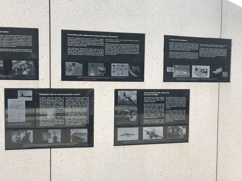
Navigation aids for traversing Earth's waters
Autonetics pioneered innovations in inertial navigation and control systems for vessels traveling Earth's oceans. On August 3, 1958, the USS Nautilus, guided by an Autonetics inertial navigator, became the first vessel to traverse the North Pole, an environment where conventional navigation techniques would not operate properly. This epic journey covered 1,200 miles under the ice and constituted a major breakthrough in underwater navigation.
Autonetics continued to advance the design of inertial navigation systems for submarines and ships. As the 21st century began, every U.S. and United Kingdom nuclear submarine relied upon an electrostatically supported gyro-navigator developed by Autonetics.
This success in navigation paved the way to numerous accoplishments in other marine systems. These included control systems, communication networks and signal processing, with one example being the Fast Time Analyzer System that provided real-time and post flight acoustic data analysis for enemy submarine identification. Autonetics navigation and control systems also contributed to leading-edge technology for approximately 100 different types of underwater vehicles such as the Long-Term Mine Reconnaissance System for surveying potential underwater mine fields. These pioneering submersibles explored the hidden world beneath the ocean's surface, spurring advances in ocean systems, proprietary programs and commercial applications.
[bottom sidebar]
Autonetics provided the Electrostatically Supported Gyro Navigator (ESGN) used on U.S. submarines (left), the Fiber Optic Data Multiplex System (FODMS), information transfer system (inset) found on U.S. and foreign Navy destroyers (center), and the Long-term Mine Reconnaissance System (LMRS), for submarines (right) - all capabilities that continue today at Boeing.
Innovations with applications beyond Earth's boundaries
Autonetics inventions first conceived to meet a national security need found new applications in space with the design and development of critical subsystems for the U.S. human spaceflight programs. These included the Apollo lunar landing program during the 1960s and the Space Shuttle program that followed beginning in the 1980s.
These innovations provided the systems that the Apollo astronauts used to determine the exact position of the lunar module during rendezvous and docking. For the Shuttle, Autonetics supported early development for the space system with simulation hardware for critical testing, as well as the master events controller that monitored the Shuttle orbiter's on-board flight computers.
Autonetics also provided technical breakthrough and major united of flight hardware for the Global Positioning System (GPS) navigational network, used worldwide. From he early 1970s until the 1990s, 55 percent of all major components used on the satellites were designed, built and tested at the Anaheim site. Boeing continues to have a role in the GPS program, building and providing a new generation of GPS satellites scheduled to begin launch in 2010.
[bottom sidebar]
Autonetics also contributed to space exploration, including rendezvous and docking systems for Apollo (left), sequencing controllers (inset) for the Space Shuttle (center) and major units of flight hardware for the GPS satellite network (right).
Images: NASA, Boeing
Improvements to the safety and precision of flight
Autonetics produced critical subsystems that enabled the air-based weapons systems in the U.S. nuclear triad to complete their mission.
From 1950 to 1970, Autonetics designed and produced more than 3,000 radar and fire control sensors to give fighter-bomber aircraft a precision all-weather weapons delivery capability. These sensors gave aircraft including the Lockheed F-104, Republic F-105, General Dynamics F-111D and Boeing B-52, the capability to enter enemy territory undetected, release their payload and return to base.
Autonetics also produced power control assemblies, test equipment, ejector racks and the main caution panel for the Boeing B-1 bomber. For the B-52, Autonetics provided critical systems for its weaponry, including the navigation system for its Hound Dog missiles and the computer for its Short Range Attack Missiles. These weapons enabled the bomber to perform its mission without exposing the aircraft or crew to enemy defenses.
The General Dynamics FB-111A and F-111D became the first aircraft to have a fully integrated radar, navigation and weapon delivery system to allow the aircraft to fly under enemy radar at supersonic speed and deliver weapons accurately. This integration, pioneered by Autonetics, is standard today on all military aircraft.
[top left sidebar]
The F-111D was one of many military aircraft types that benefitted from Autonetics-designed capabilities.
[middle left sidebar]
Technicians ready a modified all-weather radar for installation in the F-111D, a tactical strike aircraft developed in the 1960s for the U.S. Air Force.
Images: US Air Force, Boeing
[bottom sidebar]
The B-52 bomber (left) is the longest-serving bomber in U.S. military history. The B-1B Lancer (center), originally developed with a nuclear mission, was converted to support conventional munitions. Autonetics was a major supporter of electronic subsystems for the B-1B as well as ground test equipment (right) able to check out four aircraft simultaneously.
Images: Boeing
A Legacy that continues
Autonetics core expertise in electronics and electromechanics continues through Boeing's support for heritage military programs, such as the Minuteman and ballistic missile defense systems, as well as in new 21st century applications that include military networks, such as an advanced radio used for rescuing downed military personnel.
Autonetics know-how and innovation also found their way into commercial applications that have profoundly influenced the world in which we live. Autonetics stimulated improvements in the planar process used for manufacturing semiconductors. This work, originally having a military application for the Minuteman missile, contributed greatly to the growth of the modern computer industry and consumer electronics.
Examples of other commercial applications based in part of Autonetics technological developments includes modems, handheld calculators, digital watches and automated fingerprint identification systems. Thus, a heritage that began at the height of the Cold War continues today as a foundation of support for both our nation's security and commercial applications from which the world continues to benefit.
[bottom sidebar]
The Autonetics legacy continues in radio systems, such as this emergency rescue radio (left) that has saved dozens of war fighters' lives, through pioneering work in computers that have contributed to the commercial growth of the electronics industry (center), and the development of infrared local planes (right insert) and sensor assembles for diverse applications, including the Hubble Space Telescope (right)."
Erected 2010 by Boeing.
Topics. This historical marker is listed in these topic lists: Air & Space • Industry & Commerce • Science & Medicine • War, Cold.
Location. 33° 51.148′ N, 117° 51.204′ W. Marker is in Anaheim, California, in Orange County. Marker is on La Palma Avenue, 0.2 miles east of Kraemer Boulevard, on the left when traveling east. Touch for map. Marker is at or near this postal address: 3189 La Palma Ave, Anaheim CA 92806, United States of America. Touch for directions.
Other nearby markers. At least 8 other markers are within 2 miles of this marker, measured as the crow flies. Block by Block (approx. half a mile away); a different marker also named Block by Block (approx. half a mile away); a different marker also named Block by Block (approx. 0.6 miles away); Campsite of Anza (approx. 0.7 miles away); Steve Ambriz Memorial Park (approx. 1.1 miles away); Old Santa Ana (approx. 1.2 miles away); Dwight David Eisenhower (approx. 1.3 miles away); First Site of the Olive Mill (approx. 1.4 miles away). Touch for a list and map of all markers in Anaheim.
Credits. This page was last revised on December 28, 2022. It was originally submitted on April 13, 2022, by Adam Margolis of Mission Viejo, California. This page has been viewed 646 times since then and 158 times this year. Photos: 1, 2, 3, 4, 5, 6. submitted on April 13, 2022, by Adam Margolis of Mission Viejo, California. • Bill Pfingsten was the editor who published this page.


