Providence Township near Grand Rapids in Lucas County, Ohio — The American Midwest (Great Lakes)
Miami & Erie Canal
Ohio Historical Marker
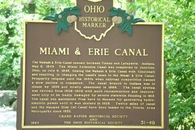
The Wabash & Erie Canal opened between Toledo and Lafayette, Indiana, May 8, 1843. The Miami Extension Canal was completed to Junction, Ohio, on July 4, 1845, linking the Wabash & Erie Canal with Cincinnati and resulting in changing the canal’s name to the Miami & Erie Canal. Prosperity reigned until the 1850s when railroad competition caused a slow decline in commerce. The canal branch to Indiana was in disuse by 1858 and totally abandoned in 1888. The canal system was revived from 1906-1909 with much reconstruction and improvement only to be badly damaged by severe statewide flooding in 1913. The canal was maintained from here to Maumee for generating hydroelectric power until it was drained in 1929. Twelve miles of canal and the Maumee Side Cut Canal have been leased to the Toledo Area Metroparks since 1932.
Erected 1994 by Grand Rapids Historical Society and The Ohio Historical Society. (Marker Number 31-48.)
Topics and series. This historical marker is listed in these topic lists: Industry & Commerce • Waterways & Vessels. In addition, it is included in the Ohio Historical Society / The Ohio History Connection, the The Miami & Erie Canal, and the Wabash & Erie Canal series lists. A significant historical date for this entry is May 8, 1843.
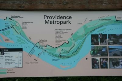
Location. 41° 24.947′ N, 83° 51.435′ W. Marker is near Grand Rapids, Ohio, in Lucas County. It is in Providence Township. Marker can be reached from River Road (U.S. 24). This historical marker is located in the south western corner of Lucas County, along the canal that runs adjacent to the Maumee River, just off of US 24, in Providence Metropark which is part of the Toledo Area Metroparks system. Touch for map. Marker is at or near this postal address: 13200 River Road, Grand Rapids OH 43522, United States of America. Touch for directions.
Other nearby markers. At least 8 other markers are within walking distance of this marker. The Towpath Trail (here, next to this marker); Welcome (within shouting distance of this marker); Through The Eyes Of An Artist (about 700 feet away, measured in a direct line); The Oberle Hotel (about 700 feet away); a different marker also named The Towpath Trail (approx. 0.2 miles away); Whalers And Wickets Of Lock 44 (approx. ¼ mile away); Tough Times On The Towpath (approx. ¼ mile away); Water Power: Turbines and Races (approx. ¼ mile away). Touch for a list and map of all markers in Grand Rapids.
More about this marker. When attempting to view this historical marker, park your vehicle in the metropark's parking lot and head for the canal boat ride. The historical marker is on the north side of the pedestrian bridge that one must cross to get to the canal boat ride.
This historical marker
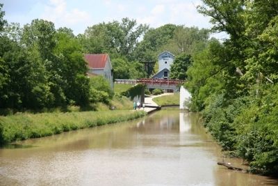
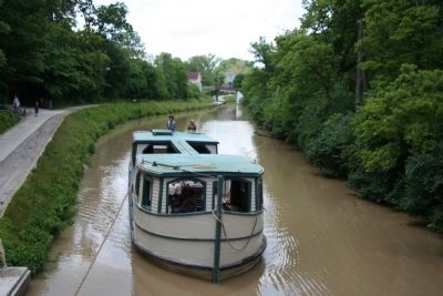
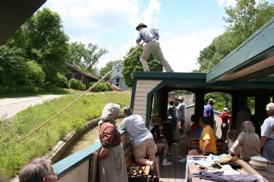
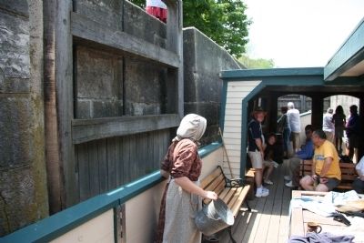
is in a very unique location. Providence Metropark not only is one of the few places in Ohio, and the surrounding area, where one can obtain a ride on an authentic canal boat, it is also the only location in the entire state where you can experience a restored, working canal lock, while locking up and down on a canal boat. In addition to the working canal lock and the authentic canal boat, there is also a canal era, water powered mill, that is open to the public, located at this site.
Also see . . .
1. Miami and Erie Canal. Ohio History Central website entry (Submitted on June 2, 2009, by Dale K. Benington of Toledo, Ohio.)
2. Miami & Erie Canal. Touring Ohio website entry (Submitted on June 2, 2009, by Dale K. Benington of Toledo, Ohio.)
3. Providence Metropark Canal Experience. Touring Ohio website entry (Submitted on June 2, 2009, by Dale K. Benington of Toledo, Ohio.)
Credits. This page was last revised on February 6, 2023. It was originally submitted on June 2, 2009, by Dale K. Benington of Toledo, Ohio. This page has been viewed 2,152 times since then and 38 times this year. It was the Marker of the Week July 26, 2009. Photos: 1, 2, 3, 4, 5, 6. submitted on June 2, 2009, by Dale K. Benington of Toledo, Ohio. • Kevin W. was the editor who published this page.
