
Near Sandston in Henrico County, Virginia — The American South (Mid-Atlantic)
Seven Days Battles
White Oak Swamp
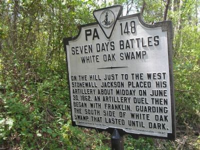
Photographed by Bill Coughlin, April 25, 2007
1. Seven Days Battles - White Oak Swamp marker
Erected 1932 by Conservation & Development Commission. (Marker Number PA-148.)
Topics and series. This historical marker is listed in this topic list: War, US Civil. In addition, it is included in the Virginia Department of Historic Resources (DHR) series list. A significant historical date for this entry is June 30, 1862.
Location. 37° 28.738′ N, 77° 12.796′ W. Marker is near Sandston, Virginia, in Henrico County. It is at the intersection of Elko Road (Virginia Route 156) and Rail Drive, on the right when traveling north on Elko Road. Touch for map. Marker is in this post office area: Sandston VA 23150, United States of America. Touch for directions.

Regionally, this marker is in Virginia’s Piedmont, in Central Virginia, and in the Richmond Metropolitan Area. It is also in the American South, specifically in the Upper South, and on the Eastern Seaboard. Globally, it is in the North Atlantic Region, North
this page online
Other nearby markers. At least 8 other markers are within 3 miles of this marker, measured as the crow flies: White Oak Swamp (approx. 0.7 miles away); a different marker also named White Oak Swamp (approx. 0.7 miles away); Elko Community Center (approx. one mile away); 1896 Engineer Aviation Battalion Memorial (approx. one mile away); Decoy Airfield (approx. 1.1 miles away); a different marker also named Seven Days Battles (approx. 1.1 miles away); Bottom's Bridge (approx. 2½ miles away); Capt. John Smith Captured (approx. 2½ miles away). Touch for a list and map of all markers in Sandston.
Other markers no longer nearby. Seven Days Battles (was approx. 0.7 miles away but has been confirmed missing); a different marker also named White Oak Swamp (was approx. 0.7 miles away but has been replaced with another marker now near it); New Kent Road (was
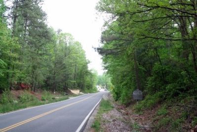
Photographed by Bernard Fisher, May 1, 2009
2. Elko Road facing south (original location)
More about this marker. Marker was moved 0.4 miles north from its original location (GPS 37.47450, -77.21308).
Also see . . . Battle of White Oak Swamp. (Submitted on November 28, 2007, by Craig Swain of Leesburg, Virginia.)

Photographed by James Dean, April 20, 2022
3. Seven Days Battles Marker (relocated)
Credits. This page was last revised on July 1, 2025. It was originally submitted on November 20, 2007, by Bill Coughlin of Woodland Park, New Jersey. This page has been viewed 2,005 times since then and 57 times this year. Last updated on April 20, 2022, by James Dean of Chesterfield, Virginia. Photos: 1. submitted on November 20, 2007, by Bill Coughlin of Woodland Park, New Jersey. 2. submitted on May 1, 2009, by Bernard Fisher of Richmond, Virginia. 3. submitted on April 27, 2022, by James Dean of Chesterfield, Virginia. • Bernard Fisher was the editor who published this page.
