Near Sandston in Henrico County, Virginia — The American South (Mid-Atlantic)
Seven Days Battles
White Oak Swamp
Inscription.
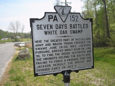
Here the greater part of McClellan’s army and wagon trains crossed the swamp, June 28-30, 1862. Jackson, pursuing, arrived about noon on June 30, to find the bridge destroyed and the Unionists holding the south side. Failing to force a passage that day, Jackson rebuilt the bridge and crossed early on July 1.
Erected 1932 by Conservation & Development Commission. (Marker Number PA-152.)
Topics and series. This historical marker is listed in this topic list: War, US Civil. In addition, it is included in the Virginia Department of Historic Resources (DHR) series list. A significant historical date for this entry is June 28, 1855.
Location. Marker is missing. It was located near 37° 28.153′ N, 77° 12.551′ W. Marker was near Sandston, Virginia, in Henrico County. Marker was on Elko Road (County Route 156), on the right when traveling south. Touch for map. Marker was in this post office area: Sandston VA 23150, United States of America. Touch for directions.
Other nearby markers. At least 8 other markers are within 2 miles of this location, measured as the crow flies. White Oak Swamp (here, next to this marker); a different marker also named White Oak Swamp (a few steps from this marker); a different marker also named Seven Days Battles (approx. half a mile away); a different marker also named Seven Days Battles (approx. 0.7 miles away); Decoy Airfield (approx. 1.4 miles away); Elko Community Center (approx. 1.7 miles away); Riddell's Shop (approx. 2.1 miles away); Glendale (Frayser’s Farm) (approx. 2.1 miles away). Touch for a list and map of all markers in Sandston.
More about this marker. Marker confirmed missing since at least May of 2015 by Google Streetview.
Also see . . .
1. Battle of White Oak Swamp. (Submitted on November 28, 2007, by Craig Swain of Leesburg, Virginia.)
2. White Oak Swamp. Details about the bridge, swamp, and the marker placement with regard to the historical landmarks. (Submitted on November 28, 2007, by Craig Swain of Leesburg, Virginia.)
Credits. This page was last revised on April 21, 2022. It was originally submitted on November 20, 2007, by Bill Coughlin of Woodland Park, New Jersey. This page has been viewed 1,433 times since then and 7 times this year. Last updated on April 20, 2022, by James Dean of Chesterfield, Virginia. Photos: 1, 2. submitted on November 20, 2007, by Bill Coughlin of Woodland Park, New Jersey. • Mark Hilton was the editor who published this page.

