Spring in Harris County, Texas — The American South (West South Central)
Spring Cemetery
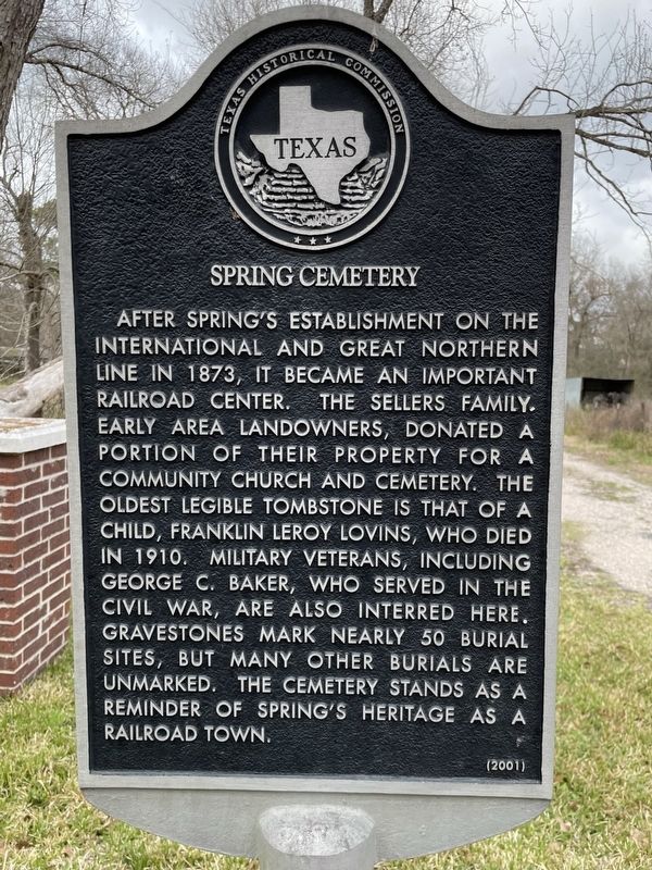
Photographed by Brian Anderson, March 6, 2022
1. Spring Cemetery Marker
Erected 2001 by Texas Historical Commission. (Marker Number 12603.)
Topics. This historical marker is listed in this topic list: Cemeteries & Burial Sites. A significant historical year for this entry is 1910.
Location. 30° 4.728′ N, 95° 24.824′ W. Marker is in Spring, Texas, in Harris County. It can be reached from Aldine Westfield Road, on the right when traveling north. Spring Cemetery is located behind the Lexington Woods Church of Christ. It is accessible from a dirt road off of Aldine Westfield just south of the church. Touch for map. Marker
this page online

Regionally, this marker is in the Houston Metropolitan Area. It is also in the American South and on the Gulf Coast. Globally, it is in North America, a Gulf of Mexico state, the Western Hemisphere, the Western World, and the Anglosphere. Historically, it finds itself in what was once New Spain, the Republic of Texas, one of the Confederate States of America, and the Antebellum South.
Other nearby markers. At least 8 other markers are within 4 miles of this marker, measured as the crow flies: Wunsche Bros. Saloon and Hotel (approx. ¼ mile away); Spring (approx. half a mile away); Immanuel United Church of Christ of Spring (approx. half a mile away); Spring Peaceful Rest Cemetery (approx. 1.4 miles away); Texas Wetlands (approx. 3.3 miles away); Petrified Wood (approx. 3.4 miles away); If Tree Facts Give You a Headache.... (approx. 3.4 miles away); Prehistoric Garden (approx. 3.4 miles away). Touch for a list and map of all markers in Spring.

Photographed by Brian Anderson, March 6, 2022
2. Spring Cemetery Marker
The cemetery itself is visible in the background.
Credits. This page was last revised on February 1, 2023. It was originally submitted on April 22, 2022, by Brian Anderson of New Albany, Ohio. This page has been viewed 830 times since then and 92 times this year. Photos: 1, 2. submitted on April 22, 2022, by Brian Anderson of New Albany, Ohio.
