Hopewell, Virginia — The American South (Mid-Atlantic)
U.S. Government Bakery
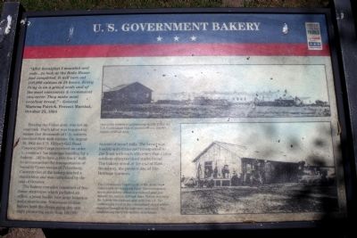
“After breakfast I mounted and rode...to look at the Bake House just completed. It will turn out 100,000 rations in 24 hours. Every thing is on a grand scale and of the most convenient & Economical character. They make most excellent bread.” - General Marsena Patrick, Provost Marshal, October 25, 1864
Feeding the Union army was not an easy task. Much labor was required to ensure that thousands of U.S. Soldiers received their daily rations. On August 30, 1864 the U.S. Military Rail Road Construction Corps received an order to construct “an immense building for a bakery...[&] to have a side track” built to accommodate the transportation of bread to Union troops at Petersburg. Construction of the bakery started a month later and was completed by the end of October.
The bakery complex consisted of five frame structures which included an office, a yeast house, two large bakeries and a storehouse. Numerous civilian bakers kept the ovens going day and night producing more than 100,000 rations of bread daily. The bread was loaded onto trains and transported to the front with such efficiency that Union soldiers often received warm bread. The bakery stood at the end of East Broadway, the present site of Heritage Gardens.
Erected by Virginia Civil War Trails.
Topics and series. This historical marker is listed in this topic list: War, US Civil. In addition, it is included in the Virginia Civil War Trails series list. A significant historical date for this entry is October 25, 1838.
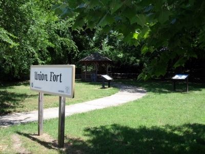
Location. This marker has been replaced by another marker nearby. It was located near 37° 18.575′ N, 77° 16.755′ W. Marker was in Hopewell, Virginia. Marker could be reached from the intersection of Appomattox Street and Fort Street. This marker is located on the east side of the Union Fort. Touch for map. Marker was at or near this postal address: 701 Appomattox St, Hopewell VA 23860, United States of America. Touch for directions.
Other nearby markers. At least 8 other markers are within walking distance of this location. City Point Defenses (here, next to this marker); a different marker also named U.S. Government Bakery (here, next to this marker); Union Fort (within shouting distance of this marker); St. John's Episcopal Church Bell (approx. ¼ mile away); The Bull Ring At City Point (approx. 0.3 miles away); St. John's Episcopal Church (approx. 0.3 miles away); Dr. Peter Eppes House (approx. 0.4 miles away); Porter House (approx. 0.4 miles away). Touch for a list and map of all markers in Hopewell.
More about this marker. On the upper right is a photo of the bakery with the caption, "One of the busiest establishments at City Point; the U.S. Government Bakery produced over 100,000 rations of bread daily."
On the lower right is a photo of the railroad which served the bakery. The caption reads, "The Commissary Department of the Army was responsible for supplying food. The commissary depot and bakery stood on a railroad spur just outside the interior defense lines. Before reaching the bakery, the railroad spur split into a Y. The northern leg went to the commissary depot where supplies brought in by train were unloaded. The southern leg ran to the bakery storehouse."
Related marker. Click here for another marker that is related to this marker. New Marker At This Location also titled "U.S. Government Bakery".
Also see . . . Petersburg National Battlefield. City Point. (Submitted on June 4, 2009.)
Credits. This page was last revised on November 7, 2021. It was originally submitted on June 4, 2009, by Bernard Fisher of Richmond, Virginia. This page has been viewed 1,315 times since then and 13 times this year. Photos: 1, 2, 3. submitted on June 4, 2009, by Bernard Fisher of Richmond, Virginia. 4, 5. submitted on June 5, 2009, by Bernard Fisher of Richmond, Virginia.


