Near Myersville in Frederick County, Maryland — The American Northeast (Mid-Atlantic)
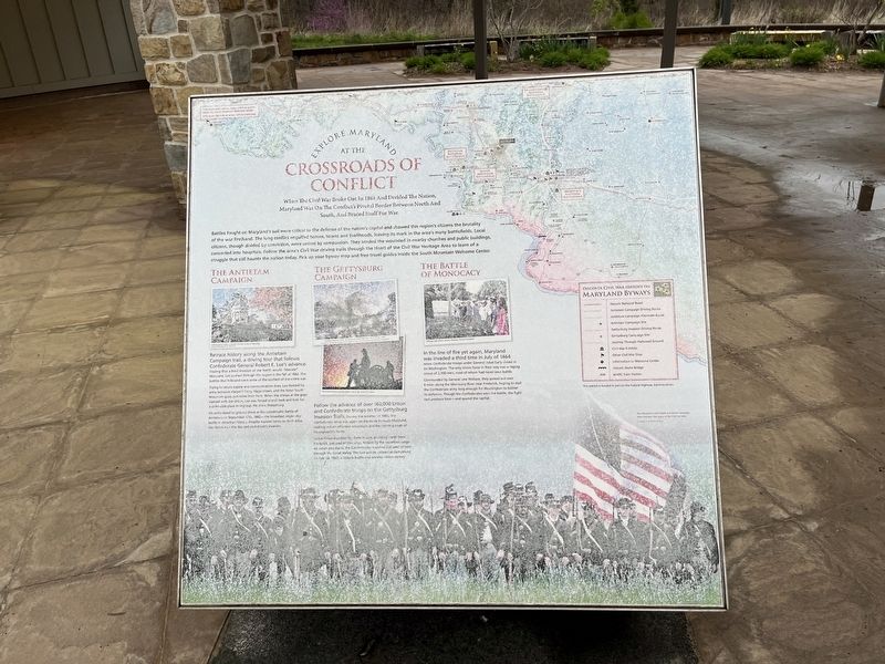
Explore Maryland at the Crossroads of Conflict

Photographed By Devry Becker Jones (CC0), April 21, 2022
1. Explore Maryland at the Crossroads of Conflict Marker
When The Civil War Broke Out In 1861 And Divided The Nation, Maryland Was On The Conflict's Pivotal Border Between North And South, And Braced Itself For War.
Battles fought on Maryland's soil were critical to the defense of the nation's capital and showed this region's citizens the brutality of the war firsthand. The long conflict engulfed homes, towns and livelihoods, leaving its mark in the area's many battlefields. Local citizens, though divided by conviction, were united by compassion. They tended the wounded in nearby churches and public buildings converted into hospitals. Follow the area's Civil War driving trails through the Heart of the Civil War Heritage Area to learn of a struggle that still haunts the nation today. Pick up your byway map and free travel guides inside the South Mountain Welcome Center.
The Antietam Campaign
Retrace history along the Antietam Campaign trail, a driving tour that follows Confederate General Robert E. Lee's advance. Hoping that a bold invasion of the North would "liberate" Maryland, Lee pushed through this region in the fall of 1862. The battles that followed were some of the costliest of the entire war.
Trying to secure supply and communication lines, Lee divided his army between Harper's Ferry, Hagerstown, and the three South Mountain gaps, just miles from here. When the troops at the gaps clashed with the Union, Lee was forced to pull back and look for a defensible place to regroup. He chose Sharpsburg.
His army stood its ground there at the catastrophic Battle of Antietam on September 17, 1862—the bloodiest single-day battle in American history. Despite massive losses on both sides, the Union won the day and ended Lee's invasion.
The Gettysburg Campaign
Follow the advance of over 160,000 Union and Confederate troops on the Gettysburg Invasion Trails. During the summer of 1863, the Confederate Army was again on the move through Maryland, seeking out an offensive advantage and the ripening crops Pennsylvania's farms.
Union forces searched for them in vain, plodding north from Frederick, just east of this ridge. Hidden by the mountain range on which you stand, the Confederates marched just west of here through the Great Valley. The two armies collided at Gettysburg on July 1st, 1863, a historic battle and another Union victory.
The Battle of Monocacy
In the line of fire yet again, Maryland was invaded a third time in July of 1864 when Confederate troops under General Jubal Early closed in on Washington. The only Union force in their way was a ragtag group of 2,300 men, most of whom had never seen battle.
Commanded by General
Topics. This historical marker is listed in this topic list: War, US Civil. A significant historical date for this entry is July 1, 1863.
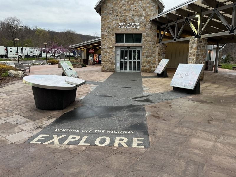
Location. 39° 31.502′ N, 77° 36.058′ W. Marker has been reported damaged. Marker is near Myersville, Maryland, in Frederick County. Marker can be reached from Dwight D. Eisenhower Highway (Interstate 70) 2 miles west of Maryland Route 17, on the right when traveling west. Touch for map. Marker is in this post office area: Myersville MD 21773, United States of America. Touch for directions.
Other nearby markers. At least 8 other markers are within walking distance of this location. The Historic National Road (here, next to this marker); Explore Maryland as the Crucible of the Nation (here, next to this marker); Camp David (here, next to this marker); Underground Railroad (here, next to this marker); The Battle of Antietam (here, next to this marker); Washington County (here, next to this marker); C&O Canal (here, next to this marker); Frederick County (here, next to this marker). Touch for a list and map of all markers in Myersville.
Related marker. Click here for another marker that is related to this marker. An identical marker can be found on the eastbound rest area.
Credits. This page was last revised on April 23, 2022. It was originally submitted on April 23, 2022, by Devry Becker Jones of Washington, District of Columbia. This page has been viewed 121 times since then and 14 times this year. Photos: 1, 2. submitted on April 23, 2022, by Devry Becker Jones of Washington, District of Columbia.
