Myersville in Frederick County, Maryland — The American Northeast (Mid-Atlantic)
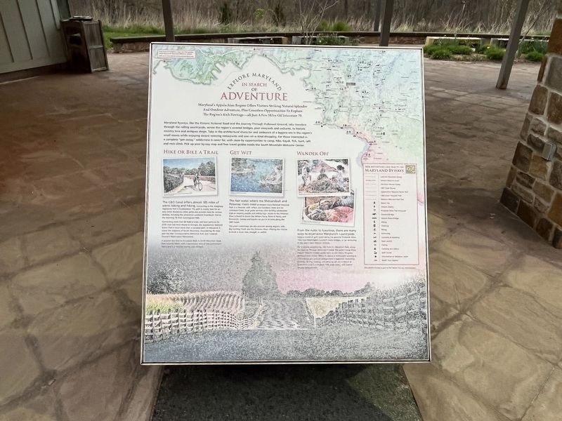
Explore Maryland in Search of Adventure

Photographed By Devry Becker Jones (CC0), April 21, 2022
1. Explore Maryland in Search of Adventure Marker
Maryland's Appalachian Region Offers Visitors Natural Splendor And Outdoor Adventure, Plus Countless Opportunities To Explore The Region's Rich Heritage—all Just A Few Miles Off Interstate 70.
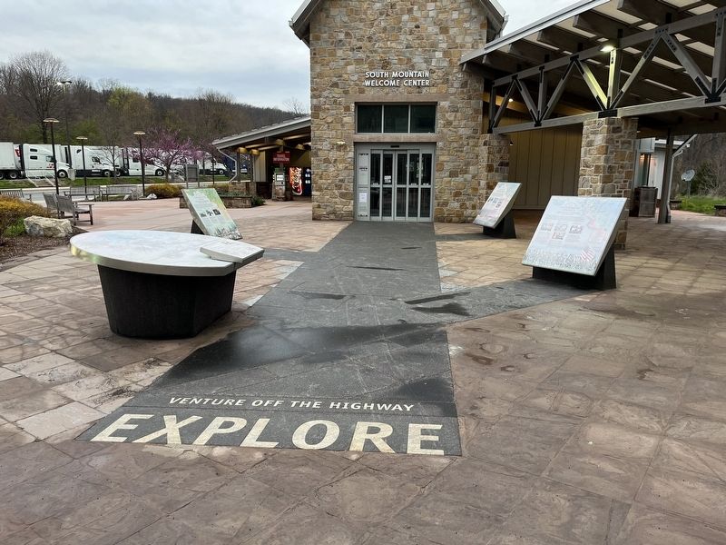
Maryland Byways, like the Historic National Road and the Journey Through Hallowed Ground, take travelers through the rolling countryside, across the region's covered bridges, past vineyards and orchards, to historic country inns and antique shops. Take in the architectural character and ambiance of a bygone era in the region's small towns while enjoying award-winning restaurants and one-of-a-kind shopping. For those interested in a complete "get-away," wilderness is never far, with close-by opportunities to camp, hike, kayak, fish, hunt, raft and rock climb. Pick up your byway map and free travel guides inside the South Mountain Welcome Center.
Hike or Bike a Trail
The C&O Canal offers almost 185 miles of scenic biking and hiking, connecting to the Allegheny Highlands Trail in Cumberland. The path is mostly level for various abilities, including the wheelchair accessible Boardwalk Trail to the stunning 78-foot Cunningham Falls.
Connecting more than 60 federal state and local parks on its 2175-mile trek from Maine to Georgia, the Appalachian National Scenic Trail is much more than a wooded path. In Maryland, it traces the ridgeline of South Mountain, meandering 40 miles past the War Correspondents Memorial Arch and Frederick County's Washington Monument.
A popular day hike to Annapolis Rock in South Mountain State Park rewards hikers with a spectacular view of the Cumberland Valley and is a favorite among rock climbers.
Get Wet
The fast water where the Shenandoah and Potomac rivers meet at Harpers Ferry National Historical Park is a favorite with rafters and kayakers. Here and on Antietam Creek, local guide services offer thrilling whitewater trips or relaxing paddle and tubing trips. Access to the Potomac River is found in towns like White's Ferry, Point of Rocks, and Brunswick. Canoes and kayaks can put in at locks along the C&O Canal.
The area's waterways are also popular among anglers, with Big Hunting Creek and the Potomac River offering the chance to hook a trout, bass, bluegill, or catfish.
Wander Off
From the rustic to luxurious, there are many ways to experience Maryland's countryside. Enjoy a round of golf, picnic along the pastoral Frederick Wine Trail, tour Washington County's stone bridges, or go antiquing in the area's many historic districts.
For a unique camping trip, visit Catoctin Mountain Park, along the Journey Through Hallowed Ground.
Topics and series. This historical marker is listed in these topic lists: Parks & Recreational Areas • Waterways & Vessels. In addition, it is included in the Chesapeake and Ohio (C&O) Canal, and the Works Progress Administration (WPA) projects series lists.
Location. 39° 31.505′ N, 77° 36.058′ W. Marker is in Myersville, Maryland, in Frederick County. Touch for map. Marker is in this post office area: Myersville MD 21773, United States of America. Touch for directions.
Other nearby markers. At least 8 other markers are within walking distance of this marker. Frederick County (here, next to this marker); C&O Canal (here, next to this marker); Washington County (here, next to this marker); The Historic National Road (here, next to this marker); Explore Maryland as the Crucible of the Nation (here, next to this marker); Underground Railroad (here, next to this marker); Explore Maryland at the Crossroads of Conflict (here, next to this marker); Camp David (here, next to this marker). Touch for a list and map of all markers in Myersville.
Related marker. Click here for another marker that is related to this marker. An identical marker can be found on the eastbound rest area.
Credits. This page was last revised on April 23, 2022. It was originally submitted on April 23, 2022, by Devry Becker Jones of Washington, District of Columbia. This page has been viewed 66 times since then and 6 times this year. Photos: 1, 2. submitted on April 23, 2022, by Devry Becker Jones of Washington, District of Columbia.
