Near Gorman in Los Angeles County, California — The American West (Pacific Coastal)
Castaic Powerplant
Built 1969
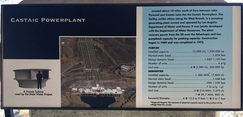
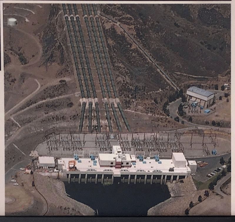
Located about 10 miles south of here between Lake Pyramid and Castaic Lake lies the Castaic Powerplant. This facility, unlike others along the West Branch, is a pumping-generating plant owned and operated by Los Angeles Department of Water and Power. It was jointly developed with the Department of Water Resources. The plant recovers power from the lift over the Tehachapis and has pumpback capacity for peaking capacity. Construction began in 1969 and was completed in 1973.
Pumping
Installed capacity…12,000 cfs, 1,920,000 hp. Normal static head…1,078 feet. Design dynamic head…1,060-1,150 feet. Number of units…6 p/g. Unit size…6 @ 2,300 cfs, 320,000 hp.
Generating
Installed capacity…1,260 MVA, 17,840 cfs. Normal static head…1,048 feet. Design dynamic head…900-1,050 feet. Number of units…7 (6 p/g, 1 g). Unit size…6 @ 210 MVA, 3,470 cfs, 1 @ 59.7 MVA, 800 cfs. Penstock/diameter…6 @ 13.5 to 9 feet / 1 @ 9 to 7 feet.
*Megavolt Ampere (MVA): the measure of electrical capacity equal to the product of the voltage times the current.
Pumped Storage
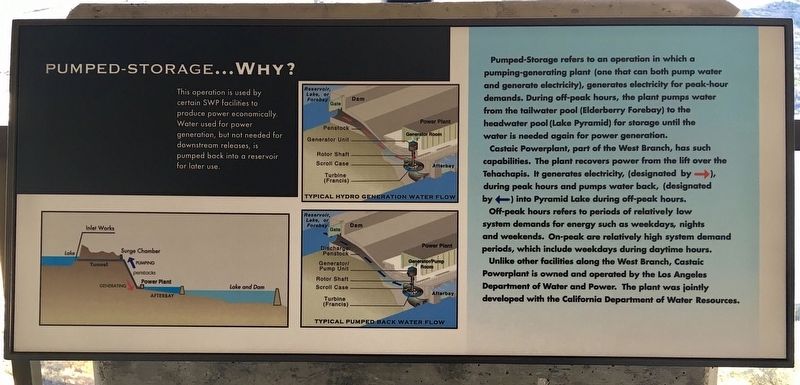
Pumped-Storage refers to an operation in which a pumping-generating plant (one that can both pump water and generate electricity), generates electricity for peak-hour demands. During off-peak hours, the plant pumps water from the tailwater pool (Elderberry Forebay) to the headwater pool (Lake Pyramid) for storage until the water is needed again for power generation. Castaic Powerplant, part of the West Branch, has such capabilities. The plant recovers power from the lift over the Tehachapis. It generates electricity during peak hours and pumps water back into Pyramid Lake during off-peak hours. Off-peak hours refers to periods of relatively low system demands for energy such as weekdays, nights and weekends. On-peak are relatively high system demand periods, which include weekdays during daytime hours. Unlike other facilities along the West Branch, Castaic Powerplant is owned and operated by the Los Angeles Department of Water and Power. The plant was jointly developed with the California Department of Water Resources.
Elderberry Forebay and Dam
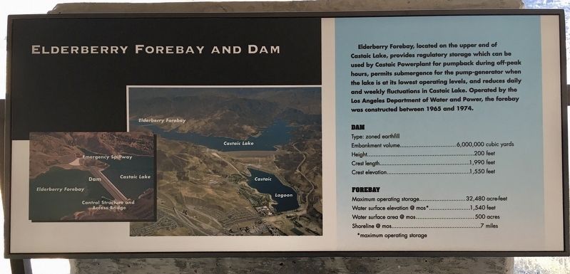
Elderberry Forebay, located on the upper end of Castaic Lake, provides regulatory storage which can be used by Castaic Powerplant for pumpback during off-peak hours, permits submergence for the pump-generator when the lake is at its lowest operating levels, and reduces daily and weekly fluctuations in Castaic Lake. Operated by the Los Angeles Department of Water and Power, the forebay was constructed between 1965 and 1974.
Dam
Type: zoned earthfill. Embankment volume…6,000,000 cubic yards. Height…200 feet. Crest length…1,990 feet. Crest elevation…1,550 feet.
Forebay
Maximum operating storage…32,480 acre-feet. Water surface elevation @ mos…1,540 feet. Water surface area @ mos…500 acres. Shoreline @ mos…7 miles.
*mos: maximum operating storage.
Angeles Tunnel and Surge Chamber
Angeles Tunnel
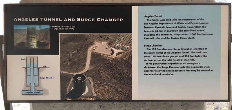
The Tunnel was built with the cooperation of the Los Angeles Department of Water and Power. Located between Pyramid Lake and Castaic Powerplant, the tunnel is 30 feet in diameter. The steel-lined tunnel, including the penstocks, drops water 1,060 feet between Pyramid Lake and the Castaic Powerplant.
Surge Chamber
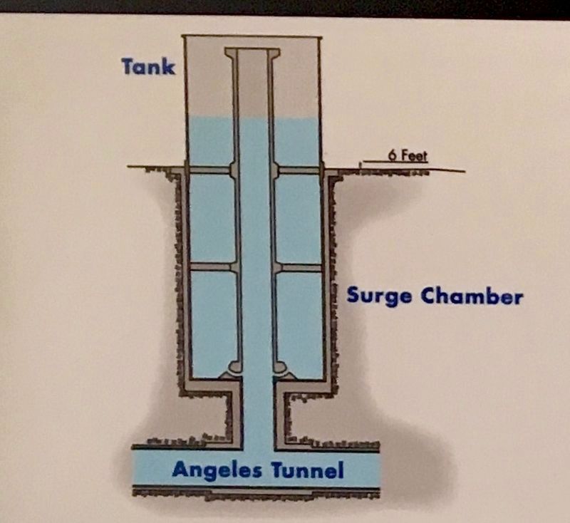
The 120 foot diameter Surge Chamber is located at the South Portal of the Angeles Tunnel. The steel core soars 158 feet above ground and 235 feet below the surface, giving it a total height of 393 feet. If the power plant experiences an emergency shutdown, the Surge Chamber acts like a gigantic shock absorber relieving excess pressure that may be created in the tunnel and penstocks.
Topics. This historical marker is listed in these topic lists: Industry & Commerce • Natural Resources • Waterways & Vessels. A significant historical year for this entry is 1969.
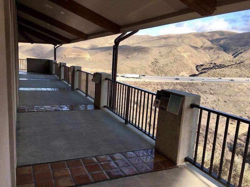
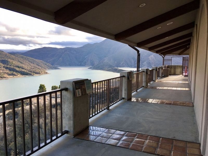
Location. 34° 39.72′ N, 118° 45.655′ W. Marker is near Gorman, California, in Los Angeles County. Marker can be reached from Vista Del Lago Road just west of Interstate 5. Located at Vista Del Lago Visitor Center, open daily 9-5. Touch for map. Marker is at or near this postal address: 38500 Vista Del Lago Rd, Lebec CA 93243, United States of America. Touch for directions.
Other nearby markers. At least 8 other markers are within 6 miles of this marker, measured as the crow flies. The “Ridge Route” (about 400 feet away, measured in a direct line); Reservoir Summit (approx. 2 miles away); Kelly’s Halfway Inn (approx. 2.3 miles away); Swede’s Cut (approx. 2.6 miles away); Tumble Inn (approx. 3.9 miles away); Liebre State Highway Camp (approx. 4.6 miles away); National Forest Inn (approx. 4.6 miles away); Liebre Summit (approx. 5½ miles away). Touch for a list and map of all markers in Gorman.
Regarding Castaic Powerplant. Pyramid Lake and Castaic Lake are part of the California Aqueduct’s West Branch which supplies water to the Los Angeles area. The East Branch supplies the Riverside area and the Inland Empire.
Additional commentary.
1. DWP Employees
My father worked on construction — and I worked on maintenance — of Castaic Powerplant.
— Submitted November 1, 2022, by Craig Baker of Sylmar, California.
Credits. This page was last revised on January 30, 2023. It was originally submitted on February 3, 2022, by Craig Baker of Sylmar, California. This page has been viewed 2,234 times since then and 309 times this year. Last updated on April 23, 2022, by Ronald D. (Ron) Trigueiro of Fresno, California. Photos: 1, 2, 3, 4, 5, 6, 7, 8. submitted on February 3, 2022, by Craig Baker of Sylmar, California. • J. Makali Bruton was the editor who published this page.
