Hamilton in Steuben County, Indiana — The American Midwest (Great Lakes)
Fish Creek Restoration
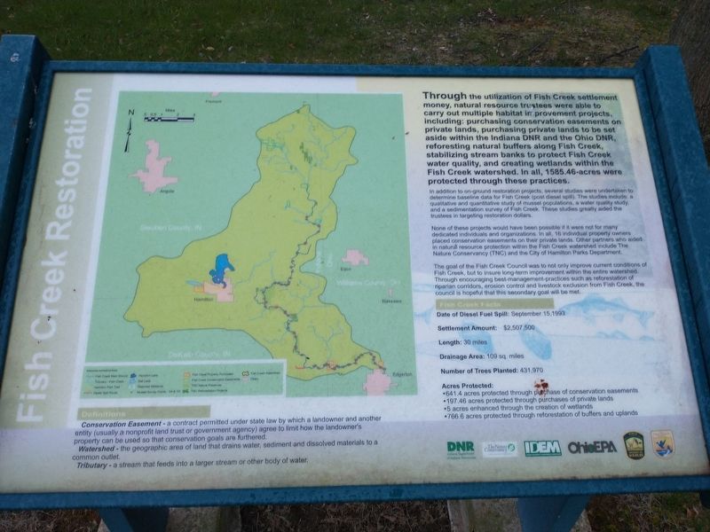
Through the utilization of Fish Creek settlement money, natural resource trustees were able to carry out multiple habitat improvement projects, including: purchasing conservation easements on private lands, purchasing private lands to be set aside within the Indiana DNR and the Ohio DNR, reforesting natural buffers along Fish Creek, stabilizing stream banks to protect Fish Creek water quality, and creating wetlands within the Fish Creek watershed. In all, 1585.46-acres were protected through these practices.
In addition to on-ground restoration projects, several studies were undertaken to determine baseline data for Fish Creek (post diesel spill). The studies include: a qualitative and quantitative study of mussel populations, a water quality study, and a sedimentation survey of Fish Creek. These studies greatly aided the trustees in targeting restoration dollars.
None of these projects would have been possible if it were not for many dedicated individuals and organizations. In all, 16 individual property owners placed conservation easements on their private lands. Other partners who aided in natural resource protection within the Fish Creek watershed include The Nature Conservancy (TNC) and the City of Hamilton Parks Department.
The goal of the Fish Creek Council was to not only improve current conditions of Fish Creek, but to insure long-term improvement within the entire watershed. Through encouraging best-management-practices such as reforestation of riparian corridors, erosion control and livestock exclusion from Fish Creek, the council is hopeful that this secondary goal will be met.
Fish Creek Facts
Date of Diesel Fuel Spill: September 15,1993
Settlement Amount: $2,507,500
Length: 30 miles
Drainage Area: 109 sq. miles
Number of Trees Planted: 431,970
Acres Protected:
•641.4 acres protected through purchase of conservation easements
•197.46 acres protected through purchases of private lands
•5 acres enhanced through the creation of wetlands
•766.6 acres protected through reforestation of buffers and uplands
Definitions
Conservation Easement-a contract permitted under state law by which a landowner and another entity (usually a nonprofit land trust or government agency) agree to limit how the landowner's property can be used so that conservation goals are furthered.
Watershed-the geographic area of land that drains water, sediment and dissolved materials to a common outlet.
Tributary-a stream that feeds into a larger stream or other body of water.
Topics. This historical marker is listed in these topic lists: Environment • Waterways & Vessels. A significant historical date for this entry is September 15, 1993.
Location. 41° 31.995′ N, 84° 55.213′ W. Marker is in Hamilton, Indiana, in Steuben County. Marker can be reached from East Bellefountaine Road west of Peninsula Street, on the right when traveling east. Touch for map. Marker is at or near this postal address: 3779 E Church St, Hamilton IN 46742, United States of America. Touch for directions.
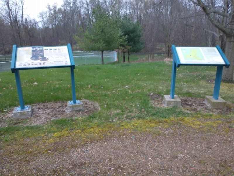
Other nearby markers. At least 8 other markers are within 3 miles of this marker, measured as the crow flies. A different marker also named Fish Creek Restoration (here, next to this marker); Waterway History (a few steps from this marker); Early Hamilton (a few steps from this marker); Early Settlers (a few steps from this marker); Native Americans (a few steps from this marker); Arthur Russell Perry (within shouting distance of this marker); Welcome to the Fish Creek Trail (within shouting distance of this marker); Site Of First Settler In DeKalb County (approx. 2.7 miles away). Touch for a list and map of all markers in Hamilton.
Credits. This page was last revised on May 5, 2022. It was originally submitted on April 26, 2022, by Craig Doda of Napoleon, Ohio. This page has been viewed 144 times since then and 18 times this year. Photos: 1, 2, 3. submitted on April 26, 2022, by Craig Doda of Napoleon, Ohio. • Devry Becker Jones was the editor who published this page.


