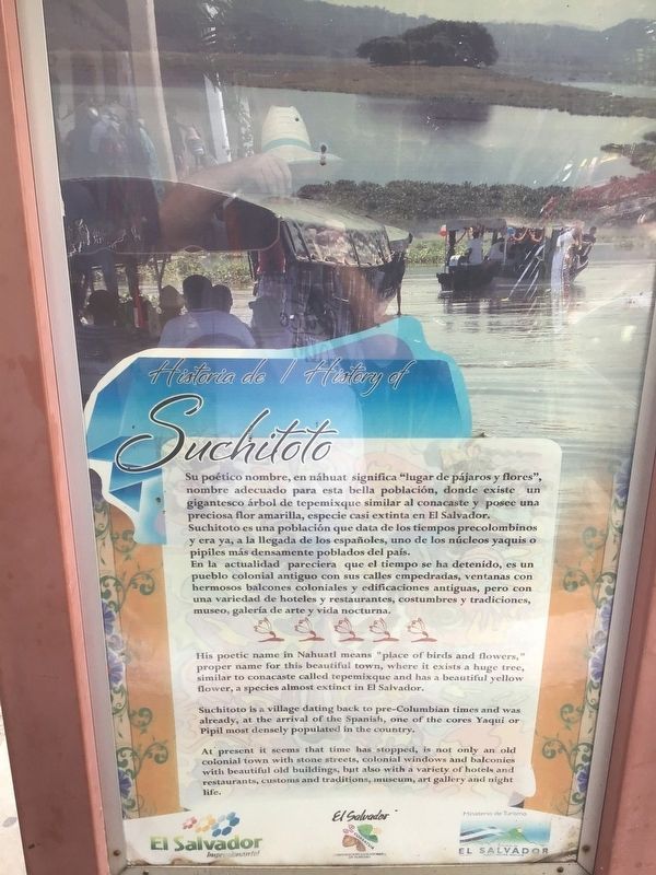
Suchitoto in El Salvador, Cuscatlán, El Salvador — Central America (West Coast)
Historia de / History of Suchitoto
Inscription.
His poetic name in Nahuatl means “place of birds and flowers”, proper name for this beautiful town, where it exists a huge tree, similar to concaste called tepemixque and has a beautiful yellow flower, a species almost extinct in El Salvador. Suchitoto is a village dating back to pre-Colombian times and was already, at the arrival of the Spanish, one of the cores yaqui or pipil most densely populated in the country. At present is seems that time has stopped, is not only an old colonial town with stone streets, colonial windows and balconies with beautiful old buildings, but also with a variety of hotels and restaurants, custom and traditions, museum, art gallery, and night life.
Topics. This historical marker is listed in these topic lists: Agriculture • Hispanic Americans.
Location. 13° 56.195′ N, 89° 1.583′ W. Marker is in Suchitoto, Cuscatlán, in El Salvador. Marker is on Calle San Martin. Touch for map. Touch for directions.
Other nearby markers. At least 8 other markers are within 10 kilometers of this marker, measured as the crow flies. The Church of Santa Lucía (here, next to this marker); Suchitoto (about 240 meters away, measured in a direct line); Structure 4E1 or Cabildo (approx. 8.6 kilometers away); Church Platform (approx. 8.6 kilometers away); Structure 4D1 (approx. 8.6 kilometers away); Ciudad Vieja Archaeological Site (approx. 8.6 kilometers away); Structure 3D2 (approx. 8.7 kilometers away); Streets of Ciudad Vieja (approx. 8.7 kilometers away). Touch for a list and map of all markers in Suchitoto.
Credits. This page was last revised on June 6, 2022. It was originally submitted on April 27, 2022, by Ashley Vanessa Soto Cifuentes of Whitakers, North Carolina. This page has been viewed 88 times since then and 16 times this year. Photo 1. submitted on April 27, 2022, by Ashley Vanessa Soto Cifuentes of Whitakers, North Carolina. • Bill Pfingsten was the editor who published this page.
