Big Sur in Monterey County, California — The American West (Pacific Coastal)
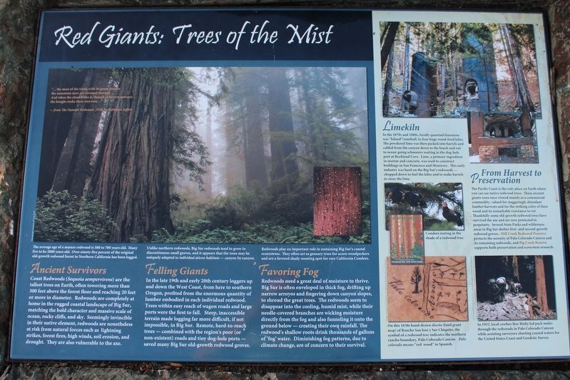
Red Giants: Trees of the Mist
Inscription.
Limekiln
In the 1870s and 1880s, locally quarried limestone was kilned (smelted) in four huge wood-fired kilns. The powdered lime was then packed in barrels and cabled from the canyon down to the beach and out to ocean-going schooners waiting at the dog-hole port at Rockland Cove. Lime, a primary ingredient in mortar and concrete, was used to construct buildings in San Francisco and Monterey. This early industry was hard on Big Sur's redwoods - chopped down to fuel the kilns and to make barrels to store the lime.
From Harvest to Preservation
The Pacific Coast is the only place on Earth where you can see native redwood trees. These ancient giants were once viewed mainly as a commercial commodity, valued for staggeringly abundant lumber harvests and for the striking color of their wood and its remarkable resistance to rot. Thankfully some old-growth redwoods trees have survived the axe and are now protected in perpetuity. Several State Parks and wilderness areas in Big Sur shelter first- and second-growth redwood groves. Mill Creek Redwood Preserve protects the serenity of Palo Colorado Canyon and its remaining redwoods, and Big Creek Reserve supports both preservation and ecosystem research.
Ancient Survivors
Coast Redwoods (Sequoia sempervirens) are the tallest trees on Earth, often towering more than 300 feet above the forest floor and reaching 20 feet or more in diameter. Redwoods are completely at home in the rugged coastal landscape of Big Sur, matching the bold character and massive scale of ocean, rocky cliffs, and sky. Seemingly invincible in their native element, redwoods are nonetheless at risk from natural sources such as lightening strikes, forest fires, high winds, soil erosion, and drought. They are also vulnerable to the axe.
Felling Giants
In the late 19th and early 20th century loggers up and down the West Coast, from here to southern Oregon, profited from the enormous quantity of lumber embodied in each individual redwood. Trees within easy reach of wagon roads and large ports were the first to fall. Steep, inaccessible terrain made logging far more difficult, if not impossible, in Big Sur. Remote, hard-to-reach trees – combined with the region's poor (or non-existent) roads, and tiny dog-hole ports – saved many Big Sur old-growth redwood groves.
Favoring Fog
Redwoods need a great deal of moisture to thrive. Big Sur is often enveloped in thick fog, drifting up narrow arroyos and fingering down canyon slopes, to shroud the great trees. The redwoods seem to disappear into the cooling, humid mist, while their needle-covered branches are wicking moisture directly from the fog
and also funneling it into the ground below – creating their own rainfall. The redwood's shallow roots drink thousands of gallons of 'fog' water. Diminishing fog patterns, due to climate change, are of concern to their survival.
Topics. This historical marker is listed in these topic lists: Environment • Horticulture & Forestry.
Location. 36° 10.172′ N, 121° 41.08′ W. Marker is in Big Sur, California, in Monterey County. Marker can be reached from Cabrillo Highway (State Highway 1 at milepost 37). The marker is at the Julia Pfeiffer Burns State Park Vista Point on Highway 1, 11.7 miles south of the community of Big Sur. Touch for map. Marker is in this post office area: Big Sur CA 93920, United States of America. Touch for directions.
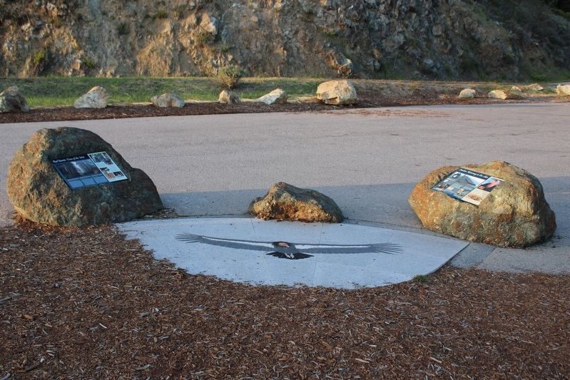
Other nearby markers. At least 8 other markers are within walking distance of this marker. Condors: Returning to Our Skies (here, next to this marker); Esselen: We Are Still Here (a few steps from this marker); High Seas: The Ocean Highway (within shouting distance of this marker); Daring: Dog-hole Ports (within shouting distance of this marker); Pioneers: Homesteading the Sur (within shouting distance of this marker); Inspiration: A Wild Coast and Lonely (within shouting distance of this marker); House with a View (approx. 0.9 miles away); Two Women From Two Worlds (approx. 0.9 miles away). Touch for a list and map of all markers in Big Sur.
Credits. This page was last revised on June 30, 2022. It was originally submitted on April 28, 2022, by Joseph Alvarado of Livermore, California. This page has been viewed 120 times since then and 18 times this year. Photos: 1, 2. submitted on April 28, 2022, by Joseph Alvarado of Livermore, California. • Syd Whittle was the editor who published this page.

