Near Marietta in Cobb County, Georgia — The American South (South Atlantic)
The Fall of Atlanta
Courtesy of Thomas P. Martin, February 16, 2017
1. The Fall of Atlanta Marker
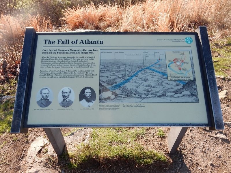
After the battle of Kennesaw Mountain, the muddy roads dried, allowing Union Maj. Gen. William T. Sherman to return to his flanking strategy. On July 2, Gen. Joseph E. Johnston's Confederate soldiers abandoned their Kennesaw line for other prepared defenses at Smyrna and then the Chattahoochee River, only to have the larger Union Army go around them each time.
President of the Confederacy Jefferson Davis, dissatisfied with Johnston's retreats, replaced him with the combative Lt. Gen. John Bell Hood. With the Union Army closing in on Atlanta, Hood went on the offensive with his beleaguered Confederate Army.
[Captions (left to right)]
• Maj. Gen. William T. Sherman, USA
• Gen. Joseph E. Johnston, CSA
• Gen. John Bell Hood, CSA
• Sherman's army severed Atlanta's railroads with victories against Hood at Peachtree Creek, Atlanta, Ezra Church, and Jonesboro. The city's capture on Setember 2 was a bitter blow to the Confederacy.
Erected by National Park Service.
Topics. This historical marker is listed in this topic list:
this page online
Location. 33° 58.58′ N, 84° 34.745′ W. Marker is near Marietta, Georgia, in Cobb County. It can be reached from Pigeon Hill/Big Mountain Hike trail south of Kennesaw Mountain Drive parking lot, on the left when traveling south. Marker is near the summit of Kennesaw Mountain, approximately 700 feet from the parking lot, in Kennesaw Mountain National Battlefield Park. Touch for map. Marker is in this post office area: Marietta GA 30060, United States of America. Touch for directions.

Regionally, this marker is in Georgia’s Piedmont and in Metro Atlanta. It is also in the American South and specifically in the Deep South. Globally, it is in North America, the Western Hemisphere, the Western World, and the Anglosphere. Historically, it finds itself in what was once the original Cherokee Nation, the territory of the Mississippian Culture, one of the original Thirteen Colonies, one of the Confederate States of America, and the Antebellum South.
Other nearby markers. At least 8 other markers are within walking distance of this marker: Atlanta Falls (here, next

Courtesy of Thomas P. Martin, February 16, 2017
2. The Fall of Atlanta Marker
Credits. This page was last revised on April 29, 2022. It was originally submitted on April 29, 2022, by Duane and Tracy Marsteller of Murfreesboro, Tennessee. This page has been viewed 611 times since then and 47 times this year. Photos: 1, 2. submitted on April 29, 2022, by Duane and Tracy Marsteller of Murfreesboro, Tennessee.
