Chesnee in Spartanburg County, South Carolina — The American South (South Atlantic)
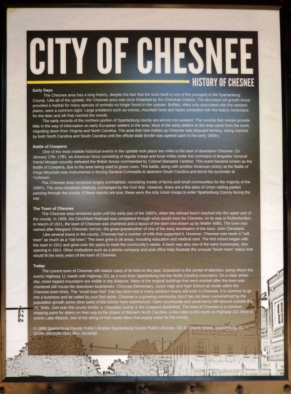
City of Chesnee
History of Chesnee
Early Days
The Chesnee area has a long history, despite the fact that the town itself is one of the youngest in the Spartanburg County. Like all of the upstate, the Chesnee area was once inhabited by the Cherokee Indians. The abundant old growth forest provided a habitat for many species of animals no longer found in the upstate. Buffalo, often only associated with the western plains, were a common sight. Large predators such as wolves, mountain lions and bears competed with the Native Americans for the deer and elk that roamed the woods.
The early records of the northern portion of Spartanburg county are almost nonexistent. The records that remain provide little in the way of information on early European settlers in the area. Most of the early settlers to the area came from the north, migrating down from Virginia and North Carolina. The area that now makes up Chesnee was disputed territory, being claimed by both North Carolina and South Carolina until the official state border was agreed upon in the early 1800's.
Battle of Cowpens
One of the most notable historical events in the upstate took place two miles to the east of downtown Chesnee. On January 17th, 1781, an American force consisting of regular troops and local militia under the command of Brigadier General Daniel Morgan soundly defeated the British forces commanded by Colonel Banastre Tarleton. This event became known as the Battle of Cowpens, due to the area being used to graze cows. This battle, along with another American victory at the Battle of Kings Mountain was instrumental in forcing General Cornwallis to abandon South Carolina and led to his surrender at Yorktown.
The Chesnee area remained largely uninhabited, consisting mostly of farms and small communities for the majority of the 1800's. The area remained relatively unchanged by the Civil War. However, there are a few tales of Union raiding parties passing through the county. If these reports are true, these were the only Union troops to enter Spartanburg County during the war.
The Town of Chesnee
The Chesnee area remained quiet until the early part of the 1900's, when the railroad boom reached into the upper part of the county. In 1909, the Clinchfield Railroad was completed through what would soon be Chesnee, on its way to Rutherfordton. In March of 1911, the town of Chesnee was chartered and a layout of the town was drawn up by Walter Willis. The town was named after Margaret Chesnee Vernon, the great-grandmother of one of the early developers of the town, John Cleveland.
Like several towns in the county, Chesnee had a number of mills that supported it. However, Chesnee was never a "mill town" as much as a "rail
town." The town grew in all areas, including education and medical care. The first school began with the town in 1911 and grew over the years to meet the community's needs. A bank was also one of the early businesses, also opening in 1911. Other institutions such as a phone company and post office help illustrate the unusual "boom town" status that would fit the early years of the town of Chesnee.
Today
The current town of Chesnee still retains many of its links to the past. Downtown is the center of attention, being where the scenic Highway 11 meets with Highway 221 as it runs from Spartanburg into the North Carolina mountains. On a clear winter day, snow topped mountains are visible in the distance. Many of the original buildings that were erected after the town was chartered still house the downtown businesses. Chesnee Elementary, Junior High and High School all reside within the Chesnee town limits. The "small town feel" that has been lost in many southern towns still exists in Chesnee. It is common to go into a business and be called by your first name. Chesnee is a growing community, but it has not been overwhelmed by the population growth some other parts of the county have experienced. Open countryside and small farms still abound outside the city limits. Just over the county border in Cherokee county is the Cowpens Battlefield. The town of Chesnee is a common stopping point for skiers on their way to the slopes of Western North Carolina. A few miles to the south on Highway 221 there is scenic Lake Blalock, one of the string of man made lakes that supply water for the county.
Erected 1999 by Spartanburg County Public Libraries.
Topics. This historical marker is listed in these topic lists: Industry & Commerce • Native Americans • Settlements & Settlers • War, US Revolutionary. A significant historical date for this entry is January 17, 1781.
Location. 35° 8.95′ N, 81° 51.752′ W. Marker is in Chesnee, South Carolina, in Spartanburg County. Marker is on North Carolina Avenue just north of West Cherokee Street (State Route 11), on the left when traveling north. Marker is located at the Cada Park entrance, on the west side of the parking lot. Touch for map. Marker is at or near this postal address: 232 West Cherokee Street, Chesnee SC 29323, United States of America. Touch for directions.
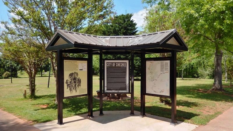
Other nearby markers. At least 8 other markers are within 3 miles of this marker, measured as the crow flies. Approaching Cowpens (here, next to this marker); Thorne (approx. 1.9 miles away); Battle of Cowpens Monument (approx. 2.7 miles away); U.S. Memorial Monument (approx. 2.7 miles away); The Battle of Cowpens: Prelude to Victory (approx. 2.7 miles away); Welcome to Cowpens National Battlefield (approx. 2.7 miles away); Morgan's Flying Army (approx. 2.8 miles away); Spirit up the People (approx. 2.8 miles away). Touch for a list and map of all markers in Chesnee.
Also see . . . Chesnee, South Carolina.
In the early 20th century, the Chesnee Land Company bought a sizeable acreage at what is now Chesnee. A leading member of the company was John B. Cleveland of Spartanburg. Cleveland named the company - and later the town - after his great-grandmother, Margaret Chesnee. The Chesnee post office was established in 1910, and the town was chartered in 1911. Early businesses included a hotel, pharmacy, cotton mill, and lumber mill.(Submitted on April 30, 2022, by Cosmos Mariner of Cape Canaveral, Florida.)
Credits. This page was last revised on April 30, 2022. It was originally submitted on April 30, 2022, by Cosmos Mariner of Cape Canaveral, Florida. This page has been viewed 546 times since then and 125 times this year. Photos: 1, 2. submitted on April 30, 2022, by Cosmos Mariner of Cape Canaveral, Florida.

