Woonsocket in Providence County, Rhode Island — The American Northeast (New England)
Blackstone River Valley
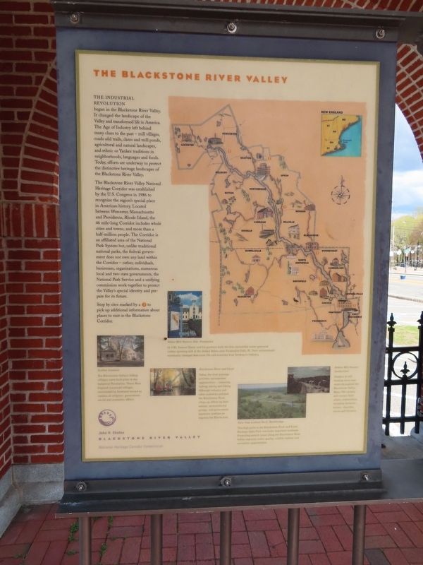
The Industrial Revolution began in the Blackstone River Valley. It changed the landscape of the Valley and transformed life in America. The Age of Industry left behind many clues to the past - mill villages, roads and trails, dams and mill ponds, agricultural and natural landscapes, and ethnic or Yankee traditions in neighborhoods, languages and foods. Today, efforts are underway to protect the distinctive heritage landscapes of the Blackstone River Valley.
The Blackstone River Valley National Heritage Corridor was established by the U.S. Congress in 1986 to recognize the region's special place in American history. Located between Worcester, Massachusetts and Providence, Rhode Island, the 46 mile-long Corridor includes whole cities and towns, and more than a half-million people. The Corridor is an affiliated area of the National Park System but, unlike traditional national parks, the federal government does not own any land within the Corridor - rather, individuals, businesses, organizations, numerous local and two state governments, the National Park Service and a unifying commission work together to protect the Valley's special identity and prepare for its future.
Stop by sites marked by a ? to pick up additional information about places to visit in the Blackstone Corridor.
( photo captions )
— Slater Mill Historic Site, Pawtucket. In 1793, Samuel Slater and his partners built the first successful water-powered cotton spinning mill in the United States near Pawtucket Falls, RI. Their achievement eventually changed American life and economy from farming to industry.
— Blackstone River and Canal. Today, the river passage provides recreational opportunities - canoeing, fishing, biking and hiking. Although industry and other activities polluted the Blackstone River, clean-up efforts by businesses, environmental groups, and government agencies continue to improve the Blackstone.
— View from Lookout Rock Northbridge. This high point in the Blackstone River and Canal Heritage State Park overlooks important wetlands. Protecting natural areas along the Blackstone River Valley improves water quality, wildlife habitat and recreation opportunities.
— Grafton Common. The Blackstone Valley's hilltop villages were built prior to the Industrial Revolution. These New England crossroad villages surrounded by farmland served as centers of religious, government, social and economic affairs.
— Ashton Mill Houses, Cumberland. Clusters of mill housing exist near rivers throughout the Blackstone Valley Many 19th century mill owners built whole communities including factories houses, churches stores and libraries.
Topics. This historical marker is listed in these topic lists: Industry & Commerce • Waterways & Vessels. A significant historical year for this entry is 1986.
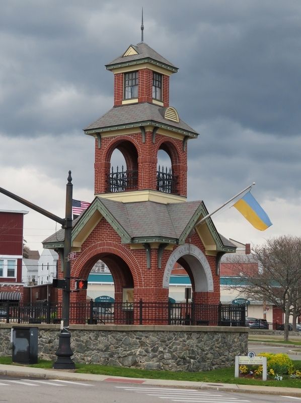
Location. 41° 59.969′ N, 71° 31.023′ W. Marker is in Woonsocket, Rhode Island, in Providence County. Marker is at the intersection of Main Street and River Street, on the right when traveling south on Main Street. Located in Market Square. Touch for map. Marker is in this post office area: Woonsocket RI 02895, United States of America. Touch for directions.
Other nearby markers. At least 8 other markers are within walking distance of this marker. Ethnicity (here, next to this marker); Community Development (here, next to this marker); Woonsocket Falls (within shouting distance of this marker); Blackstone Canal (within shouting distance of this marker); Market Square (within shouting distance of this marker); Power Trenches (within shouting distance of this marker); Cross of Malta (approx. 0.2 miles away); Veterans Memorial Park (approx. 0.3 miles away). Touch for a list and map of all markers in Woonsocket.
Credits. This page was last revised on May 1, 2022. It was originally submitted on May 1, 2022, by Michael Herrick of Southbury, Connecticut. This page has been viewed 87 times since then and 6 times this year. Photos: 1, 2. submitted on May 1, 2022, by Michael Herrick of Southbury, Connecticut.

