Knoxville in Knox County, Tennessee — The American South (East South Central)
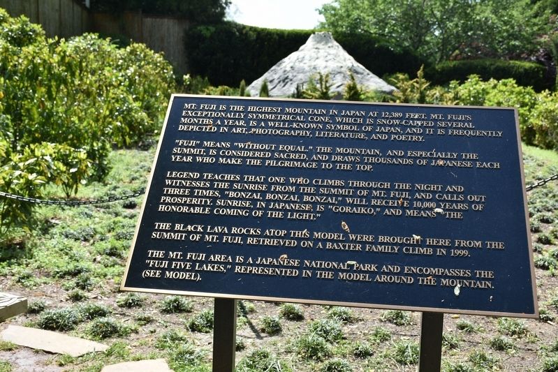
Mt. Fuji
"Fuji" means "without equal." The mountains, and especially the summit, is considered sacred, and draws thousands of Japanese each year who make the pilgrimage to the top.
Legend teaches that one who climbs through the night and witnesses the sunrise from the summit of Mt Fuji, calls out three times, "Bonzai, Bonzai, Bonzai," will receive 10,000 years of prosperity. Sunrise, in Japanese, is "Goraiko," and means the honorable coming of the light."
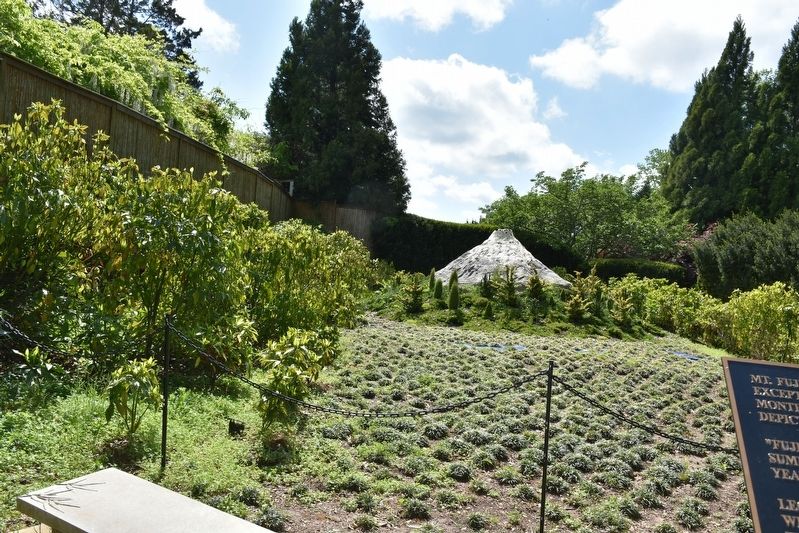
The Black lava rocks atop this model were brought here form the summit of Mt Fuji, retrieved on a Baxter Family Climb in 1999. The Mt. Fuji area is a Japanese national park and encompasses the "Fuji Five Lakes," represented in the model around the mountain.
(see model).
Topics. This historical marker is listed in these topic lists: Environment • Exploration.
Location. 36° 3.45′ N, 83° 55.268′ W. Marker is in Knoxville, Tennessee, in Knox County. Marker can be reached from the intersection of Sam Cooper Lane and Black Oak Ridge Lane, on the right when traveling west. Located on the Baxter estate in the Japanese Gardens. Touch for map. Marker is at or near this postal address: 3901 Sam Cooper Ln, Knoxville TN 37918, United States of America. Touch for directions.
Other nearby markers. At least 8 other markers are within 3 miles of this marker, measured as the crow flies. Savage Garden (approx. 1.1 miles away); Fountain City Schools (approx. 1˝ miles away); Fountain City United Methodist Church (approx. 1.6 miles away); Norris Freeway (approx. 2 miles away); Site of Fort Adair (approx. 2.2 miles away); Fort Adair (approx. 2.2 miles away); Mary Frances Housley (approx. 2.3 miles away); Mr. Anderson's Log College (approx. 2.3 miles away). Touch for a list and map of all markers in Knoxville.
Credits. This page was last revised on May 3, 2022. It was originally submitted on May 2, 2022, by Sandra Hughes Tidwell of Killen, Alabama, USA. This page has been viewed 214 times since then and 36 times this year. Photos: 1, 2. submitted on May 2, 2022, by Sandra Hughes Tidwell of Killen, Alabama, USA. • Mark Hilton was the editor who published this page.

