Hanover in York County, Pennsylvania — The American Northeast (Mid-Atlantic)
Warfare Engulfs Downtown
A Heart of Hanover Trail Stop
Rebels Capture the Square
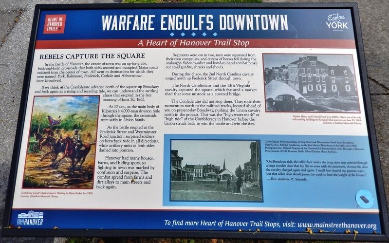
In the Battle of Hanover, the center of town was an up-for-grabs, back-and-forth crossroads that both sides wanted and occupied. Major roads radiated from the center of town. All went to destinations for which they were named: York, Baltimore, Frederick, Carlisle and Abbottstown (now Broadway).
If we think of the Confederate advance north of the square up Broadway and back again as a rising and receding tide, we can understand the swirling chaos that erupted in the late morning of June 30, 1863.
At 10 a.m., as the main body of Kilpatrick's 4,000-man division rode through the square, the crossroads were safely in Union hands.
As the battle erupted at the Frederick Street and Westminster Road junction, surprised soldiers on horseback rode in all directions, while artillery units of both sides dashed into position.
Hanover had many houses, barns, and hiding spots, so fighting in town was marked by confusion and surprise. The combat spread from farms and dirt alleys to main streets and back again.
Regiments were cut in two, men were separated from their own companies, and dozens of horses fell during the onslaught. Saber-to-saber and hand-to-hand combat broke out amid gunfire, shrieks and shouts.
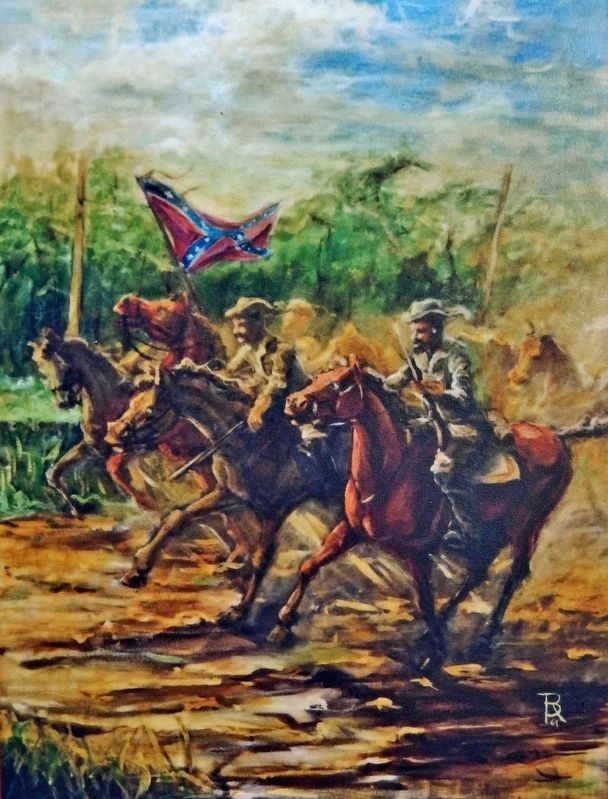
During this chaos, the 2nd North Carolina cavalry surged north up Frederick Street through town.
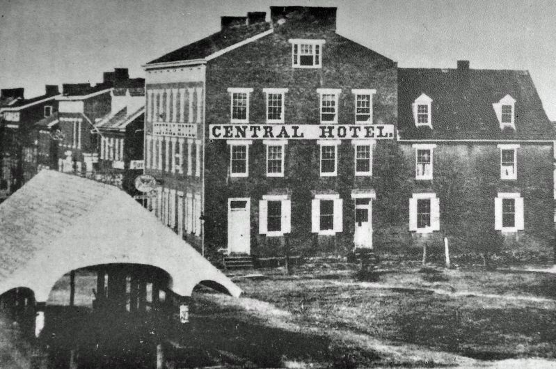
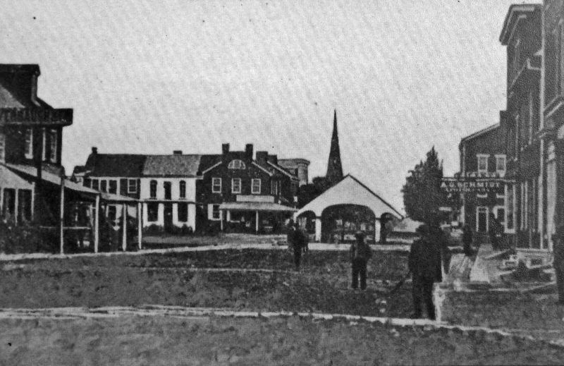
The North Carolinians and the 13th Virginia cavalry captured the square, which featured a market shed that some mistook as a covered bridge.
The Confederates did not stop there. They rode their momentum north to the railroad tracks, located ahead of you on present-day Broadway, pushing the Union cavalry north in the process. This was the "high water mark" or "high tide" of the Confederacy in Hanover before the Union struck back to win the battle and win the day.
"On Broadway side, the cellar door under the drug store was entered through a large wooden door that lay flat or even with the pavement. Across this door the cavalry charged again and again. I recall how fearful my parents were, lest that cellar door should prove too weak to bear the weight of the horses."
—Rev. Ambrose M. Schmidt
Erected 2022 by Main Street Hanover; and Heart of Hanover Trails.
Topics and series. This historical marker is listed in these topic lists: Roads & Vehicles • War, US Civil. In addition, it is included in the Pennsylvania, Battle of Hanover Walking Tour series list. A significant historical date for this entry is June 30, 1863.
Location. 39° 48.298′ N, 76° 58.816′ W. Marker is in Hanover, Pennsylvania, in York County. Marker is
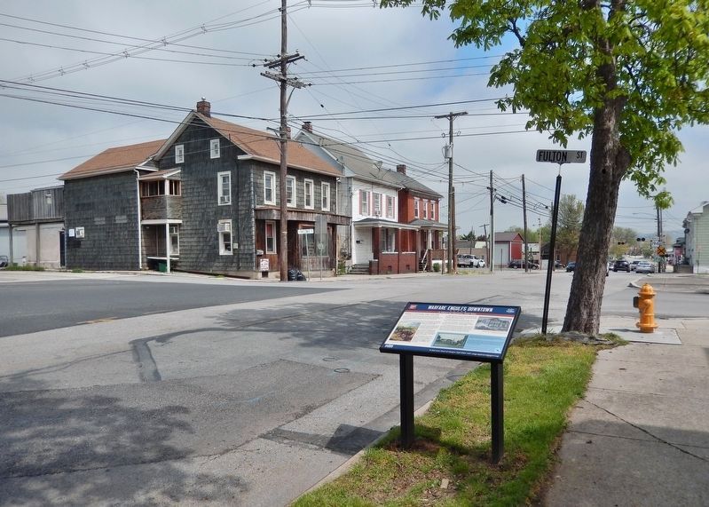
at the intersection of Broadway (Pennsylvania Route 194) and Fulton Street, on the right when traveling north on Broadway. Touch for map. Marker is at or near this postal address: 335 Broadway, Hanover PA 17331, United States of America. Touch for directions.
Other nearby markers. At least 8 other markers are within walking distance of this marker. The Turning Point (about 300 feet away, measured in a direct line); Titans of Hanover Industry (about 800 feet away); Veterans Memorial (approx. 0.2 miles away); Former United States Post Office (approx. 0.2 miles away); The Confederates Take Stock (approx. ¼ mile away); Abbottstown Street/Broadway (approx. ¼ mile away); The Aftermath & Stench of Death (approx. ¼ mile away); Abraham Lincoln (approx. ¼ mile away). Touch for a list and map of all markers in Hanover.
Related markers. Click here for a list of markers that are related to this marker. Heart of Hanover Trail
Also see . . . Battle of Hanover.
Hanover was in mass confusion. Stuart’s men had pushed the rear of the 18th Pennsylvania into town, causing the regiment to become mixed with runaway wagons, ambulances and panicky citizens. Soldiers and civilians alike were running into alleys and side streets. The Confederate forces now had control of Hanover.(Submitted on May 6, 2022, by Cosmos Mariner of Cape Canaveral, Florida.)
Hanover Public School District Photo Archives
4. Marker detail: Center Square from intersection at York Street and Abbottstown Road (now Broadway)
Note the A.G. Schmidt Apothecary on the first block of Broadway on the right, circa 1868. Photograph from Official Program of the Centennial of Incorporation of the Borough of Hanover, Pennsylvania, (1915).
Credits. This page was last revised on May 8, 2022. It was originally submitted on May 2, 2022, by Cosmos Mariner of Cape Canaveral, Florida. This page has been viewed 152 times since then and 20 times this year. Photos: 1. submitted on May 2, 2022, by Cosmos Mariner of Cape Canaveral, Florida. 2, 3, 4, 5. submitted on May 6, 2022, by Cosmos Mariner of Cape Canaveral, Florida.
