Reed Township near Duncannon in Dauphin County, Pennsylvania — The American Northeast (Mid-Atlantic)
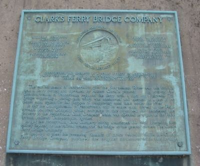
Clark's Ferry Bridge Company
Christian W. Lynch - Vice-president
William Wills - Secretary
Patrick F. Duncan - Treasurer
Frank M. Masters - Chief Engineer
Ralph Modjeski - Consulting Engineer
Paul P. Cret - Consulting Architect
The Vang Const. Co. - Contractors
(Around relief artwork of the original bridge)
The original structure at this location
built 1828-29 replaced 1924-25
Constructed and operated as a public utility in accordance
with the laws of the commonwealth and dedicated to the
people for their convenience and use.
The earliest means of transportation over the Susquehanna River near this location was a ferry owned and operated by Robert Clark, a pioneer. In 1828-29 the Commonwealth of Pennsylvania replaced the ferry with a dam and a highway Toll Bridge supporting a towing-path which was constructed and operated as a part of the State's canal system, for the purpose of transporting canal boats across the river.
In 1857 the Commonwealth of Pennsylvania sold its entire canal system to the Pennsylvania Railroad Company, which company in 1867 organized and transferred this property to the Pennsylvania Canal Company which was operated as a part of the Pennsylvania Railroad Transportation System.
In 1915 the Pennsylvania Canal Company having abandoned the canal operation, then entirely replaced by the railroad system, sold the bridge to the present owner, The Clark's Ferry Bridge Company.
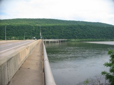
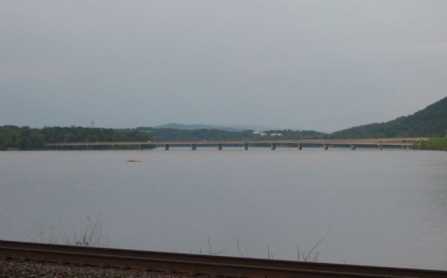
In 1924-25, to meet the increasing demands of motor vehicular traffic, the Clark's Ferry Bridge Company replaced the original structure with the bridge.
Topics and series. This historical marker is listed in these topic lists: Bridges & Viaducts • Waterways & Vessels. In addition, it is included in the Covered Bridges, and the Pennsylvania Canal series lists. A significant historical year for this entry is 1857.
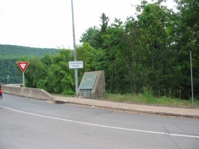
Location. 40° 24.136′ N, 77° 0.661′ W. Marker is near Duncannon, Pennsylvania, in Dauphin County. It is in Reed Township. Marker is at the intersection of William Penn Highway (U.S. 22/322) and County Road 849, on the right when traveling south on William Penn Highway. Located on the northern end of the Clark's Ferry Bridge. Touch for map. Marker is at or near this postal address: 3 Newport Rd, Duncannon PA 17020, United States of America. Touch for directions.
Other nearby markers. At least 8 other markers are within 2 miles of this marker, measured as the crow flies. Pennsylvania Canal (approx. half a mile away); Lightning Guider Sleds (approx. 0.7 miles away); Clark's Ferry Tavern (approx. 0.8 miles away); Duncannon Area Schools (approx. 1.2 miles away); a different marker also named Pennsylvania Canal (approx. 1.2 miles away); Churches of Our Ancestors (approx. 1.3 miles away); Ross McHugh Hood (approx. 1.3 miles away); Clark's Ferry Bridge (approx. 1.3 miles away). Touch for a list and map of all markers in Duncannon.
More about this marker. The marker is located in a portion of Dauphin County on the west bank of the Susquehanna River.
Credits. This page was last revised on December 19, 2023. It was originally submitted on June 6, 2009, by Craig Swain of Leesburg, Virginia. This page has been viewed 2,441 times since then and 33 times this year. Photos: 1, 2, 3, 4. submitted on June 6, 2009, by Craig Swain of Leesburg, Virginia.


