San Juan Capistrano in Orange County, California — The American West (Pacific Coastal)
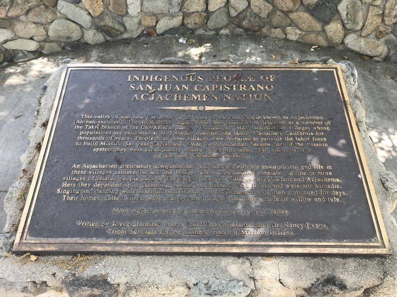
Indigenous People of San Juan Capistrano
Acjachemen Nation
Photographed by Adam Margolis, May 5, 2022
1. Indigenous People of San Juan Capistrano Marker
An Acjachemen community complemented and blended with the environment and life in these villages centered around the family. Some communities consisted of one or more villages of related people such as The People from the villages of Putiudem and Acjachema. Here they depended upon gathering, hunting and fishing for a living and were not nomadic. Singing and dancing were essential activities to the Acjachemen and often continued for days. Their homes, called kiitca, were round domed shaped structures
this page online
Many Acjachemen/San Juanenos still live in this valley.
Written by Joyce Stanfield Perry, Chief David Belardes and Dr. Nancy Evan, Tribal Scholars for the Jwaneno Band of Mission Indians.
Erected by Tribal Scholars for the Juaneno Band of Mission Indians.
Topics. This historical marker is listed in these topic lists: Indigenous Peoples and Communities • Religion & Religious Structures.
Location. 33° 30.943′ N, 117° 40.14′ W. Marker is in San Juan Capistrano, California, in Orange County. It is on Camino Capistrano south of Oso Road, on the right when traveling north. Touch for map. Marker is in this post office area: San Juan Capistrano CA 92675, United States of America. Touch for directions.

Regionally, this marker is in Greater Los Angeles and in the Peninsular Ranges. It is also on the American Pacific Coast. Globally, it is in North America, on the Ring of Fire, on the Pacific Rim, in the Western Hemisphere, in the Western World, and in the Anglosphere. Historically, it finds itself in what was once New Spain and also Mexico’s
Photographed by Adam Margolis, May 5, 2022
2. Indigenous People of San Juan Capistrano Marker
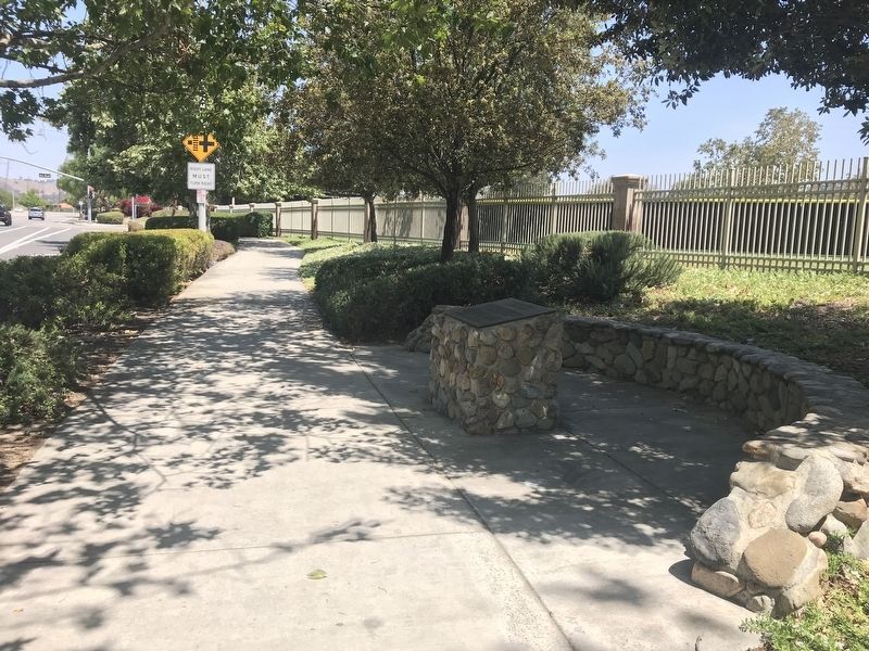
Marker can be seen on the right, looking north.
Other nearby markers. At least 8 other markers are within walking distance of this marker: Capistrano Union High School (approx. 0.7 miles away); The Villa (approx. 0.7 miles away); Mission Yard & Reservoir Site (approx. 0.8 miles away); San Juan Capistrano Regional Library (approx. 0.8 miles away); Mission Bells (approx. 0.8 miles away); New Mission Church (approx. 0.8 miles away); San Juan Elementary School Site (approx. one mile away); Historic Mission Cemetery (approx. one mile away). Touch for a list and map of all markers in San Juan Capistrano.
Credits. This page was last revised on May 17, 2022. It was originally submitted on May 5, 2022, by Adam Margolis of Mission Viejo, California. This page has been viewed 550 times since then and 57 times this year. Photos: 1, 2. submitted on May 5, 2022, by Adam Margolis of Mission Viejo, California. • Syd Whittle was the editor who published this page.
