Bridgeport in Jackson County, Alabama — The American South (East South Central)
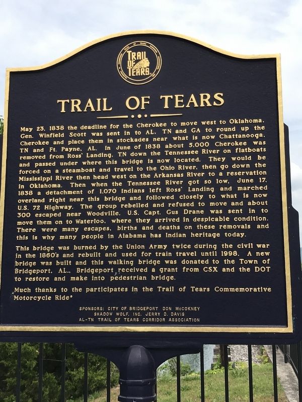
Trail of Tears
Photographed by Duane and Tracy Marsteller, May 5, 2022
1. Trail of Tears Marker
This bridge was burned by the Union Army twice during the Civil War in the
this page online
Much thanks to the participates in the Trail of Tears Commemorative Motorcycle Ride
Erected by City of Bridgeport Don McCokney • Shadow Wolf, Inc. Jerry D. Davis • AL-TN Trail of Tears Corridor Association.
Topics. This historical marker is listed in these topic lists: Bridges & Viaducts • Indigenous Peoples and Communities • Waterways & Vessels. A significant historical date for this entry is May 23, 1838.
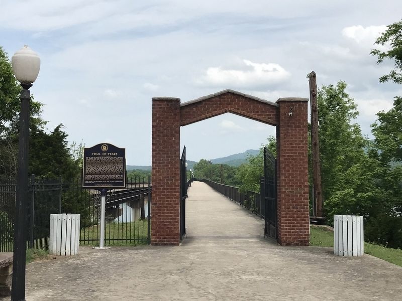
Location. 34° 57.148′ N, 85° 42.254′ W. Marker is in Bridgeport, Alabama, in Jackson County. It is on Bradley Avenue half a mile east of Hoffman Avenue, on the left when traveling east. Marker is at west end of the Historic Dual Railroad Tennessee River Bridge. Touch for map. Marker is at or near this postal address: 1 Bradley Ave, Bridgeport AL 35740, United States of America. Touch for directions.

Regionally, this marker is in North Alabama. It is also in the American South, specifically
Photographed by Duane and Tracy Marsteller, May 5, 2022
2. Trail of Tears Marker
Other nearby markers. At least 8 other markers are within 5 miles of this marker, measured as the crow flies: In Rememberance of Those Who Served (approx. half a mile away); Bridgeport (approx. 1.3 miles away); a different marker also named Trail of Tears (approx. 2½ miles away); Rocky Springs Church of Christ (approx. 2.7 miles away); Sequatchie Valley Tennessee (approx. 4.1 miles away in Tennessee); Birthplace of Jobyna Lancaster Ralston-Arlen (approx. 4.1 miles away in Tennessee); Christmas Night Shootout (approx. 4.1 miles away in Tennessee); James Thomas Fitz-Gerald, Jr. (approx. 4.2 miles away in Tennessee). Touch for a list and map of all markers in Bridgeport.
Photographed by Duane and Tracy Marsteller, May 5, 2022
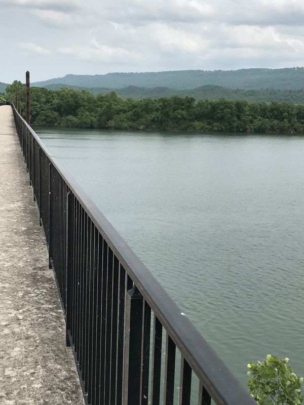
3. View from bridge
Some 5,000 Cherokee passed through this point on the Tennessee River during their forced removal in 1838.
Credits. This page was last revised on May 9, 2022. It was originally submitted on May 9, 2022, by Duane and Tracy Marsteller of Murfreesboro, Tennessee. This page has been viewed 1,719 times since then and 183 times this year. Photos: 1, 2, 3. submitted on May 9, 2022, by Duane and Tracy Marsteller of Murfreesboro, Tennessee.
