Fort Washington in Prince George's County, Maryland — The American Northeast (Mid-Atlantic)
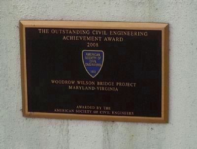
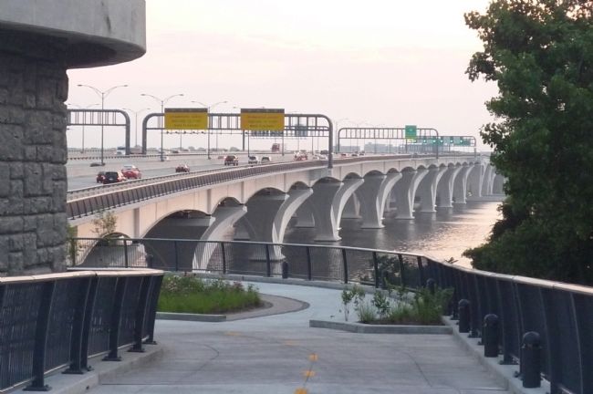
Woodrow Wilson Memorial Bridge
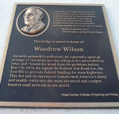
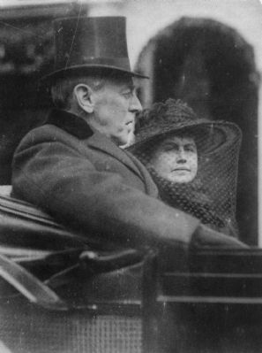
This bridge is named in honor of Woodrow Wilson.
An early automobile enthusiast, he reportedly spent an average of two hours per day riding in his automobile to relax and “loosen his mind from the problems before him.” In 1916, he signed the Federal Aid Road Act, the first bill to provide federal funding for state highways. This Act and its successors transformed America’s dusty and muddy trails into the most advanced and comprehensive road network in the World.
“I tell you very frankly that my interest in good roads is not merely an interest in the pleasure of riding in automobiles...it is also the interest in weaving as complicated and elaborate a net of neighborhood and state and national opinions together as it is possible to weave.”
Woodrow Wilson, 1912 - 28th President of the United States
(Image courtesy of Bureau of Engraving and Printing.)
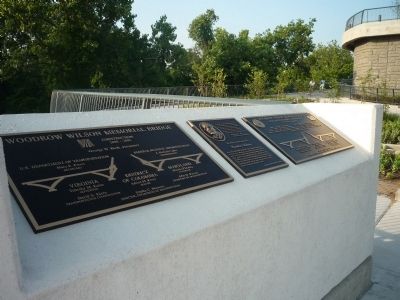
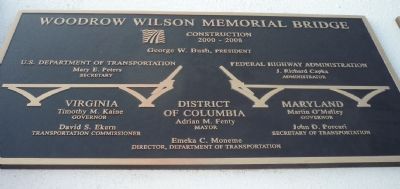
[Left Panel]
WOODROW WILSON MEMORIAL BRIDGE
Construction 2000-2008
George W. Bush, President
U.S. Department of Transportation
Mary E. Peters, Secretary
Federal Highway Administration
J. Richard Capka, Administrator
VIRGINIA
Timothy M. Kaine, Governor
David S. Ekern, Transportation Commissioner
DISTRICT OF COLUMBIA
Adrian M. Fenty, Mayor
Emeka C. Monomeme, Director, Department of Transportation
MARYLAND
Martin O’Malley, Governor
John D. Porcari, Secretary of Transportation
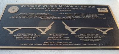
[Right Panel]
WOODROW WILSON MEMORIAL BRIDGE
Maryland State Highway Administration
[Seals of the State of Maryland and the State Highway Administration.]
Neil J. Pedersen - Administrator
Robert D. Douglass - Project Manager
Paul J. Gudelski - SHA Construction Manager
Michael D. Bonin - GEC Bridge Construction Manager
Earle S. Freedman - Director, Office of Bridge Development
Robert J. Healy - SHA Project Manager
Thomas E. Mohler - GEC Project Manager
General Engineering Consultants: Parsons Brinkerhoff, Inc. / URS Corporation / Rummel
Klepper & Kahl, LLP
Designer: Parsons Transportation Group
Construction of Virginia Approach Spans
Granite Construction, Inc.
Corman Construction, Inc.
Construction of Drawspan:
American Bridge Company
Edward Bridge Company
Edward Kraemer & Sons, Inc.
Construction of Maryland Approach Spans:
Edward Kraemer & Sons, Inc.
American Bridge Company
Trumbull Corporation
Dredging: Weeks Marine, Inc.
Foundations: Tidewater Skanska, Inc./Kiewit Construction Company/Clark Construction
Erected
2009 by State Highway Administration, Maryland.
Topics and series. This historical marker is listed in these topic lists: Bridges & Viaducts • Government & Politics • Roads & Vehicles • Waterways & Vessels. In addition, it is included in the ASCE Civil Engineering Landmarks, and the Former U.S. Presidents: #28 Woodrow Wilson series lists. A significant historical year for this entry is 1916.
Location. 38° 47.607′ N, 77° 1.513′ W. Marker is in Fort Washington, Maryland, in Prince George's County. Marker can be reached from the Woodrow Wilson Bridge Trail (U.S. I-95) 0.8 miles west of Oxon Hill Road (State Route 414). The marker panels are on the west side of Rosalie Island and are accessible from Maryland via the eastern entrance to the hiker/biker trail (west of Oxon Hill Road and north of National Harbor); or from Alexandria, Virginia via the western entrance to the trail, off S. Washington St./Mt. Vernon Hwy. (VA-400). Touch for map. Marker is in this post office area: Oxon Hill MD 20745, United States of America. Touch for directions.
Other nearby markers. At least 8 other markers are within walking distance of this marker. Crossing the River (a few steps from this marker); Two Worlds Meet in the Summer of 1608. (within shouting distance of this marker); Working to Improve the River (about 300 feet away, measured in a direct line); Potomac Fisheries (about 300 feet away); The Nation's River
(about 300 feet away); Neighbor to the Nation's Capital (about 400 feet away); The Tobacco Economy (about 400 feet away); Bladensburg (about 400 feet away). Touch for a list and map of all markers in Fort Washington.
Also see . . .
1. Woodrow Wilson Bridge. (Submitted on June 8, 2009, by Richard E. Miller of Oxon Hill, Maryland.)
2. Wilson Bridge Bike Path Opens. (Submitted on June 8, 2009, by Richard E. Miller of Oxon Hill, Maryland.)
Additional keywords. Potomac River; Rosalie Island
Credits. This page was last revised on March 3, 2023. It was originally submitted on June 7, 2009, by Richard E. Miller of Oxon Hill, Maryland. This page has been viewed 2,329 times since then and 48 times this year. Photos: 1, 2, 3. submitted on June 7, 2009, by Richard E. Miller of Oxon Hill, Maryland. 4. submitted on June 8, 2009, by Richard E. Miller of Oxon Hill, Maryland. 5. submitted on November 20, 2013, by Richard E. Miller of Oxon Hill, Maryland. 6, 7. submitted on June 8, 2009, by Richard E. Miller of Oxon Hill, Maryland. • Craig Swain was the editor who published this page.
