Mableton in Cobb County, Georgia — The American South (South Atlantic)
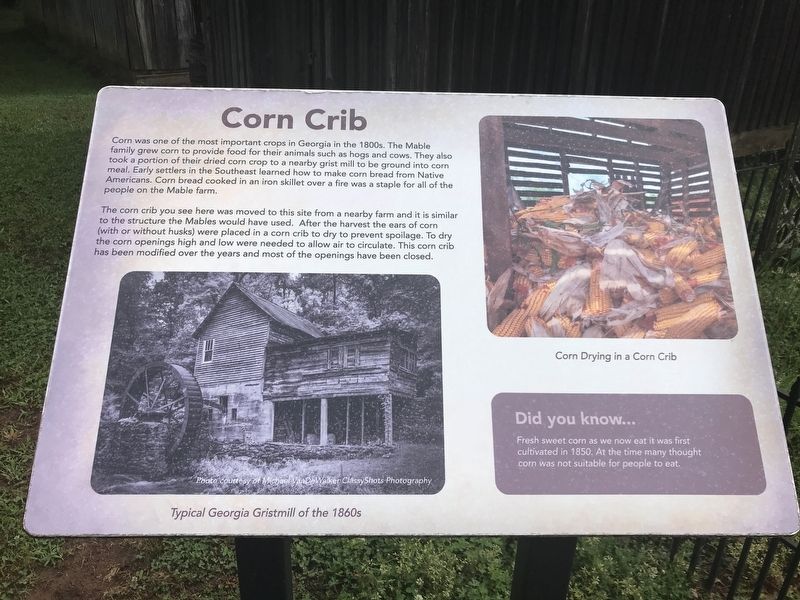
Corn Crib
| — | The Mable House | — |
Photographed by Duane and Tracy Marsteller, May 6, 2022
1. Corn Crib Marker
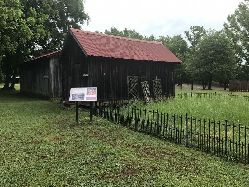
The corn crib you see here was moved to this site from a nearby farm and it is similar to the structure the Mables would have used. After the harvest the ears of corn (with or without husks) were placed in a corn crib to dry to prevent spoilage. To dry the corn openings high and low were needed to allow air to circulate. This corn crib has been modified over the years and most of the openings have been closed.
Did you know …
Fresh sweet corn as we now eat it was first cultivated in 1850. At the time many thought corn was not suitable for people to eat.
[Captions]
• (Left) Typical Georgia Gristmill of the 1860s Photo courtesy of Michael VanDeWalker ClassyShots Photography
• (Right)
this page online
Topics. This historical marker is listed in these topic lists: Agriculture • Architecture. A significant historical year for this entry is 1850.
Location. 33° 49.619′ N, 84° 34.489′ W. Marker is in Mableton, Georgia, in Cobb County. It can be reached from Floyd Road Southwest 0.1 miles north of Maran Lane Southwest, on the right when traveling north. Marker is behind the Mable House. Touch for map. Marker is at or near this postal address: 5239 Floyd Rd SW, Mableton GA 30126, United States of America. Touch for directions.

Regionally, this marker is in the Piedmont and in Metro Atlanta. It is also in the American South and specifically in the Deep South. Globally, it is in North America, the Western Hemisphere, the Western World, and the Anglosphere. Historically, it finds itself in what was once the original Cherokee Nation, the territory of the Mississippian Culture, one of the original Thirteen Colonies, one of the Confederate States of America, and the Antebellum South.
Other nearby markers. At least 8 other markers are within walking distance of this marker: Blacksmith Shop (a few steps
Photographed by Duane and Tracy Marsteller, May 6, 2022
2. Corn Crib Marker
Credits. This page was last revised on May 10, 2022. It was originally submitted on May 10, 2022, by Duane and Tracy Marsteller of Murfreesboro, Tennessee. This page has been viewed 377 times since then and 33 times this year. Photos: 1, 2. submitted on May 10, 2022, by Duane and Tracy Marsteller of Murfreesboro, Tennessee.
