Near Wiinder in Barrow County, Georgia — The American South (South Atlantic)
William Pentecost
Born Nov. 4, 1762 – Died Jan. 27, 1839
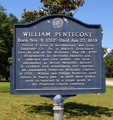
Photographed by David Seibert, May 30, 2009
1. William Pentecost Marker
Erected by Pentecost Family and Barrow County Historical Society.
Topics. This historical marker is listed in these topic lists: Cemeteries & Burial Sites • Religion & Religious Structures • War, US Revolutionary. A significant historical date for this entry is May 29, 1890.
Location. 33° 59.81′ N, 83° 38.9′ W. Marker is near Wiinder, Georgia, in Barrow County. It is on Georgia Route 82 at milepost 4, 0.1 miles east of Steed Road, on the right when traveling east. The marker is located in front of the Pentecost United Methodist Church. Touch for map. Marker is in this post office area: Winder GA 30680, United States of America.
this page online

Regionally, this marker is in the Classic City Area, in the Piedmont, and in Metro Atlanta. It is also in the American South and specifically in the Deep South. Globally, it is in North America, the Western Hemisphere, the Western World, and the Anglosphere. Historically, it finds itself in what was once the territory of the Mississippian Culture, one of the original Thirteen Colonies, one of the Confederate States of America, and the Antebellum South.
Other nearby markers. At least 8 other markers are within 4 miles of this marker, measured as the crow flies: Russell House (approx. 3½ miles away); Glenwood Elementary and High School (approx. 3.6 miles away); Statham House (approx. 3.8 miles away); First Georgia Chapter Future Farmers of America (approx. 3.9 miles away); Statham High School (approx. 3.9 miles away); United States Bicentennial (approx. 4 miles away); a different marker also named First Georgia Chapter Future Farmers of America (approx. 4 miles away); Hal Jackson Park (approx. 4.1 miles away).
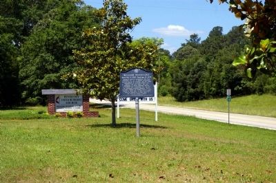
Photographed by David Seibert, May 30, 2009
2. William Pentecost Marker
The front yard of the church with the marker and church signs, and Ga 82 (looking west) in the background
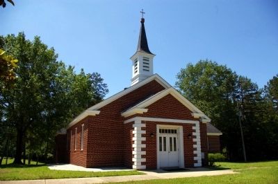
Photographed by David Seibert, May 30, 2009
3. Pentecost United Methodist Church
The church was founded in 1785 by William Pentecost
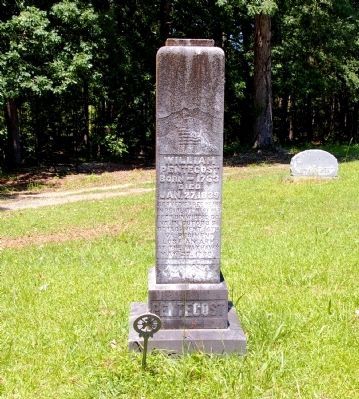
Photographed by David Seibert, May 30, 2009
4. William Pentecost Grave
Located in the cemetery behind the Pentecost United Methodist Church (The birth year on the monument and the year on the marker disagree by one year.)
Credits. This page was last revised on January 26, 2020. It was originally submitted on June 8, 2009, by David Seibert of Sandy Springs, Georgia. This page has been viewed 2,389 times since then and 89 times this year. Photos: 1, 2, 3, 4. submitted on June 8, 2009, by David Seibert of Sandy Springs, Georgia. • Craig Swain was the editor who published this page.
