Lawrenceville in Gwinnett County, Georgia — The American South (South Atlantic)
Tipsy Mules & Horses
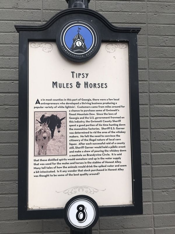
Photographed by Duane and Tracy Marsteller, May 6, 2022
1. Tipsy Mules & Horses Marker
Erected by City of Lawrenceville.
this page online
Topics and series. This historical marker is listed in these topic lists: Animals • Food & Drink • Industry & Commerce • Law Enforcement. In addition, it is included in the Believe It or Not series list.
Location. 33° 57.378′ N, 83° 59.233′ W. Marker is in Lawrenceville, Georgia, in Gwinnett County. It is on East Crogan Street east of South Clayton Street, on the right when traveling east. Touch for map. Marker is at or near this postal address: 178 E Crogan St, Lawrenceville GA 30046, United States of America. Touch for directions.

Regionally, this marker is in the Piedmont and in Metro Atlanta. It is also in the American South and specifically in the Deep South. Globally, it is in North America, the Western Hemisphere, the Western World, and the Anglosphere. Historically, it finds itself in what was once the territory of the Mississippian Culture, one of the original Thirteen Colonies, one of the Confederate States of America, and the Antebellum South.
Other nearby markers. At least 8 other markers are within walking distance of

Photographed by Duane and Tracy Marsteller, May 6, 2022
2. Tipsy Mules & Horses Marker
Credits. This page was last revised on September 24, 2026. It was originally submitted on May 11, 2022, by Duane and Tracy Marsteller of Murfreesboro, Tennessee. This page has been viewed 414 times since then and 25 times this year. Photos: 1, 2. submitted on May 11, 2022, by Duane and Tracy Marsteller of Murfreesboro, Tennessee.
