Milledgeville in Baldwin County, Georgia — The American South (South Atlantic)
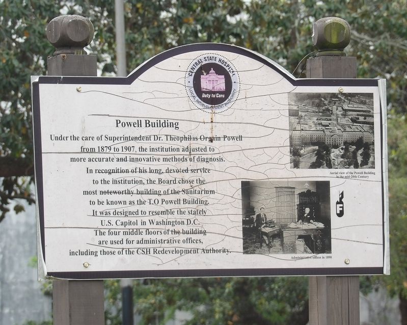
Powell Building
[Captions]
• (Top) Aerial view of the Powell Building in the mid-20th Century
• (Bottom) Administrative offices in 1890
Erected by Central State Hospital Redevelopment Authority.
Topics. This historical marker is listed in these topic lists: Architecture • Science & Medicine. A significant historical year for this entry is 1879.
Location. 33° 3.097′ N, 83° 13.316′ W. Marker is in Milledgeville, Georgia, in Baldwin County. Marker is on Broad Street west of Swint Avenue Southeast, on the left when traveling west. Touch for map. Marker is in this post office area: Milledgeville GA 31062, United States of America. Touch for directions.
Other nearby markers. At least 8 other markers are within walking distance of this marker. Milledgeville State Hospital (a few steps from this marker); The Walker Building (about 300 feet away, measured in a direct line); Cornerstone/Auditorium Building (about 400 feet away); The Green Building (about 600 feet away); Summer Home (of) Governor Herschel V. Johnson (approx. 0.7 miles away); Fort Wilkinson (approx. 0.7 miles away); Cedar Lane Cemetery (approx. ¾ mile away); Old Fort Wilkinson (approx. 0.8 miles away). Touch for a list and map of all markers in Milledgeville.
Regarding Powell Building. It is among some 200 buildings on the former hospital campus. The Central State Hospital Redevelopment Authority was created to revitalize and re-purpose the 2,000-acre site, which has been re-branded as Renaissance Park for business purposes.
Credits. This page was last revised on May 13, 2022. It was originally submitted on May 13, 2022, by Duane and Tracy Marsteller of Murfreesboro, Tennessee. This page has been viewed 213 times since then and 38 times this year. Photos: 1, 2, 3. submitted on May 13, 2022, by Duane and Tracy Marsteller of Murfreesboro, Tennessee.


