Near Mingo in Champaign County, Ohio — The American Midwest (Great Lakes)
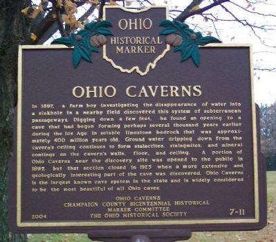
Ohio Caverns
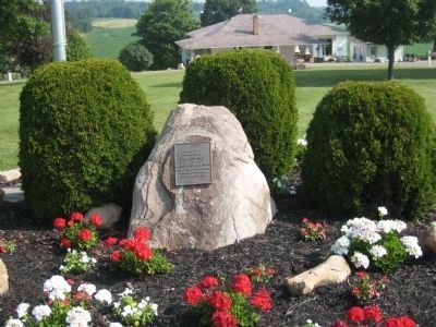
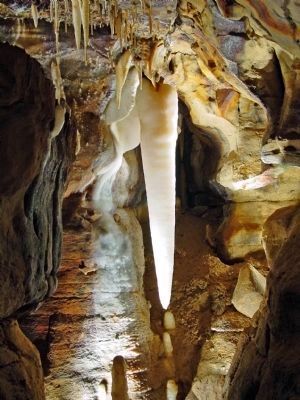
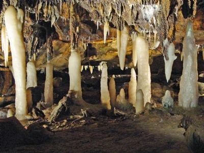
In 1897, a farm boy investigating the disappearance of water into a sinkhole in a nearby field discovered this system of subterranean passageways. Digging down a few feet, he found an opening to a cave that had begun forming perhaps several thousand years earlier during the Ice Age in soluble limestone bedrock that was approximately 400 million years old. Ground water dripping down from the cavern's ceiling continues to form stalactites, stalagmites, and mineral coatings on the cavern's walls, floor, and ceiling. A portion of Ohio Caverns near the discovery site was opened to the public in 1897, but that section closed in 1925 when a more extensive and geologically interesting part of the cave was discovered. Ohio Caverns is the largest known cave system in the state and is widely considered to be the most beautiful of all Ohio caves.
Erected 2004 by Ohio Caverns, Champaign County Bicentennial Historical Marker Committee, and The Ohio Historical Society. (Marker Number 7-11.)
Topics and series. This historical marker is listed in this topic list: Natural Features. In addition, it is included in the Ohio Historical Society / The Ohio History Connection series list. A significant historical year for this entry is 1897.
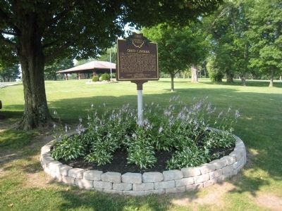
Location. 40° 14.283′ N, 83° 41.82′ W. Marker is near Mingo, Ohio, in Champaign County. Marker is on the grounds of Ohio Caverns, 2210 E. State Route 245, about four miles east south east of West Liberty. Touch for map. Marker is in this post office area: West Liberty OH 43357, United States of America. Touch for directions.
Other nearby markers. At least 8 other markers are within 2 miles of this marker, measured as the crow flies. Mt. Tabor Church / Mt. Tabor Cemetery (approx. 0.6 miles away); The Ludlow Road / The Ludlow Line (approx. 0.8 miles away); Mac-O-Chee Castle (approx. 1.7 miles away); The Barn at Mac-A-Cheek Castle (approx. 1.8 miles away); Storing the Crops, Livestock and Machinery (approx. 1.8 miles away); The Broad and Fertile Acres (approx. 1.8 miles away); Who's in the Dog House? (approx. 1.8 miles away); Let's Play (approx. 1.8 miles away).
Also see . . . Ohio Caverns. Website homepage (Submitted on November 23, 2008, by Bill Pfingsten of Bel Air, Maryland.)
Credits. This page was last revised on June 20, 2022. It was originally submitted on November 23, 2008, by William Fischer, Jr. of Scranton, Pennsylvania. This page has been viewed 3,532 times since then and 60 times this year. Last updated on May 16, 2022, by Craig Doda of Napoleon, Ohio. Photos: 1. submitted on November 23, 2008, by William Fischer, Jr. of Scranton, Pennsylvania. 2. submitted on November 30, 2010, by Tim Grissom of West Liberty, Ohio. 3, 4. submitted on November 23, 2008, by William Fischer, Jr. of Scranton, Pennsylvania. 5, 6, 7. submitted on November 30, 2010, by Tim Grissom of West Liberty, Ohio. • Devry Becker Jones was the editor who published this page.
