Warwick in Kent County, Rhode Island — The American Northeast (New England)
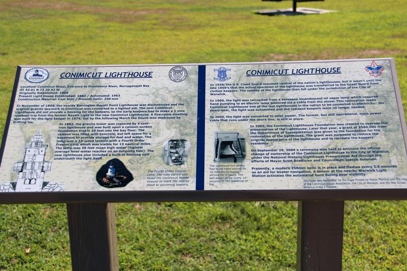
Conimicut Lighthouse
Location: Conimicut Shoal, entrance to Providence River, Narragansett Bay
41 43 01 N 71 20 42 W
Originally Established: 1868
Present Light House Established: 1882 / Automated: 1963
Construction Material: Cast iron / Present Optic: 250 mm
In November of 1868, the nearby Barrington Nyatt Point Lighthouse was discontinued and the original granite daymark in Conimicut was converted to a lighted aid. The new Conimicut Lighthouse did not provide a housing for the keepers, so the early keepers had to make a 1 mile rowboat trip from the former Nyatt Light to the new Conimicut Lighthouse. A five-room dwelling was built for the light keeper in 1874; but by the following March the house was destroyed by drifting ice.
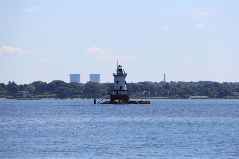
In 1882, the granite tower was replaced by a cast-iron lighthouse and was built upon a caisson sunken foundation that is 10 feet into the bay floor. The caisson was filled with concrete, but left space for a basement to provide storage for fuel and water. The lamp was a 10-sided lantern with a Fourth Order Fresnel Lens which was visible for 13 nautical miles. The lamp was 58 feet mean high water (highest average level water reaches on an outgoing tide). The new lighthouse also included a built-in housing unit underneath the light itself.
In 1939 the U.S. Coast Guard assumed control of the nation's lighthouses, but it wasn't until the late 1950's that the actual operation of the lighthouse was transferred to the Coast Guard from civilian keepers. The upkeep of the lighthouse then fell under the jurisdiction of the City of Warwick.
In 1960, the light was converted from a kerosene incandescent oil vapor lamp which required hand pumping to an electric lamp powered via a cable from the shore. This renovation made Conimicut Lighthouse one of the last lighthouses in the nation to be converted to electricity. Six years later, the light was automated and the resident keepers were no longer needed.
In 2003, the light was converted to solar power. The former, but still operational, main power cable that runs under the shore line, is still in place.
In 2005, the Conimicut Lighthouse Foundation was created to oversee the preservation of the Lighthouse. Later that year, a grant of $560,000 from the Department of Transportation was given to the foundation for the restoration of the lighthouse. The grant was purposed to restore the original appearance of the lighthouse and to recreate the keeper's residence.
On September 29, 2004 a ceremony was held to announce the official change of ownership of the Conimicut Lighthouse to the City of Warwick under the National Historic Lighthouse Preservation Act through the efforts of Mayor Scott Avedisian
Presently, a modern 250mm optic is in place and flashes every 2.5 seconds as an aid for boater navigation. A sensor at the nearby Warwick Light Station activates the automated horn during poor visibility.
[Captions]
• (Left) The Fourth Order Fresnel lens. The ruby paned side faced the Conimicut Middle Ground to mark the nearby shoal to oncoming boaters.
• (Right) The Gamewell bell striker had to be hand-wound for 10 minutes to supply service for 2 hours. The bell would strike every 10 seconds in the presence of fog.
Erected by Mason Martino • Conimicut Village Association • City of Warwick • Boy Scouts of America Troop 4 Gaspee.
Topics. This historical marker is listed in these topic lists: Communications • Waterways & Vessels. A significant historical month for this entry is November 1868.
Location. 41° 43.016′ N, 71° 21.507′ W. Marker is in Warwick, Rhode Island, in Kent County. Marker is on Point Avenue, 0.2 miles east of Elgin Street, on the right when traveling east. Marker is in Conimicut Point Beach park. Touch for map. Marker is in this post office area: Warwick RI 02889, United States of America. Touch for directions.
Other nearby markers. At least 8 other markers are within 4 miles of this marker, measured as the crow flies. Crescent Park Looff Carousel (approx. 2.7 miles away); Barrington Center (approx. 3.2 miles away); Police Cove (approx. 3.4 miles away); Osamequin (approx. 3˝ miles away); New Meadow Neck (approx. 3.6 miles away); Burr's Hill (approx. 3.8 miles away); The Middle Passage (approx. 3.9 miles away); Massasoit Park Sacred Circle Monument (approx. 3.9 miles away).
Credits. This page was last revised on May 8, 2023. It was originally submitted on May 20, 2022, by Duane and Tracy Marsteller of Murfreesboro, Tennessee. This page has been viewed 190 times since then and 16 times this year. Photos: 1, 2. submitted on May 20, 2022, by Duane and Tracy Marsteller of Murfreesboro, Tennessee.
Editor’s want-list for this marker. Wide shot of marker and surrounding area in context. • Can you help?

