Tysons in Fairfax County, Virginia — The American South (Mid-Atlantic)
Family Strength
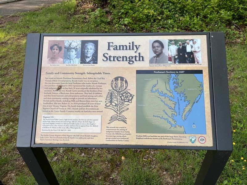
Family and Community Strength. Inhospitable Times.
You stand on historic Powhatan Paramountcy land. Before the Civil War, women seldom owned property. Keziah Carter was an exception. She was descended from the local Powhatan tribe leader, Keziah Powhatan. Her purchase of this land in 1842 represented the resolve of a woman with indigenous roots to buy back 50 acres originally inhabited by her ancestors. Before the war, Keziah Carter purchased the freedom of her husband, Robert, a Black man, from indenture. They had 10 children, and they lived, bartered, and sold property and food among each other and their community, earning enough to provide an inheritance. Keziah and her family, including Mills and Boston lines, were key area landholders. Her son, Robert Jr., in 1852 purchased 10 acres of land that is now Vienna, Virginia. His family helped establish the First Baptist Church of Vienna in 1867. Keziah and her descendants are buried in the Carter Family Cemetery nearby on land they once owned.
[Sidebar:]
Register 151The Fairfax County Register of Free Negroes tells little about Keziah's daughter, Sally Carter. This record masked that the family was multiracial, and their Native American Heritage was obscured.
The hearer hereof Sally Carter, a light brown woman, five feet six and three quarter inches high,about twenty two years of age, full suit of hair, the little finger on each hand slightly crooked; no other perceivable marks or scars, is the daughter of Keziah Carter a free woman of colour and born free as appears from the affidavit of William H. Moore on file in my office; Whereupon & c.
Click or scan to see
this page online
Examined by the Court S.M. Ball C.C. 1842
This artwork was created to commemorate the joining of indigenous families from Fairfax County (the Mills/Boston Family). Intermarriage among ethnic groups created new multiracial communities in Fairfax County.
Powhatan's Territory in 1607
Freedom Hill is on and that was part of this large Native American kingdom/confederacy known as the Powhatan's Paramountcy.
Erected 2021 by Fairfax County Park Authority.
Topics. This historical marker is listed in these topic lists: African Americans • Indigenous Peoples and Communities • Political Subdivisions • Settlements & Settlers
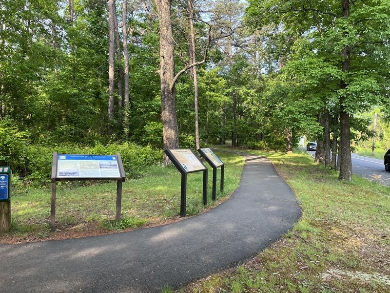
Location. 38° 55.033′ N, 77° 14.487′ W. Marker is in Tysons, Virginia, in Fairfax County. It is on Old Courthouse Road (Virginia Route 677) west of Battery Park Street, on the left when traveling west. Touch for map. Marker is at or near this postal address: 8531 Old Courthouse Rd, Vienna VA 22182, United States of America. Touch for directions.

Regionally, this marker is in the Washington Metropolitan Area and in Northern Virginia. It is also in the American South, specifically in the Upper South, in the Mid-Atlantic, and on the Eastern Seaboard. Globally, it is in the North Atlantic Region, North America, the Western Hemisphere, the Western World, and the Anglosphere. Historically, it finds itself in what was once the territory of the Mississippian Culture, one of the original Thirteen Colonies, one of the Confederate States of America, and the Antebellum South.
Other nearby markers. At least 8 other markers are within 2 miles of this marker, measured as the crow flies: A Union Spy of Color? (here, next to this marker); Freedom Hill is a Droplet in an Ocean of History (within shouting distance of this marker); Defending the Nation's Capital (about 300 feet away, measured in a direct line); A Tent Design Inspired by Native Americans (about 300 feet away); Outpost Life (about 400 feet away); First Court House of Fairfax County (approx. 0.2 miles away); A Fairfax Legacy (approx. 1.1 miles away); Ash Grove (approx. 1.1 miles away). Touch for a list and map of all markers in Tysons.
Another marker is no longer nearby. Freedom Hill Redoubt (was a few steps from this marker but has been confirmed missing).
Credits. This page was last revised on August 14, 2025. It was originally submitted on May 20, 2022, by Devry Becker Jones of Washington, District of Columbia. This page has been viewed 1,350 times since then and 134 times this year. Photos: 1, 2. submitted on May 20, 2022, by Devry Becker Jones of Washington, District of Columbia.
