Tysons in Fairfax County, Virginia — The American South (Mid-Atlantic)
Outpost Life
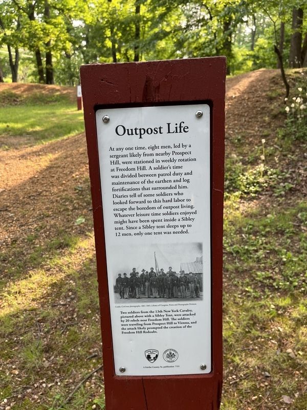
At any one time, eight men, led by a sergeant likely from nearby Prospect Hill, were stationed in weekly rotation at Freedom Hill. A soldier's time was divided between patrol duty and maintenance of the earthen and log fortifications that surrounded him. Diaries tell of some soldiers who looked forward to this hard labor to escape the boredom of outpost living. Whatever leisure time soldiers enjoyed might have been spent inside a Sibley tent. Since a Sibley tent sleeps up to 12 men, only one tent was needed.
[Caption:]
Two soldiers from the 13th New York Cavalry pictured above with a Sibley Tent, were attacked by 20 rebels near Freedom Hill. The soldiers were traveling from Prospect Hill to Vienna, and the attack likely prompted the creation of the Freedom Hill Redoubt.
Erected 2021 by Fairfax County Park Authority.
Topics and series. This historical marker is listed in these topic lists: Forts and Castles • War, US Civil. In addition, it is included in the Defenses of Washington series list.
Location. 38° 55.002′ N, 77° 14.551′ W. Marker is in Tysons,
this page online

Regionally, this marker is in the Washington Metropolitan Area and in Northern Virginia. It is also in the American South, specifically in the Upper South, in the Mid-Atlantic, and on the Eastern Seaboard. Globally, it is in the North Atlantic Region, North America, the Western Hemisphere, the Western World, and the Anglosphere. Historically, it finds itself in what was once the territory of the Mississippian Culture, one of the original Thirteen Colonies, one of the Confederate States of America, and the Antebellum South.
Other nearby markers. At least 8 other markers are within 2 miles of this marker, measured as the crow flies: A Tent Design Inspired by Native Americans (a few steps from this marker); Defending the Nation's Capital (within shouting distance of this marker); Freedom Hill is a Droplet in an Ocean of History
Another marker is no longer nearby. Freedom Hill Redoubt (was about 400 feet away but has been confirmed missing).
Credits. This page was last revised on May 20, 2022. It was originally submitted on May 20, 2022, by Devry Becker Jones of Washington, District of Columbia. This page has been viewed 240 times since then and 19 times this year. Photos: 1, 2. submitted on May 20, 2022, by Devry Becker Jones of Washington, District of Columbia.
