
Conyers in Rockdale County, Georgia — The American South (South Atlantic)
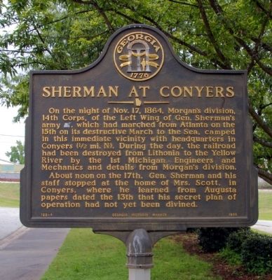
Sherman at Conyers
Photographed by David Seibert, June 6, 2009
1. Sherman at Conyers Marker
About noon on the 17th, Gen. Sherman and his staff stopped at the home of Mrs. Scott, in Conyers, where he learned from Augusta papers dated the 13th that his secret plan of operation had not yet been divined.
Erected 1985 by Georgia Department of Natural Resources. (Marker Number 122-4.)
Topics and series. This historical marker is listed in this topic list: War, US Civil. In addition, it is included in the Georgia Historical Society, and the Sherman’s March to the Sea series lists. A significant historical date for this entry is October 17, 1864.
Location. 33° 39.922′ N, 84° 1.063′ W. Marker is in Conyers, Georgia, in Rockdale County. It is on Green Street SW 0 miles east of Travis Street SW, on the right when
this page online

Regionally, this marker is in Georgia’s Piedmont and in Metro Atlanta. It is also in the American South and specifically in the Deep South. Globally, it is in North America, the Western Hemisphere, the Western World, and the Anglosphere. Historically, it finds itself in what was once the territory of the Mississippian Culture, one of the original Thirteen Colonies, one of the Confederate States of America, and the Antebellum South.
Other nearby markers. At least 8 other markers are within walking distance of this marker: “Fightin’ Joe” Wheeler (a few steps from this marker); Unity Garden at Olde Town (about 400 feet away, measured in a direct line); Conyers Station (about 400 feet away); City of Conyers (about 600 feet away); The Dinky (about 600 feet away); Rockdale County Korea and Vietnam War Memorial (approx. 0.2 miles away); Rockdale County World War I and World War II Memorial
Photographed by David Seibert, June 6, 2009
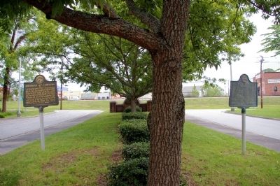
2. Sherman at Conyers Marker
Looking toward Green Street from the library, the Sherman at Conyers Marker in to the left. The marker to the right is "Fightin' Joe" Wheeler.
More about this marker. This marker, originally located less than one-half mile east on Green Street, replaced an earlier marker of the same name. That marker had been located on US 278 prior to the construction of Interstate 20.
Photographed by David Seibert, June 6, 2009
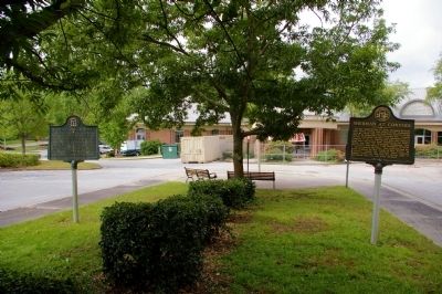
3. Sherman at Conyers Marker
Looking toward the library (under renovation), the Sherman at Conyers marker is on the right. The marker to the left is "Fightin' Joe" Wheeler.
Credits. This page was last revised on June 16, 2016. It was originally submitted on June 9, 2009, by David Seibert of Sandy Springs, Georgia. This page has been viewed 1,884 times since then and 41 times this year. Photos: 1, 2, 3. submitted on June 9, 2009, by David Seibert of Sandy Springs, Georgia. • Craig Swain was the editor who published this page.
