Chemung in Chemung County, New York — The American Northeast (Mid-Atlantic)
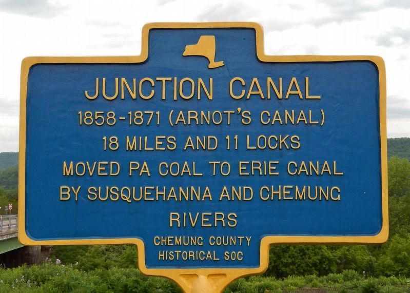
Junction Canal
18 miles and 11 locks
Moved PA coal to Erie Canal
by Susquehanna and Chemung Rivers
Erected 2019 by Chemung County Historical Society.
Topics and series. This historical marker is listed in these topic lists: Industry & Commerce • Waterways & Vessels. In addition, it is included in the Erie Canal series list. A significant historical year for this entry is 1858.
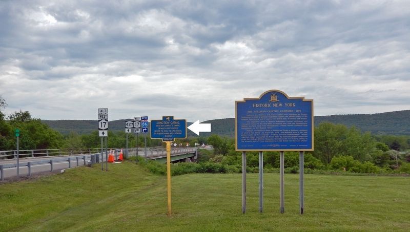
Location. 42° 0.547′ N, 76° 37.579′ W. Marker is in Chemung, New York, in Chemung County. Marker is on Wyncoop Creek Road (County Road 3) just south of Main Street (County Road 60), on the right when traveling south. Touch for map. Marker is at or near this postal address: 773 County Road 60, Chemung NY 14825, United States of America. Touch for directions.
Other nearby markers. At least 8 other markers are within 3 miles of this marker, measured as the crow flies. The Sullivan-Clinton Campaign — 1779 (here, next to this marker); Old Chemung (about 300 feet away, measured in a direct line); Sullivan Road (approx. ¼ mile away); Military Route (approx. 0.9 miles away); Chemung (approx. 2.3 miles away); Chemung Village (approx. 2.3 miles away); Soldiers of the American Revolution (approx. 2.9 miles away); Riverside Cemetery (approx. 2.9 miles away). Touch for a list and map of all markers in Chemung.
Also see . . .
1. Junction Canal.
John Arnot, Sr. became the president and financial backer for the newly formed Junction Canal Company. Construction of the canal began in 1853. The Junction Canal was proudly opened in 1856 between Elmira, NY and Athens, PA, although the canal was not totally completed until 1858. Coal was carried from Pennsylvania on the canal system to the turning basin in Chemung, where it was transferred to the Erie Railroad for transshipment. In 1865 the Junction Canal (also known as the Arnot Canal), was devastated by major flooding of the Chemung River. Although the canal system was abandoned in 1871/72, a large portion of the canal can still be seen today, along with several lock houses.(Submitted on May 20, 2022, by Cosmos Mariner of Cape Canaveral, Florida.)
2. The Junction Canal Story.
The Junction Canal was created to join together the North Branch Extension of the Pennsylvania Canal, at the border of Athens Township and Chemung with the Chemung Canal in Elmira, N.Y. Eighteen miles of canal, it ran through the Town of Chemung, Village of Lowman and Town and City of Elmira. Remnants of canal bed, locks and dams can be viewed today. Some of the canal bed still holds water during high water levels in the area. The canal required the building of three dams, two aqueducts, 42 bridges, 11 locks and various canal houses and buildings. The Irish were the primary canal diggers, carpenters, blacksmiths, teamsters and foreman. They were paid 10 cents an hour and worked 10-hour days.(Submitted on May 20, 2022, by Cosmos Mariner of Cape Canaveral, Florida.)
3. Junction Canal.
Competition with railroads led to diminished use of the canal. In 1865 the canal was severely damaged by a flood. In 1866, the stock company was authorized to change its name to the "Junction Canal and Railroad Company," and work commenced in constructing a railroad on its right of way. The canal was last used in 1871 and was then abandoned.(Submitted on May 20, 2022, by Cosmos Mariner of Cape Canaveral, Florida.)
Credits. This page was last revised on May 20, 2022. It was originally submitted on May 20, 2022, by Cosmos Mariner of Cape Canaveral, Florida. This page has been viewed 146 times since then and 25 times this year. Photos: 1, 2. submitted on May 20, 2022, by Cosmos Mariner of Cape Canaveral, Florida.

