Port Burwell in Elgin County, Ontario — Central Canada (North America)
Port Burwell Lighthouse 1840
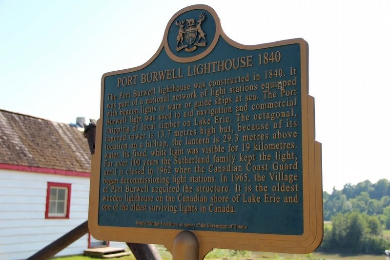
Erected by Ontario Heritage Foundation.
Topics and series. This historical marker is listed in these topic lists: Communications • Waterways & Vessels. In addition, it is included in the Canada, Ontario Heritage Trust, and the Lighthouses series lists. A significant historical year for this entry is 1840.
Location. 42° 38.715′ N, 80° 48.411′ W.
this page online

Regionally, this marker is in the Southwest Ontario Area and in Southwestern Ontario. It is also in Central Canada. Globally, it is in North America, on the Great Lakes, in the Western Hemisphere, in the Western World, and in the Anglosphere. Historically, it finds itself in what was once a British colony, the Viceroyalty of New France, the Haudenosaunee (Iroquois) Confederacy, and Rupert’s Land.
Other nearby markers. At least 8 other markers are within 24 kilometers of this marker, measured as the crow flies: Lieut.-Col. Mahlon Burwell (about 150 meters away, measured in a direct line); Trinity Anglican Church 1836 (approx. 0.3 kilometers away); The Edison Homestead (approx. 3.7 kilometers away); Port Bruce Site of the Royal Salute (approx. 16.6 kilometers away); Aylmer Cenotaph (approx. 20.3 kilometers away); The Founding of Aylmer (approx. 20.3
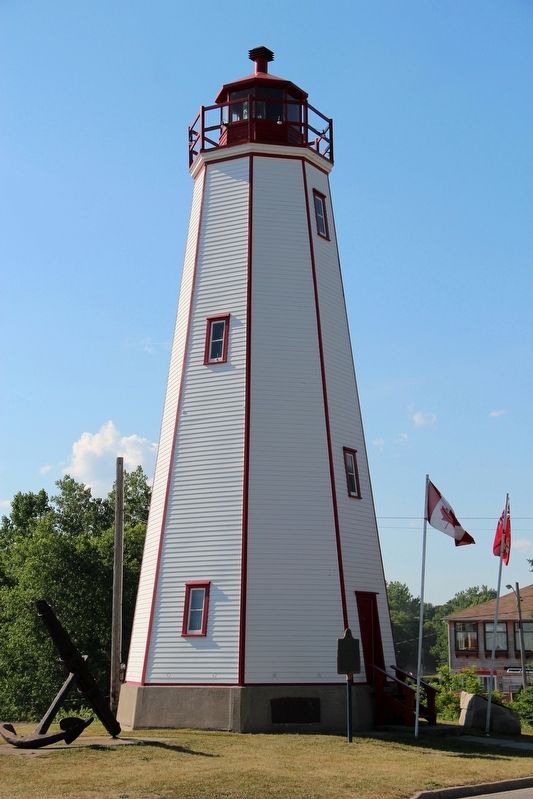
Also see . . . Port Burwell Lighthouse. In-depth history and extensive details about the lighthouse, where members of one family were keepers from 1852 to 1962 except for a three-year hiatus during the Korean War. (LighthouseFriends.com) (Submitted on May 21, 2022, by Duane and Tracy Marsteller of Murfreesboro, Tennessee.)
Credits. This page was last revised on May 21, 2022. It was originally submitted on May 21, 2022, by Duane and Tracy Marsteller of Murfreesboro, Tennessee. This page has been viewed 405 times since then and 31 times this year. Photos: 1, 2. submitted on May 21, 2022, by Duane and Tracy Marsteller of Murfreesboro, Tennessee.
