Spencer in Worcester County, Massachusetts — The American Northeast (New England)
Capt. Edmond Bemis
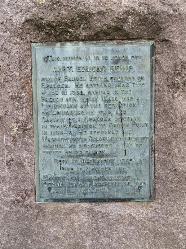
Capt. Edmond Bemis,
Son of Samuel Bemis, founder of
Spencer. He settled near this
place in 1750, served in the
French and Indian Wars, was a
Lieutenant at the reduction
of Louisburg in 1745, and
Captain of a Spencer company
in the expedition to Crown Point
in 1755-6. He rendered the
Massachusetts Colony distinguished
service by discovering a way to
utilize spiked cannon.
Born at Watertown 1720.
Died at Spencer 1810.
Erected by a great grandson,
Geo.W.Bemis of Independence, Lowa
A.D. 1901.
Erected 1901 by Geo.W.Bemis (Grandson).
Topics. This memorial is listed in these topic lists: Colonial Era • Settlements & Settlers • War, French and Indian. A significant historical year for this entry is 1750.
Location. 42° 13.935′ N, 72° 1.022′ W. Marker is in Spencer, Massachusetts, in Worcester County. Memorial is at the intersection of W Main Street (Massachusetts Route 9) and Massachusetts Route 49, on the left when traveling east on W Main Street. Located in Bemis Memorial Park. Touch for map. Marker is in this post office area: Spencer MA 01562, United States of America. Touch for directions.
Other nearby markers. At least 8 other markers are within 2 miles of this marker, measured as the crow flies. Samuel Bemis (a few steps from this marker); Bemis Memorial Park (a few steps from this marker); Inventors (approx. 1.1 miles away); George Washington (approx. 1.4 miles away); The Massasoit Hotel (approx. 1.4 miles away); Gen. Henry Knox Trail (approx. 1.4 miles away); Donald B. Mandeville Sr. (approx. 1.6 miles away); East Brookfield World War II Monument (approx. 1.6 miles away). Touch for a list and map of all markers in Spencer.
Credits. This page was last revised on May 22, 2022. It was originally submitted on May 22, 2022, by Michael Herrick of Southbury, Connecticut. This page has been viewed 207 times since then and 57 times this year. Photos: 1, 2, 3. submitted on May 22, 2022, by Michael Herrick of Southbury, Connecticut.


