Wheeling in Ohio County, West Virginia — The American South (Appalachia)
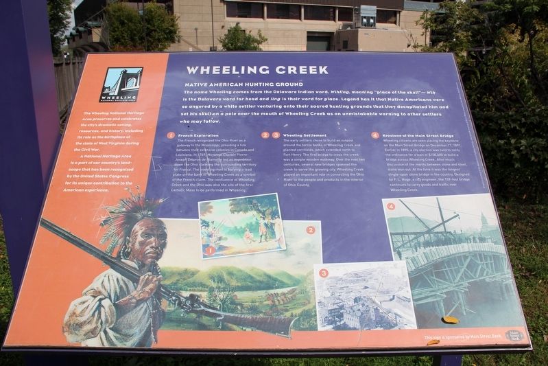
Wheeling Creek
Native American Hunting Ground
1. French Exploration
The French recognized the Ohio River as a gateway to the Mississippi, providing a link between their extensive colonies in Canada and Louisiana. In 1749, Montreal Captain Pierre-Joseph Céloron de Blainville led an expedition down the Ohio claiming the surrounding territory for France. The kneeling man is burying a lead plate on the bank of Wheeling Creek as a symbol of the French claim. The confluence of Wheeling Creek and the Ohio was also the site of the first Catholic Mass to be performed in Wheeling.
2 & 3. Wheeling Settlement
The early settlers chose to build an outpost around the fertile banks of Wheeling Creek and planted cornfields, which extended north to Fort Henry. The first bridge to cross the creek was a simple wooden walkway. Over the next two centuries, several new bridges spanned the creek to serve the growing city. Wheeling Creek played an important role in connecting the Ohio River to the people and products in the interior of Ohio County.
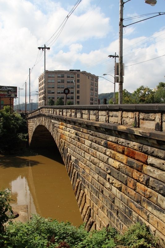
4. Keystone of the Main Street Bridge
Wheeling citizens are seen placing the keystone on the Main Street Bridge on December 17, 1891. Earlier in 1890, a city election was held to ratify the ordinance for a loan of $100,000 to build a bridge across Wheeling Creek. After much discussion of the merits between stone and steel, stone won out. At the time it was the longest single-span stone bridge in the country. Designed by F. L. Hoge, a city engineer, the 159-foot bridge continues to carry goods and traffic over Wheeling Creek.
[Left column ]
The Wheeling National Heritage Area preserves and celebrates the city's dramatic setting, resources, and history, including its role as the birthplace of the state of West Virginia during the Civil War. A National Heritage Area is a part of our country's landscape that has been recognized by the United States Congress for its unique contribution to the American experience.
Graphics courtesy of the Museums of Oglebay Institute; photograph courtesy of Kirk's Photo; artwork by Glen Barnes, Mark Missman. This sign is sponsored by Main Street Bank.
Erected by Wheeling Heritage.
Topics. This historical marker is listed in these
Location. 40° 3.817′ N, 80° 43.501′ W. Marker is in Wheeling, West Virginia, in Ohio County. Marker can be reached from Main Street north of 20th Street, on the left when traveling north. Marker is on Wheeling Heritage Trail on the south side of Wheeling Creek. The greenway is about 400 feet west of Main Street. Touch for map. Marker is at or near this postal address: 2001 Main St, Wheeling WV 26003, United States of America. Touch for directions.
Other nearby markers. At least 8 other markers are within walking distance of this marker. Gordon Battelle (about 500 feet away, measured in a direct line); The Steamboat "Washington" (about 500 feet away); Stone & Thomas Department Store (about 500 feet away); Bayha Bakery (about 500 feet away); Pocket Park (about 500 feet away); Schmulbach Brewery (about 500 feet away); Riverside Iron Works Office Building (about 500 feet away); Oglebay Mansion (about 600 feet away). Touch for a list and map of all markers in Wheeling.
Credits. This page was last revised on May 25, 2022. It was originally submitted on May 23, 2022, by Duane and Tracy Marsteller of Murfreesboro, Tennessee. This page has been viewed 260 times since then and 43 times this year. Photos: 1, 2. submitted on May 23, 2022, by Duane and Tracy Marsteller of Murfreesboro, Tennessee.
Editor’s want-list for this marker. Wide shot of marker and surrounding area in context. • Can you help?

