Sault Ste. Marie in Algoma District, Ontario — Central Canada (North America)
The Last Emergency Swing Dam in the World! / Le dernier barrage tournant de secours au monde!

cmh2315fl via Flickr (CC BY-NC 2.0), August 4, 2011
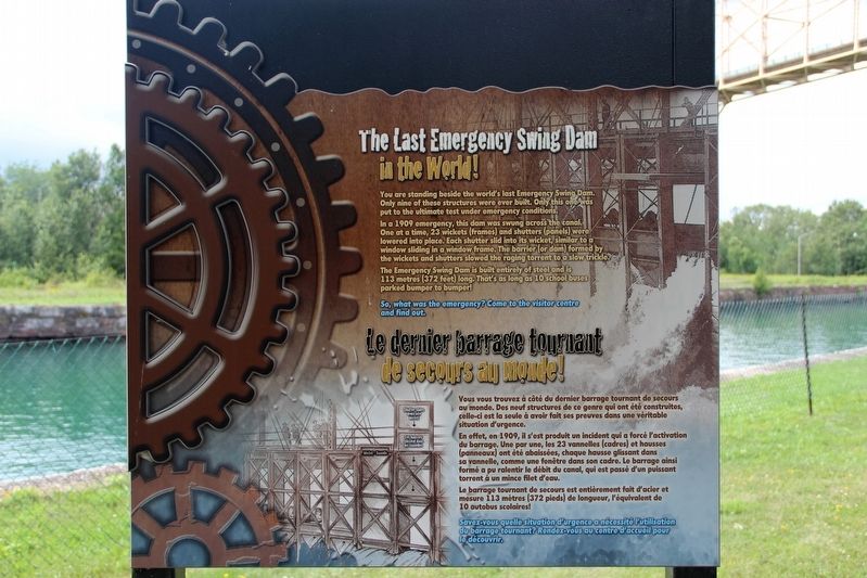
1. The Last Emergency Swing Dam in the World! / Le dernier barrage tournant de secours au monde! Marker
In a 1909 emergency, this dam was swung across the canal. One at a time, 23 wickets (frames) and shutters (panels) were lowered into place. Each shutter slid into its wicket, similar to a window sliding in a window frame. The barrier (or dam) formed by the wickets and shutters slowed the raging torrent to a slow trickle.
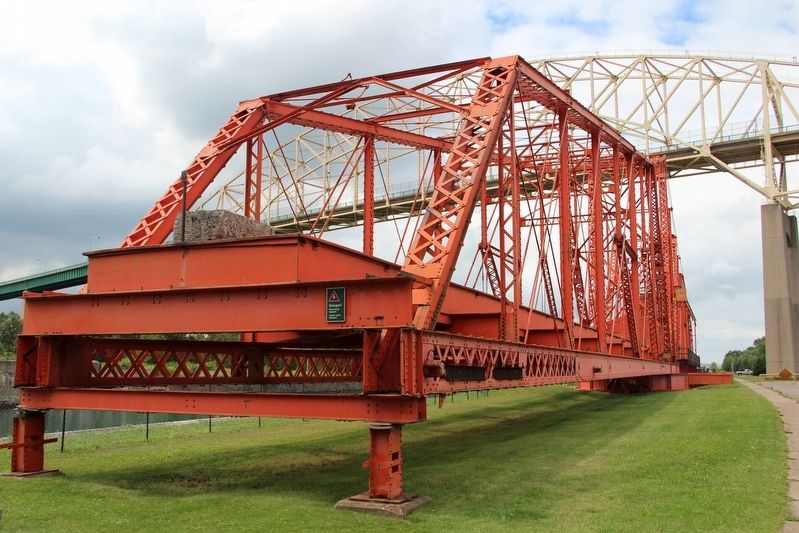
The Emergency Swing Dam is built entirely of steel and is 113 metres (372 feet) long. That's as long as 10 school buses parked bumper to bumper!
So, what was the emergency? Come to the visitor centre and find out.
[Francais] Vous vous trouvez à côté du dernier barrage tournant de secours au monde. Des neuf structures de ce genre qui ont été construites, celle-ci est la seule à avoir fait ses preuves dans une véritable situation d'urgence.
En effet, en 1909, il s'est produit un incident qui a forcé l'activation du barrage. Une par une, les 23 vannelles (cadres) et hausses (panneaux) ont été abaissées, chaque hausse glissant dans sa vannelle, comme une fenêtre dans son cadre. Le barrage ainsi formé a pu ralentir le débit du canal, qui est passé d'un puissant torrent à un mince filet d'eau.
Le barrage tournant de secours est entièrement fait d'acier et mesure 113 mètres (372 pieds) de longueur, l'équivalent de 10 autobus scolaires!
Savez-vous quelle situation d'urgence a nécessité l’utilisation du barrage tournant? Rendez-vous au centre d'accueil pour le découvrir.
Topics. This historical marker is listed in these topic lists: Man-Made Features • Waterways & Vessels. A significant historical year for this entry is 1909.
Location. 46° 30.795′ N, 84° 21.416′ W. Marker is in Sault Ste. Marie, Ontario, in Algoma District. Marker is on Canal Drive, 1.1 kilometers west of Huron Street, on the left when traveling west. Marker is in Sault Ste. Marie Canal National Historic Site. Touch for map. Marker is in this post office area: Sault Ste Marie ON P6A P6A, Canada. Touch for directions.
Other nearby markers. At least 8 other markers are within walking distance of this marker. What a Rush! / Urgence! (a few steps from this marker); Why Preserve This Big Hunk of Steel? / Pourquoi préserver cette énorme structure d'acier? (within shouting distance of this marker); Emergency Swing Bridge Dam / Barrage tournant de secours (about 90 meters away, measured in a direct line); The "Chicora" Incident (about 180 meters away); Sault Ste. Marie Ship Canal (approx. half a kilometer away); The First Sault Ste. Marie Canal (approx.
Also see . . . The Sault Canal Accident of 1909. The accident, started by a coal freighter crashing into the lower lock gates, heavily damaged several ships but claimed no lives. (Shaw Spotlight, uploaded Jan. 11, 2021) (Submitted on May 23, 2022, by Duane and Tracy Marsteller of Murfreesboro, Tennessee.)

Don Harrison (reproduced from original) (CC BY-NC-ND 2.0)
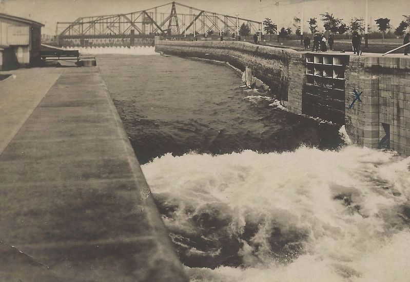
3. The 1909 accident
The Emergency Swing Dam (background slowed the surging water to a trickle, allowing repairs to be made to the locks.
Credits. This page was last revised on May 24, 2022. It was originally submitted on May 23, 2022, by Duane and Tracy Marsteller of Murfreesboro, Tennessee. This page has been viewed 107 times since then and 14 times this year. Photos: 1, 2, 3. submitted on May 23, 2022, by Duane and Tracy Marsteller of Murfreesboro, Tennessee.
Editor’s want-list for this marker. Wide shot of marker and surrounding area in context. • Can you help?
