Zion National Park in Washington County, Utah — The American Mountains (Southwest)
Cables from the Rim
Photographed by William Fischer, Jr., November 13, 2010
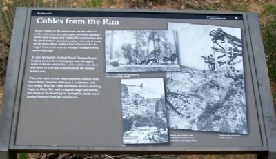
1. Cables from the Rim Marker
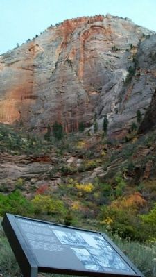
Barely visible on the canyon rim are the ruins of a cableworks from the early 1900s. Mormon pioneers in the Zion area needed lumber for construction, but the good timber - ponderosa pine - was out of reach on the mesa above. Settlers had to haul lumber by wagon from as far away as Arizona's Kaibab Forest, a two-week trip.
In 1900 Springdale resident David Flanigan began looping 50,000 feet of telegraph wire through a series of drums and pulleys in the cableworks above and down to a second framework on the mound behind you.
When the cable system was completed, boards could travel down from the clifftop in 2½ minutes - not two weeks. With the cable operation modern building began in Zion. The park's original lodge and cabins, and many of the buildings in Springdale, made use of lumber lowered from the canyon rim.
Erected by National Park Service.
Topics. This historical marker is listed in these topic lists: Horticulture & Forestry • Industry & Commerce • Man-Made Features • Settlements & Settlers. A significant historical year for this entry is 1900.
Location. 37° 16.225′ N, 112° 56.304′ W. Marker is
this page online

Regionally, this marker is in Utah’s Color Country. It is also in the American Southwest, in the Mountain West, and on the Colorado Plateau. Globally, it is in North America, the Rocky Mountains, the Western Hemisphere, the Western World, and the Anglosphere. Historically, it finds itself in what was once New Spain and also Mexico’s Alta California.
Other nearby markers. At least 8 other markers are within 5 miles of this marker, measured as the crow flies: Canyon or Cathedral (approx. half a mile away); Zion Lodge (approx. 1.7 miles away); Tourists in the Canyon (approx. 1.7 miles away); Sentinel Slide (approx. 2.6 miles away); Court of the Patriarchs (approx. 2.6 miles away); Zion Mt. Carmel Tunnel and Highway, Utah (approx. 4.1 miles away); Impassable Barrier (approx. 4.2 miles away); Stephen Tyng Mather (approx. 4.8 miles away).
Also see . . . Zion National Park.
Photographed by William Fischer, Jr., November 13, 2010
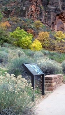
2. Cables from the Rim Marker
Photographed by William Fischer, Jr., November 13, 2010
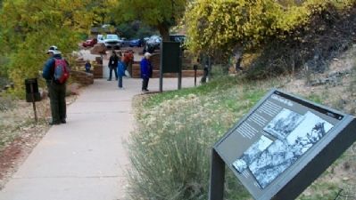
3. Cables from the Rim Marker
Looking toward the trailhead parking lot
Photographed by William Fischer, Jr., November 13, 2010
4. Rim from Cables from the Rim Marker
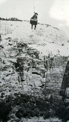
Photographed by Unknown, circa early 1900
5. Photo on Cables from the Rim Marker
[Caption reads] Rough sawn lumber, and sometimes workers, were lowered to the canyon floor
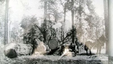
Photographed by Unknown, circa early1900s
6. Photo on Cables from the Rim Marker
[Caption reads] Trees were cut and the logs hauled by horse to a portable sawmill
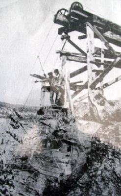
Photographed by Unknown, circa early1900s
7. Photo on Cables from the Rim Marker
[Caption reads] Cableworks on the rim of the canyon
Credits. This page was last revised on May 26, 2022. It was originally submitted on February 21, 2011, by William Fischer, Jr. of Reynoldsburg, Ohio. This page has been viewed 834 times since then and 32 times this year. Last updated on May 23, 2022, by McGhiever of Minneapolis, Minnesota. Photos: 1, 2, 3, 4, 5, 6, 7. submitted on February 21, 2011, by William Fischer, Jr. of Reynoldsburg, Ohio. • J. Makali Bruton was the editor who published this page.
