Sault Ste. Marie in Algoma District, Ontario — Central Canada (North America)
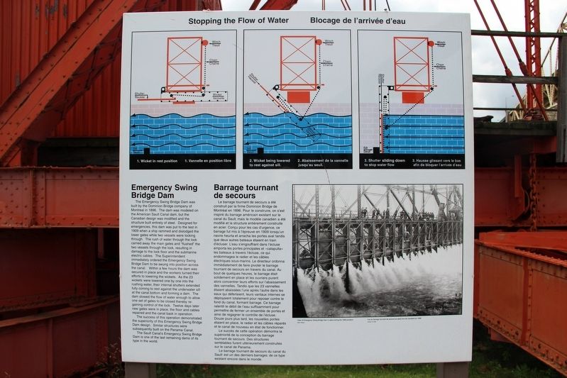
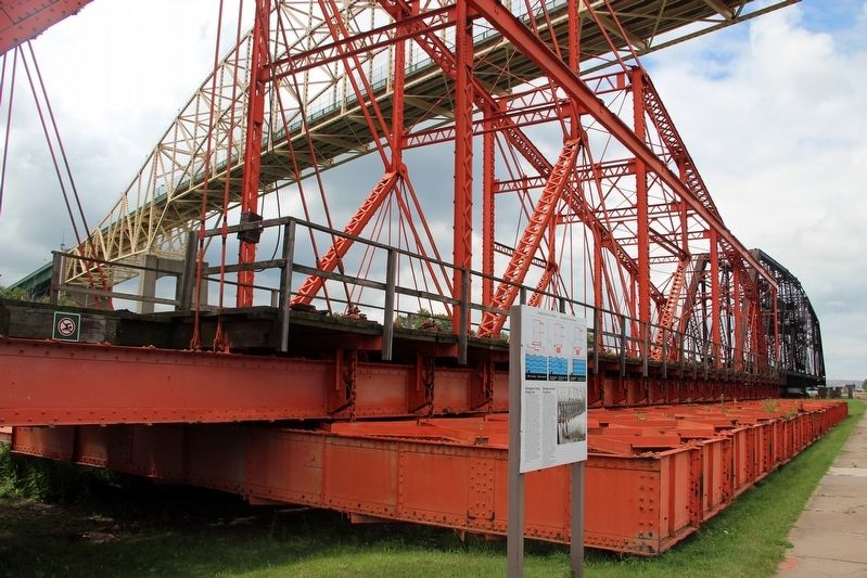
Emergency Swing Bridge Dam
⎯⎯⎯
Barrage tournant de secours
cmh2315fl via Flickr (CC BY-NC 2.0), August 4, 2011
1. Emergency Swing Bridge Dam / Barrage tournant de secours Marker
this page online
The success of this operation demonstrated the superiority of this Emergency Swing Bridge Dam design. Similar structures were subsequently built on the Panama Canal.
The Sault Canal's Emergency Swing Bridge Dam is one of the last remaining dams of its type in the world.
Caption: View of Emergency Swing Bridge Dam in place during the 1909 accident.
[Francais] Le barrage tournant de secours a été construit par la firme Dominion Bridge de Montréal en 1896. Pour le construire, on s'est inspiré du barrage américain existant sur le canal du Sault, mais le modèle canadien a été modifié et la structure entièrement construite en acier. Conçu pour les cas d'urgence, ce barrage fut mis à l'épreuve en 1909 lorsqu'un navire heurta et arracha les portes aval tandis que deux autres bateaux étaient en train d'écluser. L'eau s'engouffrant dans l'écluse emporta les portes principales et «catapulta» les bateaux à travers l'écluse, ce qui endommagea le radier et les câbles électriques sous-marins. Le directeur ordonna immédiatement de faire pivoter le barrage tournant de secours
cmh2315fl via Flickr (CC BY-NC 2.0), August 4, 2011
2. Emergency Swing Bridge Dam / Barrage tournant de secours Marker
Le succès de cette opération démontra la supériorité de la conception du barrage tournant de secours. Des structures semblables furent ultérieurement construites sur le canal de Panama.
Le barrage tournant de secours du canal du Sault est un des derniers barrages de ce type existant encore dans le monde.
Légende: Vue de barrage tournant de secours en place lors de l'accident en 1909.
Topics. This historical marker is listed in these topic lists: Disasters • Man-Made Features • Waterways & Vessels. A significant historical year for this entry is 1896.
Location. 46° 30.802′ N, 84° 21.479′ W. Marker is in Sault Ste. Marie, Ontario, in Algoma District. It is on Canal Drive 1.2 kilometers west of Huron Street, on the left when traveling west. Marker is in Sault Ste. Marie Canal National Historic Site. Touch for map. Marker is in this post office area: Sault Ste Marie ON P6A 6W4, Canada. Touch for directions.

Regionally, this marker is in the Sault Ste. Marie and Algoma Area and in Northern Ontario. It is also in Central Canada. Globally, it is in North America, in the Great North Woods, on the Great Lakes, on Lake Superior’s North Shore, in the Western Hemisphere, in the Western World, and in the Anglosphere. Historically, it finds itself in what was once a British colony, the Viceroyalty of New France, the Haudenosaunee (Iroquois) Confederacy, and Rupert’s Land.
Other nearby markers. At least 8 other markers are within walking distance of this marker: The Last Emergency Swing Dam in the World! / Le dernier barrage tournant de secours au monde! (about 90 meters away, measured in a direct line); What a Rush! / Urgence! (about 90 meters away); The Dam in Action! / Le barrage à l'œuvre! (about 90 meters away); Why Preserve This Big Hunk of Steel? / Pourquoi préserver cette énorme structure d'acier? (about 90 meters away); The "Chicora" Incident (approx. 0.3 kilometers away); Canadian Veterans Memorial (approx. 0.3 kilometers away); CPR Passenger Ships in the Lock / Paquebots de la CFCP dans l'écluse (approx. 0.4 kilometers away); 1622 (approx. half a kilometer away). Touch for a list and map of all markers in Sault Ste. Marie.
Credits. This page was last revised on May 24, 2022. It was originally submitted on May 23, 2022, by Duane and Tracy Marsteller of Murfreesboro, Tennessee. This page has been viewed 450 times since then and 42 times this year. Photos: 1. submitted on May 23, 2022, by Duane and Tracy Marsteller of Murfreesboro, Tennessee. 2. submitted on May 24, 2022, by Duane and Tracy Marsteller of Murfreesboro, Tennessee.
