Ohiopyle in Fayette County, Pennsylvania — The American Northeast (Mid-Atlantic)
Ohiopyle
Trail Map and Points of Interest
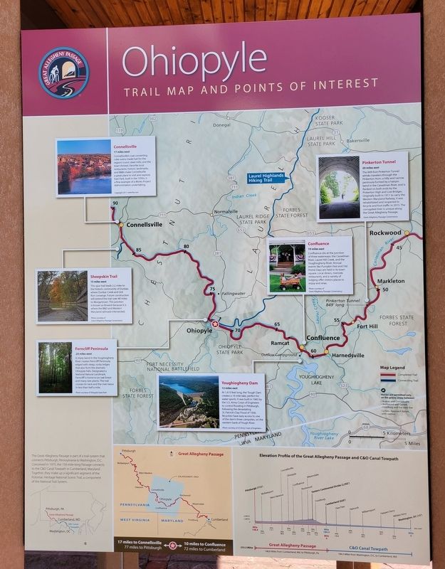
Connellsville
17 miles west
Connellsville's coal-converting coke ovens made fuel for the region's iconic steel millls, and the town thrived. Favorite local restaurants, historic landmarks, and B&Bs make Connellsville a great place to visit and explore. East Park, built in the 1930s, is a fine example of a Works Project Administration undertaking.
Copyright 2011 mdmPix.com
Sheepskin Trail
15 miles west
This spur trail leads 2.2 miles to the historic community of Dunbar, where Dunbar Creek and Gist Run converge. Future construction will extend the trail over 40 miles to Morgantown. This junction is known as Bowest because it is where the B&O and Western Maryland railroads intersected.
Photo courtesy of Great Allegheny Passage Conservancy
Ferncliff Peninsula
.25 miles west
A sharp bend in the Youghiogheny River creates Ferncliff Peninsula, edged with steep, rocky ledges that also form the dramatic Ohiopyle Falls. Designated a National Natural Landmark, Ferncliff is home to an oak forest and many rare plants. The trail crosses its neck and the river twice in less than half a mile.
Photo courtesy of Ohiopyle State Park
Youghiogheny Dam
12 miles east
At 1,610 feet long, the 'Yough' Dam creates a 16-mile lake, perfect for water sports. It was built in 1943 by the U.S. Army Corps of Engineers to control flooding in Pittsburgh, following the devastating St. Patrick's Day Flood of 1936. Bicyclists have easy access to one of the dam's three campsites, on the western bank of Yough River.
Photo courtesy of US Army Corps of Engineers
Confluence
10 miles east
Confluence sits at the junction of three waterways: the Casselman River, Laurel Hill Creek, and the Youghiogheny River. Annual events like Pumpkin Fest and Old Home Days are held in its town square. Local diners, riverside restaurants, and a variety of lodging offer visitors places to enjoy and relax.
Photo courtesy of Great Allegheny Passage Conservancy
Pinkerton Tunnel
20 miles east
The 849-foot Pinkerton Tunnel whisks travelers through the Pinkerton Horn, a hilly and narrow peninsula formed by a hairpin bend in the Casselman River, and is flanked on both ends by the Pinkerton High and Low Bridges. Originally built in 1911 to carry the Western Maryland Railway, it was rehabilitated and reopened to bicycle and foot traffic in 2015. The corrugated liner is unique along the Great Allegheny Passage.
Great Allegheny Passage Conservancy
The Great Allegheny Passage is part of a trail system that connects Pittsburgh, Pennsylvania to Washington, D.C. Conceived in 1975, the 150-mile-long Passage connects to the C&O Canal Towpath in Cumberland, Maryland. Together, they make up a significant segment of the Potomac Heritage National Scenic Trail, a component of the National Trail System.
Erected by Great Allegheny Passage.
Topics. This historical marker is listed in this topic list: Parks & Recreational Areas. A significant historical year for this entry is 2011.
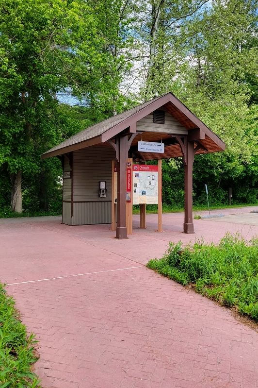
Location. 39° 52.189′ N, 79° 29.512′ W. Marker is in Ohiopyle, Pennsylvania, in Fayette County. Marker is on Sheridan Street east of Main Street (Pennsylvania Route 381), on the left when traveling east. Marker is located at the parking area for the Ohiopyle Trailhead of the Great Allegheny Passage trail. Touch for map. Marker is at or near this postal address: 7 Sheridan Street, Ohiopyle PA 15470, United States of America. Touch for directions.
Other nearby markers. At least 8 other markers are within 2 miles of this marker, measured as the crow flies. A different marker also named Ohiopyle (here, next to this marker); a different marker also named Ohiopyle (within shouting distance of this marker); Railroading (within shouting distance of this marker); Veterans Memorial (about 500 feet away, measured in a direct line); A "Most Enchanting" Resort (approx. ¼ mile away); Kentuck Knob (approx. 1.6 miles away); K6 Telephone Kiosk 1935 (approx. 1.6 miles away); Finial from One, Poultry, London EC4, 1870 (approx. 1.6 miles away). Touch for a list and map of all markers in Ohiopyle.
Regarding Ohiopyle. Marker also includes an Elevation Profile of the Great Allegheny Passage and C&O Canal Towpath from Pittsburgh to Washington, DC.
Credits. This page was last revised on May 26, 2022. It was originally submitted on May 24, 2022, by Bradley Owen of Morgantown, West Virginia. This page has been viewed 80 times since then and 4 times this year. Photos: 1, 2. submitted on May 25, 2022, by Bradley Owen of Morgantown, West Virginia. • Bill Pfingsten was the editor who published this page.

