Oxford in Calhoun County, Alabama — The American South (East South Central)
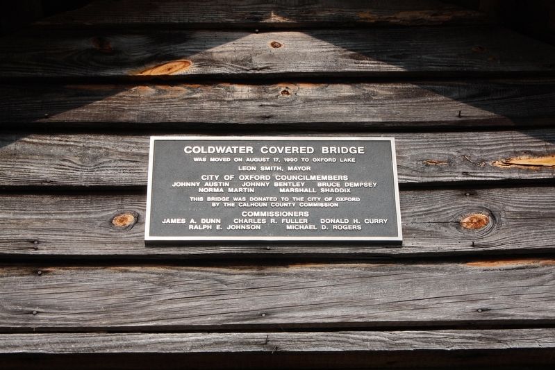
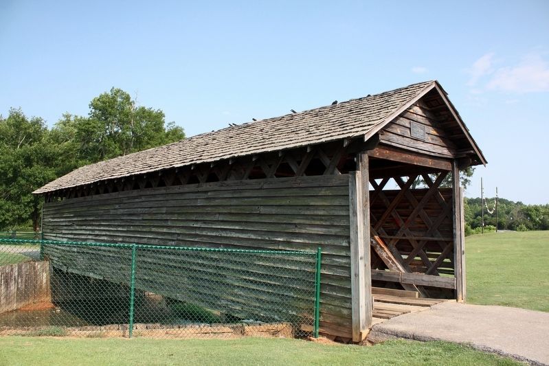
Coldwater Covered Bridge
Leon Smith, Mayor
City of Oxford Councilmembers
Johnny Austin • Johnny Bentley • Bruce Dempsey
Norma Martin • Marshall Shaddix
The bridge was donated to the City of Oxford
by the Calhoun County Commission
Commissioners
James A. Dunn • Charles R. Fuller • Donald H. Curry
Ralph E. Johnson • Michael D. Rogers
Topics and series. This historical marker is listed in this topic list: Bridges & Viaducts. In addition, it is included in the Covered Bridges series list. A significant historical date for this entry is August 17, 1990.
Location. 33° 36.458′ N, 85° 48.992′ W. Marker is in Oxford, Alabama, in Calhoun County. Marker can be reached from Recreation Drive east of Mc Cullars Lane, on the left when traveling east. Marker is east of Calhoun County Civic Center. Touch for map. Marker is at or near this postal address: 401 Mc Cullars Ln, Oxford AL 36203, United States of America. Touch for directions.
Other nearby markers. At least 8 other markers are within 2 miles of this marker, measured as the crow flies. John Tyler Morgan (about 600 feet away, measured in a direct line); George W. Ingram (about 700 feet away); Lick Skillet (approx. 0.9 miles away); The "Shattering" of the Mississippian World (approx. 1.2 miles away); Simmons Park (approx. 1.2 miles away); Creek Indian Campaign Memorial (approx. 1.2 miles away); Paleoindian (approx. 1.2 miles away); Charcoal Production at Caver-Christian-Davis Farm (approx. 1.2 miles away). Touch for a list and map of all markers in Oxford.
Regarding Coldwater Covered Bridge. Excerpt from the bridge's National Register of Historic Places nomination (1973):
This transportation landmark, which was built prior to 1850 and possibly as early as 1839, is one of three surviving bridges in the state built in the modified kingpost style.
In 1920 the structure was partially burned after a hunter dropped his torch on the bridge, but it was immediately repaired and rebuilt by Frank Morris, E. A. Walker, and Eli Bynum, as the bridge was the only available transportation across Coldwater Creek.
Also see . . .
1. Coldwater Covered Bridge. Wikipedia entry on the bridge, which built circa 1850. (Submitted on May 24, 2022, by Duane and Tracy Marsteller of Murfreesboro, Tennessee.)
2. Coldwater Creek Covered Bridge (PDF). National Register of Historic Places nomination for the bridge, which
Credits. This page was last revised on May 24, 2022. It was originally submitted on May 24, 2022, by Duane and Tracy Marsteller of Murfreesboro, Tennessee. This page has been viewed 303 times since then and 51 times this year. Photos: 1, 2. submitted on May 24, 2022, by Duane and Tracy Marsteller of Murfreesboro, Tennessee.

