Statesville in Iredell County, North Carolina — The American South (South Atlantic)
They found the fire very hot February 27, 1760
Inscription.
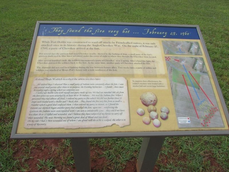
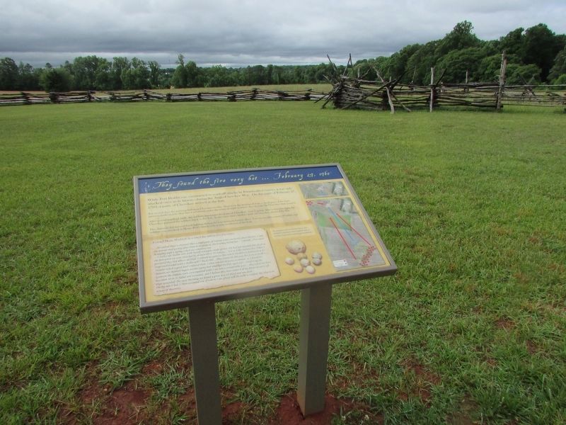
While Fort Dobbs was constructed to ward off attacks by French-allied natives, it was only attacked once in its history: during the Anglo-Cherokee War. On the night of February 27, 1760, a party of Cherokee arrived at the fort.
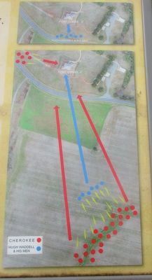
For several days the garrison had seen Cherokee nearby. Alerted by the barking of dogs, a small party of the fort's garrison (indicated by blue lines) advanced under the cover of night to where they thought the Cherokee were located.
After several hundred yards, the soldiers encountered a party of Cherokee near a spring. After a brief fire fight, the Cherokee pursued the soldiers back to the fort. At the same time, another party of Cherokee attacked the fort.
The skirmish did not end local fighting during the war between former allies. Two weeks later, a party of militia and soldiers was attacked at Moses Pott's house only a mile northwest of the fort.
Colonel Hugh Waddell described the action two days later:
for several Days I observed That a small party of Indians were constantly about the fort, I sent out several small parties after them to no purpose, the Evening before last I found there must be a party nigh a Spring which we sometimes use . I took Capt. Baillie who with myself and a party of ten; We had not marched 300 yds. from the fort when we were attacked by at least 60 or 70 Indians We recd the Indians fire; When I perceived they had almost all fired, I ordered my party to fire which We did not further than 12 Steps each loaded with a Bullet and 7 Buck shot They found the fire very hot from so small a Number which a good deal confused them. I then ordered my party to retreat, as I found the Instant our skirmish began another party had attacked the fort, upon our . . . reinforcing the Garrison the Indians were soon repulsed with I am sure considerable Loss they cou'd not have less than 10 or 12 killed and wounded, and I believed they have taken 6 of my horses to carry off their wounded; The Next Morning we found a great deal of Blood and one dead On my side I had 2 Men wounded one of whom I am afraid will die as he is scalped, the other is in a way of Recovery.
[Caption:]
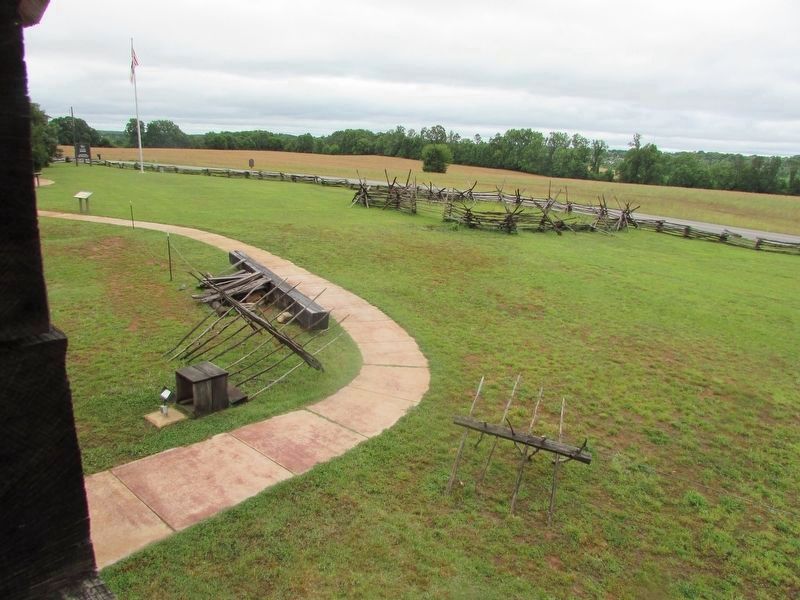
To improve their effectiveness, the soldier's muskets were loaded with a musket ball and seven large buckshot.
Topics. This historical marker is listed in these topic lists: Forts and Castles • Native Americans • War, French and Indian. A significant historical date for this entry is February 27, 1760.
Location. 35° 49.288′ N, 80° 53.824′ W. Marker is in Statesville, North Carolina, in Iredell County. Marker can be reached from Fort Dobbs
Road, 0.3 miles west of Natures Trail, on the right when traveling west. Touch for map. Marker is at or near this postal address: 438 Fort Dobbs Rd, Statesville NC 28625, United States of America. Touch for directions.
Other nearby markers. At least 8 other markers are within 3 miles of this marker, measured as the crow flies. Anglo-Cherokee War (1759 - 1761) (a few steps from this marker); The Natural Landscape of Fort Dobbs (a few steps from this marker); Site of Fort Dobbs (within shouting distance of this marker); Hugh Waddell (within shouting distance of this marker); a different marker also named Site of Fort Dobbs (within shouting distance of this marker); Preserving the Past (within shouting distance of this marker); Fort Dobbs (approx. 1.3 miles away); Iredell County Korea & Vietnam War Memorial (approx. 2.4 miles away). Touch for a list and map of all markers in Statesville.
More about this marker. A map on the right side of the marker shows the movements of the Cherokee and of Hugh Waddell and his men during the February 27, 1760 skirmish.
Credits. This page was last revised on May 26, 2022. It was originally submitted on May 26, 2022, by Bill Coughlin of Woodland Park, New Jersey. This page has been viewed 122 times since then and 14 times this year. Photos: 1, 2, 3, 4, 5, 6. submitted on May 26, 2022, by Bill Coughlin of Woodland Park, New Jersey.
