Statesville in Iredell County, North Carolina — The American South (South Atlantic)
Anglo-Cherokee War (1759 - 1761)
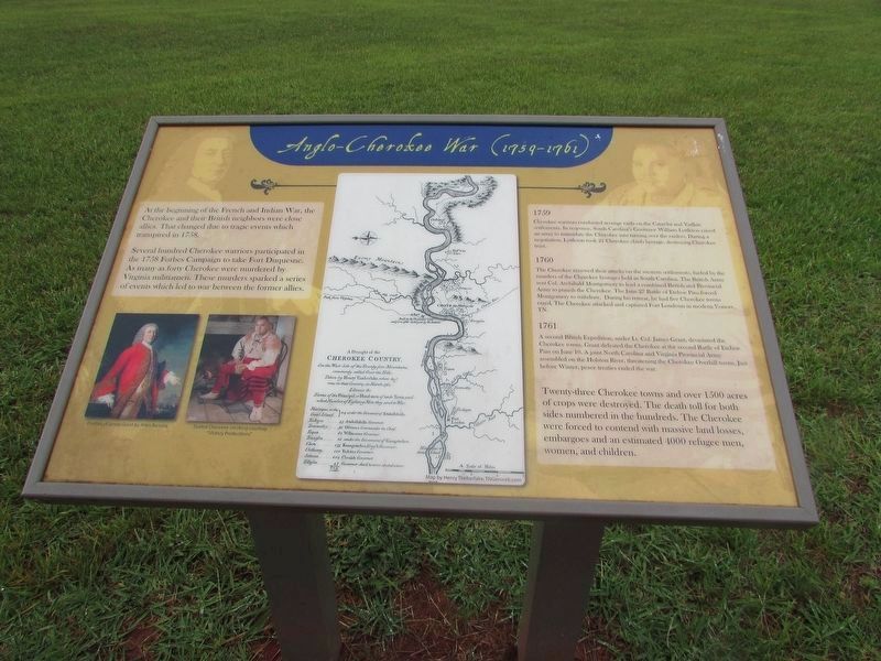
At the beginning of the French and Indian War, the Cherokee and their British neighbors were close allies. That changed due to the tragic events which transpired in 1758.
Several hundred Cherokee warriors participated in the 1758 Forbes Campaign to take Fort Duquesne. As many as forty Cherokee were murdered by Virginia militiamen. These murders sparked a series of events which led to a war between the former allies.
1759
Cherokee warriors conducted revenge raids on the Catawba and Yadkin settlements. In response, South Carolina's Governor William Lyttleton raised an army to intimidate the Cherokee into turning over the raiders. During a negotiation, Lyttleton took 21 Cherokee chiefs hostage, destroying Cherokee trust.
1760
The Cherokee renewed their attacks on the western settlements, fueled by the murders of the Cherokee hostages held in South Carolina. The British Army sent Col. Archibald Montgomery to lead a combined British and Provincial Army to punish the Cherokee. The June 27 Battle of Etchoe Pass forced Montgomery to withdraw. During his retreat, he had five Cherokee towns razed. The Cherokee attacked and captured Fort Loudoun in modern Vonore, TN.
1761
A second British Expedition, under Lt. Col. James Grant, devastated the Cherokee towns. Grant defeated the Cherokee at the second Battle of Etchoe Pass on June 10. A joint North Carolina ans Virginia Provincial Army assembled on the Holston River, threatening the Cherokee Overhill towns. Just before Winter, peace treaties ended the war.
Twenty-three Cherokee towns and over 1500 acres of crops were destroyed. The death toll for both sides numbered in the hundreds. The Cherokee were forced to contend with massive land losses, embargoes and an estimated 4000 refugee men, women, and children.
Topics. This historical marker is listed in these topic lists: Native Americans • War, French and Indian. A significant historical date for this entry is June 27, 1758.
Location. 35° 49.286′ N, 80° 53.814′ W. Marker is in Statesville, North Carolina, in Iredell County. Marker is on Fort Dobbs Road, on the right when traveling west. Touch for map. Marker is at or near this postal address: 438 Fort Dobbs Rd, Statesville NC 28625, United States of America. Touch for directions.
Other nearby markers. At least 8 other markers are within 3 miles of this marker, measured as the crow flies. The Natural Landscape of Fort Dobbs (here, next to this marker); They found the fire very hot … February 27, 1760 (a few steps from this marker); Hugh Waddell (within shouting distance of this marker); Site of Fort Dobbs (within shouting distance of this marker); a different marker also named Site of Fort Dobbs (within
shouting distance of this marker); Preserving the Past (within shouting distance of this marker); Fort Dobbs (approx. 1.3 miles away); Iredell County Korea & Vietnam War Memorial (approx. 2.4 miles away). Touch for a list and map of all markers in Statesville.
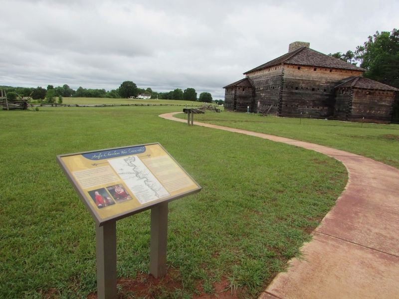
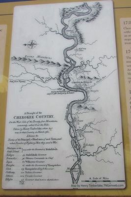
More about this marker. A Portrait of James Grant by Allen Ramsey and a Seated Cherokee smoking, courtesy of "Victory Productions" appear on the lower left of the marker. The center of the marker contains a Draught of the Cherokee Country.
Credits. This page was last revised on June 17, 2022. It was originally submitted on May 26, 2022, by Bill Coughlin of Woodland Park, New Jersey. This page has been viewed 734 times since then and 48 times this year. Photos: 1, 2, 3, 4. submitted on May 26, 2022, by Bill Coughlin of Woodland Park, New Jersey.


