
Salado in Bell County, Texas — The American South (West South Central)
The Salado Walkpath Bridge
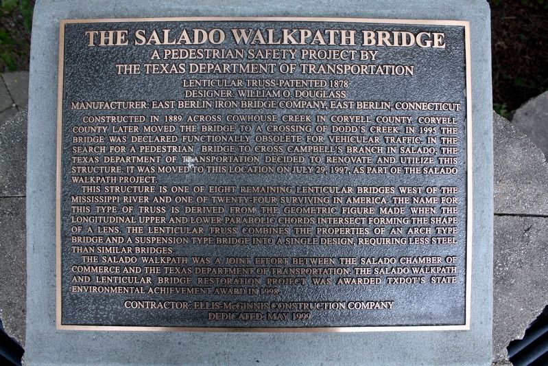
the Texas Department of Transportation
Lenticular truss-Patented 1878
Designer: William O. Douglass
Manufacturer: East Berlin Iron Bridge Company, East Berlin, Connecticut
Constructed in 1889 across Cowhouse Creek in Coryell County. Coryell County later moved the bridge to a crossing of Dodd's Creek. In 1995 the bridge was declared functionally obsolete for vehicular traffic. In the search for a pedestrian bridge to cross Campbell's Branch in Salado, the Texas Department of Transportation decided to renovate and utilize this structure. It was moved to this location on July 29, 1997, as part of the Salado Walkpath Project.
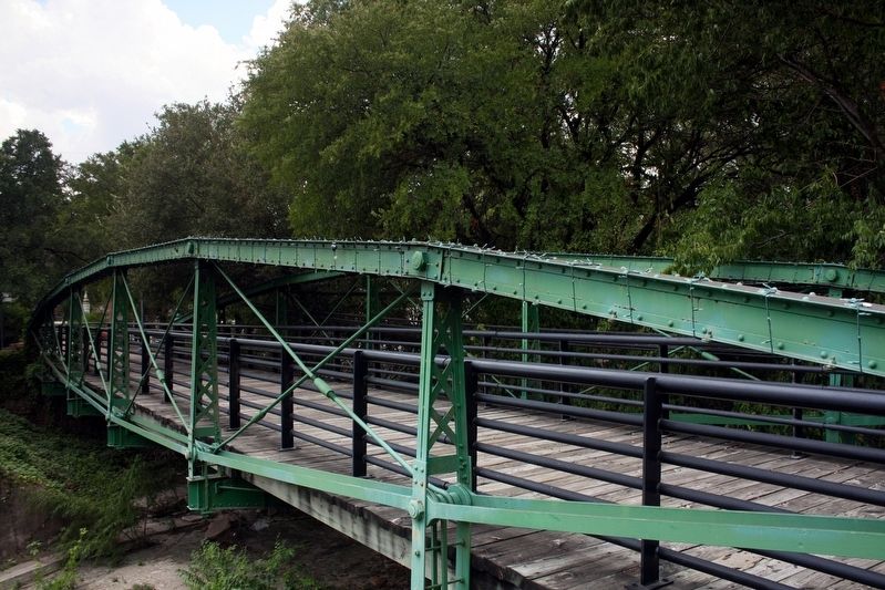
This structure is one of eight remaining lenticular bridges west of the Mississippi River and one of twenty-four surviving in America. The name for this type of truss is derived from the geometric figure made when the longitudinal upper and lower parabolic chords intersect forming the shape of a lens. The lenticular truss combines the properties of an arch type bridge and a suspension type bridge into a single design, requiring less steel than similar bridges.
The
this page online
Dedicated May 1999
Erected 1999.
Topics. This historical marker is listed in these topic lists: Bridges & Viaducts • Parks & Recreational Areas. A significant historical year for this entry is 1889.
Location. 30° 56.886′ N, 97° 32.214′ W. Marker is in Salado, Texas, in Bell County. It can be reached from North Main Street (County Road 2268) south of Rock Creek Drive, on the left when traveling north. Marker is on the Salado Walkpath parallel to North Main Street. GPS coordinates are approximate. Touch for map. Marker is in this post office area: Salado TX 76571, United States of America. Touch for directions.

Regionally, this marker is in Central Texas. It is also in the American South. Globally, it is in North America, a Gulf of Mexico state, the Western Hemisphere, the Western World, and the Anglosphere. Historically, it

Photographed by James Hulse, August 4, 2022
2. The Salado Walkpath Bridge Marker
Other nearby markers. At least 8 other markers are within walking distance of this marker: Dodd's Creek Bridge (a few steps from this marker); Home of Wellborn Barton (within shouting distance of this marker); Norton-Orgain House (about 400 feet away, measured in a direct line); Armstrong-Adams House (about 400 feet away); Old Salado Church of Christ (about 500 feet away); The J.H. Norwood Home (about 500 feet away); Salado Church of Christ (about 700 feet away); Old Anderson Place (about 700 feet away). Touch for a list and map of all markers in Salado.
Also see . . . Dodds Creek Bridge. History, details and photographs of the span. (HistoricBridges.org) (Submitted on May 27, 2022, by Duane and Tracy Marsteller of Murfreesboro, Tennessee.)

Photographed by James Hulse, August 4, 2022
3. The Salado Walkpath Bridge and Marker
cmh2315fl via Flickr (CC BY-NC 2.0), August 13, 2009
4. The Salado Walkpath Bridge
It is also known as Dodd's Creek Bridge.
Credits. This page was last revised on August 5, 2022. It was originally submitted on May 27, 2022, by Duane and Tracy Marsteller of Murfreesboro, Tennessee. This page has been viewed 708 times since then and 46 times this year. Photos: 1. submitted on May 27, 2022, by Duane and Tracy Marsteller of Murfreesboro, Tennessee. 2, 3. submitted on August 5, 2022, by James Hulse of Medina, Texas. 4. submitted on May 27, 2022, by Duane and Tracy Marsteller of Murfreesboro, Tennessee.
