Near Modoc in McCormick County, South Carolina — The American South (South Atlantic)
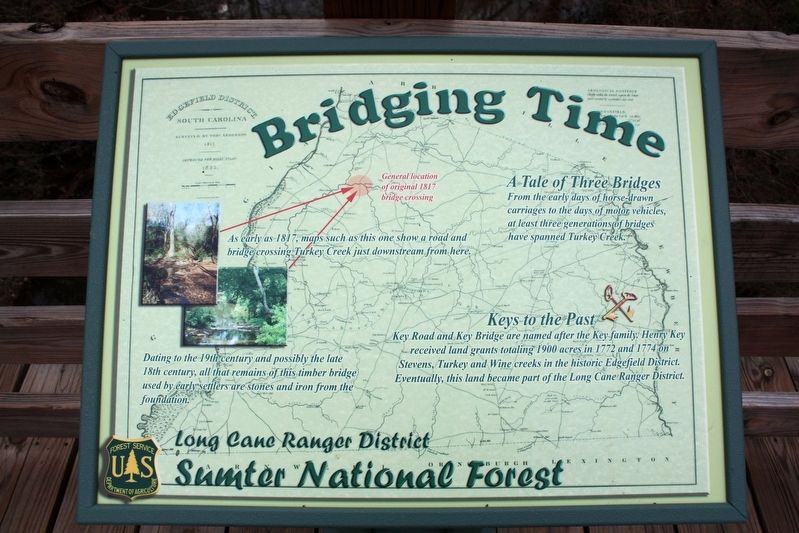
Bridging Time
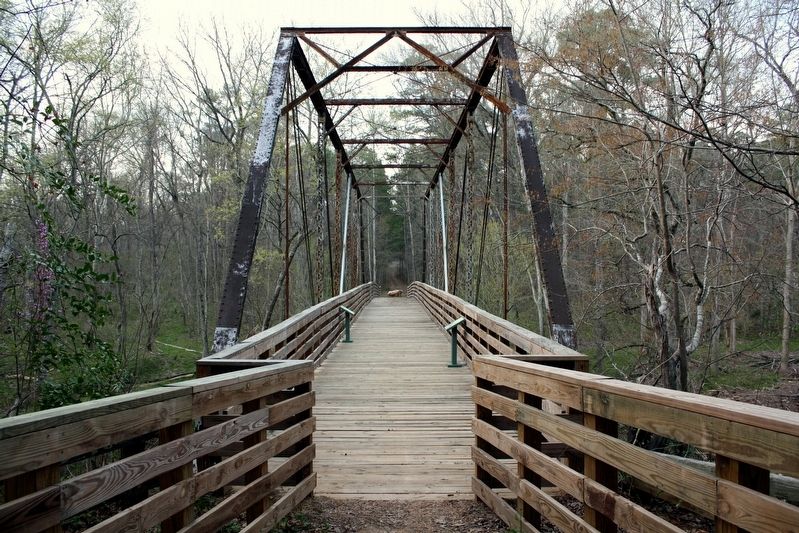
From the early days of horse-drawn carriages to the days of motor vehicles, at least three generations of bridges have spanned Turkey Creek.
As early as 1817, maps such as this one show a road and bridge crossing Turkey Creek just downstream from here.
Dating to the 19th century and possibly the late 18th century, all that remains of this timber bridge used by early settlers are stones and iron from the foundation.
Keys to the Past
Key Road and Key Bridge are named after the Key family. Henry Key received land grants totaling 1900 acres in 1772 and 1774 on Stevens, Turkey and Wine creeks in the historic Edgefield District. Eventually, this land became part of the Long Cane Ranger District.
Erected by U.S. Forest Service.
Topics. This historical marker is listed in these topic lists: Bridges & Viaducts • Roads & Vehicles • Settlements & Settlers. A significant historical year for this entry is 1817.
Location. 33° 47.68′ N, 82° 8.723′ W. Marker is near Modoc, South Carolina, in McCormick County. Marker can be reached from Key Road, 1˝ miles north of Turkey Road, on the left when traveling north. Marker is on the bridge. The bridge is on the Wine-Turkey Creek trail, north of the southern trailhead, in Sumter National Forest. Touch for map. Marker is in this post office area: Modoc SC 29838, United States of America. Touch for directions.
Other nearby markers. At least 8 other markers are within 12 miles of this marker, measured as the crow flies. A different marker also named Bridging Time (a few steps from this marker); Bethany Church (approx. 9.3 miles away); J. Strom Thurmond Dam (approx. 9˝ miles away); Thurmond Dam and Lake / McCormick County (approx. 9.6 miles away); Purpose of the Dam (approx. 9.8 miles away); McCormick Train Station (approx. 11.7 miles away); McCormick County Confederate Monument (approx. 11.7 miles away); McCormick County Veterans Monument (approx. 11.7 miles away).

cmh2315fl via Flickr (CC BY-NC 2.0), March 23, 2009
2. Bridging Time Marker
Featured marker is on the left.
Credits. This page was last revised on May 28, 2022. It was originally submitted on May 28, 2022, by Duane and Tracy Marsteller of Murfreesboro, Tennessee. This page has been viewed 228 times since then and 26 times this year. Photos: 1, 2. submitted on May 28, 2022, by Duane and Tracy Marsteller of Murfreesboro, Tennessee.
